BROWNE LAKE GROUP SITES, UT Campground Reservation, Info, Images, Map, Directions

BROWNE LAKE GROUP SITES, Utah Campground Images, Info & Reservations

Listen

Directions

From the Wyoming: Take Highway 43, turn right at the McKinnon Junction up through Sols Canyon. Turn left onto Sheep Creek Road; follow signs to Browne Lake.

From Vernal, Utah: Take Highway 191, which turns into Highway 44. Shortly past the Dowd Mountain overlook, turn left onto the pavement on the scenic loop road. Follow that road until you reach Forest Road 096; turn left and follow the dirt road to campground. Signs for Browne Lake are posted throughout the scenic loop.

Phone

801-226-3564

Activities

BIKING, BOATING, CAMPING, FISHING, HIKING, HUNTING, WILDLIFE VIEWING

Keywords

BLGS,Browne Lake,Browne,Browne Lake Group Sites,BROWNE LAKE GROUP SITES (UT),FLAMING GORGE,Flaming Gorge National Recreation Area

Related Link(s)

Rec Area Info & Images

Utah State Road Conditions

Forest Service Concessionaire

Utah State Tourism

Overview

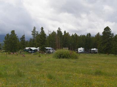
Browne Lake Group Sites are located next to their namesake lake in a high mountain meadow, at an elevation of 8,200 feet. Visitors enjoy fishing, canoeing and exploring miles of hiking and ATV trails.

Recreation

Fishing for rainbows, brook trout and kokanee salmon is a popular activity at Browne Lake, as is canoeing and other non-motorized boating.

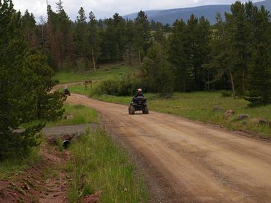
Several ATV and hiking trails are in the immediate area: Leidy Peak Trailhead is within the campground. Sheep Creek Lake, with cutthroat and brook trout fishing, is nearby.

Facilities

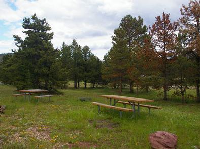
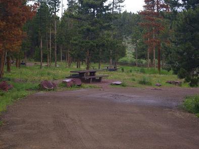
The campground consists of four reservable, accessible group sites that accommodate up to 40 people each. Sites contain picnic tables and campfire circles. Single-family sites are available only a first come, first served basis.

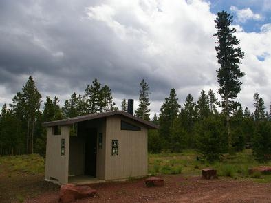
Vault toilets are provided. Roads and parking spurs are dirt. The campground is accessed via a well-maintained dirt road.

Natural Features

The campground is partially shaded by pines and aspens. Summer wildflowers dot the surrounding grassy meadows. The lake is visible from most of the sites and a short trail leads to its shore.

Nearby Attractions

Numerous scenic driving routes on maintained dirt roads crisscross the area around Browne Lake, providing miles of trails for ATVs, hikers and mountain bikers. Trails lead to reservoirs and lakes, overlooks, forests, meadows and historic sites.

Flaming Gorge National Recreation Area is known not only for its beautiful red cliffs, but also for its world-class fishing for lake, brown and rainbow trout. Boating, water skiing, jet skiing, canoeing, kayaking, swimming and scuba diving are popular activities on the reservoir.

Flaming Gorge Dam offers guided tours of the working hydroelectric plant and the dam itself; the adjacent visitor center contains area history exhibits.

The Green River below the dam provides spectacular rafting opportunities. A trip down the river offers unique geology, outlaw history and Native American rock art.

Reservation

More from CampingHiking.net:

JOHNSON BAR GROUP SITE, Idaho Campground Images, Info & Reservations

Listen Directions Johnson Bar Group Site is located 4.5 miles east of Lowell, ID on Forest Road 223 (Selway River Road). The group site is between the paved road and the river. Phone 208-926-4258 Activities BOATING, HISTORIC & CULTURAL SITE, CAMPING, FISHING, HIKING, WILDLIFE VIEWING Keywords JOHB,NEZPERCE NF – FS,JOHNSON

RENEGADE, Utah Campground Images, Info & Reservations

Listen Directions From Heber City, Utah, take Highway 40 east for 28 miles to Strawberry Bay Junction. Turn right and travel 12 miles to campground. Phone HEBER RANGER DISTRICT 435-654-0470 OR UTAH RECREATION COMPANY 385-273-1100 Activities BIKING, BOATING, CAMPING, FISHING, HIKING, WATER ACTIVITIES Keywords RENG,UINTA NF – FS Related Link(s)

SUNSTRIP, Oregon Campground Images, Info & Reservations

Listen Directions From Estacada, travel east on Highway 224 for about 21 miles to the campground. Phone 503-630-5721 Activities CAMPING, FISHING, HIKING, WATER SPORTS, WILDLIFE VIEWING Keywords SUN1,MT. HOOD NF – FS Related Link(s) Rec Area Info & Images Oregon State Tourism Forest Service Concessionaire Oregon State Road Conditions Overview

DIRT FLAT, California Campground Images, Info & Reservations

Listen Directions From Highway 140, turn on to Foresta Road. Landmarks include Red Bud Picnic Area and a National Park Service warehouse. After bridge, turn left onto the spur road. Immediately turn left onto Incline Road. Continue 1.5 miles to the facility. Phone 559-642-3212 Activities CAMPING Keywords DIRT,EL PORTAL,SIERRA NF

LOST CREEK GROUP, California Campground Images, Info & Reservations

Listen Directions From Redding, California drive 48 miles east on State Highway 44 to State Highway 89. Turn right into Lassen Volcanic National Park and continue five miles south to Lost Creek Group Campground. It is 1/8-mile south of Crags Campground. Phone 530 595-6121 Activities BOATING, HISTORIC & CULTURAL SITE,

RAGLAND BOTTOM, Tennessee Campground Images, Info & Reservations

Listen Directions From Smithville, Tennessee, take US-70 east for 8 miles. Turn left on Ragland Bottom Road and follow signs to the campground, located one mile from Sligo Bridge. Phone 931-761-3616 Activities BOATING, CAMPING, FISHING, HIKING, SWIMMING, WATER ACCESS, WATER SKIING Keywords RAGL,CENTER HILL LAKE,CENTER HILL LAKE Related Link(s) Rec