
Directions
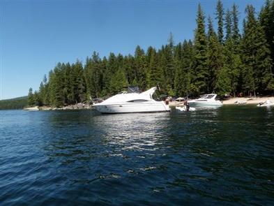
Access to the campground is by boat only. To reach various boat launches around the lake, travel north from Priest River, Idaho on State Highway 57.
To access the Kalispell Bay Boat Launch, travel on Highway 57 for 31 miles to Kalispell Bay Road. Turn east (right) until you reach West Lakeshore Road. Then head south .5 miles to the boat launch.
Phone
208-443-2512
Activities
BOATING, CAMPING, FISHING, HIKING, WATER SPORTS
Keywords
three pines group site,three pines site #29
Related Link(s)
Overview
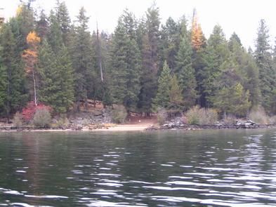
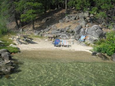
Surrounded by clear waters of Priest Lake, the 52 sites on Kalispell Island provide the ideal getaway for people looking for a rugged, but highly rewarding, camping experience on the peaceful shores of Priest Lake. There are 51 single sites on the island as well as one group site known as Three Pines Group Site. This Group Site is located on the southeast side of the island and has been renumbered from Site #001 to site #29 for groups of 10-30 individuals. All sites are only reachable by boat.
A popular activity among visitors is to kayak, canoe, or power boat up a 3.5-mile thoroughfare, which leads to the Upper Priest Lake Scenic Area. The upper lake – just like Kalispell Island – cannot be access by car, so water is an excellent navigation option.
Recreation
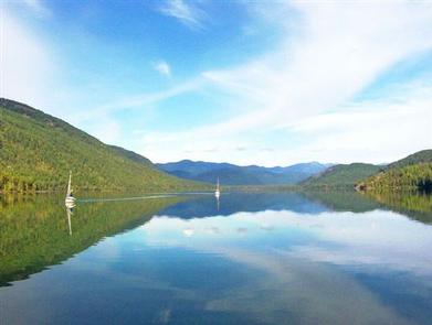
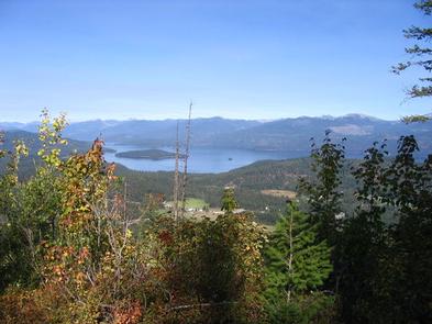
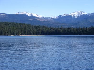
Priest Lake is less than an hour from the Canadian Border, nestled deep below the crest of the Selkirk Mountains. Surrounded by the natural beauty of Northern Idaho and the mile-high mountains, this 25,000-acre lake offers clear, blue waters reaching depths of 300 feet.
Fantastic wildlife viewing is available on the 2.5-mile loop trail that encircles Kalispell Island, offering phenomenal lake views and bird watching opportunities.
The waters of Priest Lake offer anglers access to record-breaking Mackinaw trout, Dolly Varden, Cutthroat and Kokanee.
Facilities
Most campsites require campers to bring their own portable toilets. They can check out toilet buckets at the Kalispell Boat Launch. Kalispell Island can only be accessed by boat. No drinking water is availabe and this is a pack it in, pack it out facility. Picnic tables and campfire rings are provided
Natural Features
Kalispell Island is one of seven islands scattered throughout Priest Lake. Kalispell is the largest of these islands, spanning 264 acres, and is shaped like a tooth.
Priest Lake, at a 2,400 foot elevation, is one of the top three largest lakes in Idaho. To the north, the lake connects to the Upper Priest Lake, divided by a narrow channel, which can be passed through by boat.
Nearby Attractions
Hike the Lakeshore or Beach Trails that traverse along the west shore of Priest Lake. The Beach trail extends between Outlet Bay Campground and the Kalispell Bay Boat Launch. The Lakeshore Trail runs for 8 miles along the northwest shores of Priest Lake.
In winter, ice fishing, shoe shoeing and snowmobiling on nearby trails entertain visitors.