
Directions
From Placerville take Highway 49N a half-mile and turn right on Highway 193 to Georgetown. Take a right on Main Street in Georgetown and drive about 14 miles to the campground. Ponderosa Cove is north of the Stumpy Boat Ramp.
Phone
831-245-6891
Activities
CAMPING
Keywords
ponderosa group,ponderosa
Related Link(s)
California State Road Conditions
Overview
Ponderosa Cove greets group campers with shaded campsites close to scenic Stumpy Meadows Reservoir. The campground provides a pleasant destination for bird watching and nature viewing, in addition to activities at the lake.
Recreation
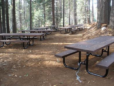
Enjoy a picnic in the campground, or head to another picnic area at Stumpy Meadows Boat Ramp. The reservoir is great for swimming and fishing for brown and rainbow trout. Boating is also popular, but this is a no-wake lake.
Facilities
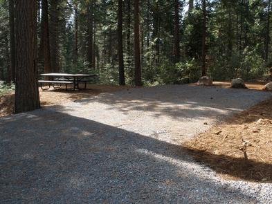
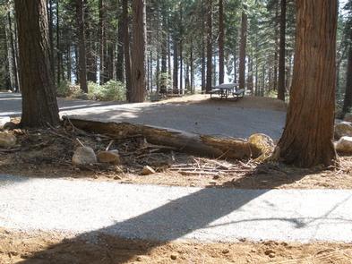
The campground can accommodate up to 75 guests along a single loop of campsites. Five parking spurs can be used for RVs and trailers. Each of these spurs has a picnic table. Ten walk-to tent pads are provided, and parking for these requires parallel parking on the loop. Vault toilets and two water faucets are provided.
Natural Features
Ponderosa Pine, the namesake of the campground, is known for its wonderful sweet vanilla aroma and its massive height. The campground sits east of the dam, just opposite the road from the Stumpy Meadows Lake, at an elevation of 4,400 feet. The lake sits in the foothills of the rugged Sierra Nevada high country of California.
In the Eldorado National Forest, the climate is similar to that of the Mediterranean with warm, dry summers and cold, wet winters.
Nearby Attractions
Eldorado National Forest boasts over 400 miles of hiking trails, so hikers have plenty of options to explore. Take a drive on the El Dorado County Scenic Highway or visit the Marshall Gold Discovery State Historic Park.