SLIDE CREEK, OR Campground Reservation, Info, Images, Map, Directions

SLIDE CREEK, Oregon Campground Images, Info & Reservations

Listen

Directions

From Blue River, travel 4 miles east on Hwy 126 to Aufderheide Drive (FS road 19). Proceed on Aufderheide Drive for 9.5 miles to FS road 1900-500 and continue for 1.5 miles to Slide Creek Campground.

Phone

801-226-3564

Activities

BOATING, FISHING, WATER SPORTS, WILDLIFE VIEWING, SWIMMING, BIRDING

Keywords

Slide Creek Campground,Slide Creek,Slide

Related Link(s)

Rec Area Info & Images

Oregon State Tourism

Oregon State Road Conditions

Forest Service Concessionaire

Overview

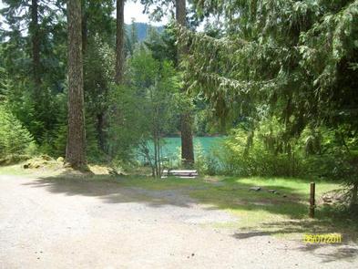
Slide Creek Campground is a unique camping destination just 50 miles from Eugene, Oregon. Located on the east bank of the Cougar Reservoir, it is known for handy access to boating and many water activities. It is also near Terwilliger Hot Springs, a pristine area with 5 soaking pools fed by the Rider Creek waterfall.

Recreation

Activities on the reservoir include water skiing, swimming, fishing and canoeing. Anglers might catch some quality rainbow trout. The campground is close to a large network of hiking trails in the Olallie Trail Area. Half of the trails are open to biking as well.

Facilities

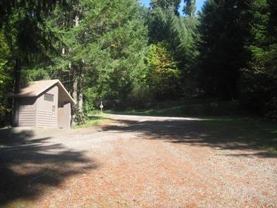
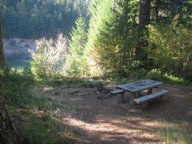
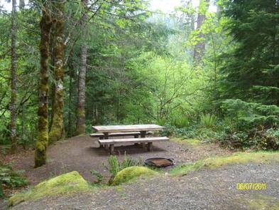
Both campground and the day use area guests have access to drinking water, vault toilets, a boat ramp, ample parking and a swimming beach. A separate parking lot is available for boat trailers. The facility has 15 campsites that can accommodate tents, trailers or RVs and come equipped with campfire rings and picnic tables.

Natural Features

The Willamette National Forest stretches for 110 miles with varied landscapes of high mountains, narrow canyons, cascading streams, and wooded slopes. Native wildlife includes Roosevelt elk, black bear, bald eagles, black tail deer and bobcats. Cougar Reservoir sits at 1,700 feet in elevation and is an estimated 1,280 acres. Some campsites have views of Cougar Reservoir and all sites are an easy walk to the swimming area.

Reservation

More from CampingHiking.net:

BIG ELK GUARD STATION, Oregon Campground Images, Info & Reservations

Listen Directions Drive east from Butte Falls on the Butte Falls-Fish Lake Highway (County Road #821) for approximately 19 miles to the junction with State Highway #140. Turn right, go .08 miles on Highway #140 to the junction with Forest Service Road #37. Turn left, and travel approximately 4 miles

ABRAM’S CREEK CAMPGROUND, Tennessee Campground Images, Info & Reservations

Listen Directions There is no street address for this campground North: From I-40 take US-129/Alcoa Highway through Maryville, TN. Continue South on US-129 until mile marker 14.3 (Foothills Parkway exit). Proceed .5 miles beyond Foothills Parkway turning left onto Happy Valley Road. Turn Right onto Abram’s Creek Road passing the

WILSON VIEW CABIN, Alaska Campground Images, Info & Reservations

Listen Directions Approximately 44 miles east of Ketchikan on the mainland, north of Wilson Arm. Cabin is located at the north end of Wilson Lake. Accessible by float plane only. This cabin is in a designated Wilderness area, and access by helicopter is illegal. Refer to USGS map Ketchikan B-2

KINNIKINNICK, California Campground Images, Info & Reservations

Listen Directions Take Highway 168 east from Clovis to Shaver Lake. Continue through Shaver Lake to Huntington Lake. Continue around Huntington Lake for 1.3 miles to Kinnikinnick Campground (located adjacent to Catavee Campground). Phone 559-893-2111 Activities BOATING, CAMPING, INTERPRETIVE PROGRAMS, FISHING, HIKING, WATER SPORTS, SWIMMING SITE Keywords KINN,HUNTINGTON LAKE,SIERRA NF

FRENCH CREEK, Idaho Campground Images, Info & Reservations

Listen Directions From Boise, Idaho, travel north on Highway 55 for 85 miles to Cascade. Turn west on Old State Highway and go a half-mile to Lakeshore Drive. Turn south and travel 3 miles to West Mountain Road. Turn west and follow the road 5 miles to the campground. Phone