HOOD PARK, WA Campground Reservation, Info, Images, Map, Directions

HOOD PARK, Washington Campground Images, Info & Reservations

Listen

Directions

From Pasco, Washington, take Highway 12 east. After crossing the Snake River Bridge, take the next exit and continue to State Route 124. The park entrance is on the left just after the roundabout.

Phone

509-547-2048

Activities

BOATING, CAMPING, FISHING, HIKING, DAY USE AREA, SWIMMING SITE

Keywords

HOOD,MCNARY,LAKE WALLUA,MCNARY LOCK & DAM

Related Link(s)

Rec Area Info & Images

Washington State Tourism

Washington State Road Conditions

Overview

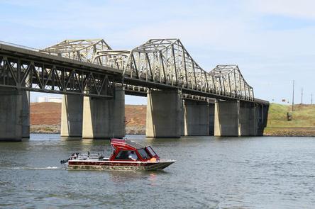
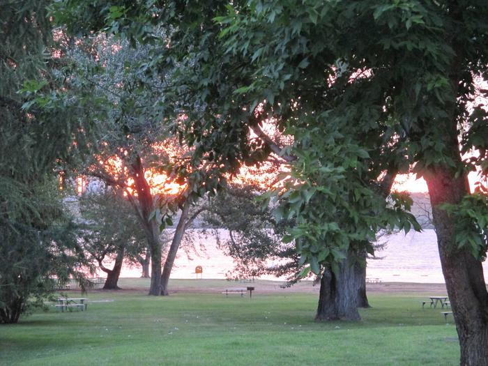
Hood Park is located on Lake Wallula in eastern Washington. The lake is formed by McNary Lock and Dam on the Mid-Columbia River.

Lewis and Clark camped two miles downstream at the confluence of the Snake and Columbia Rivers, which is now the location of Sacajawea State Park.

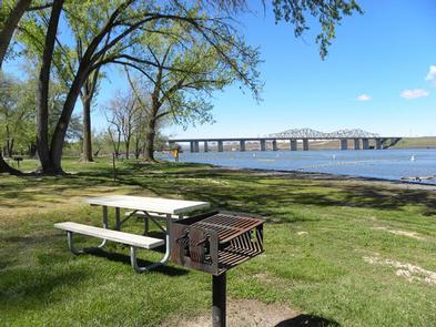
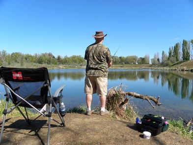
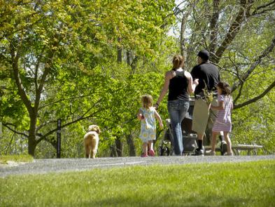
Visitors enjoy camping, fishing, boating, hiking, picnicking and swimming.

Recreation

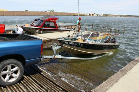
The lake provides great boating and swimming opportunities, and a boat ramp is provided for guests.

Fishing is also a popular pastime, and anglers will find excellent salmon and steelhead fishing on the lake.

Facilities

Hood Park offers 67 family sites and one day-use group picnic shelter, all with electric hookups.

Natural Features

The campground is situated along the banks of the lake, offering sweeping views. Campers enjoy relaxing in the shade of the mature trees throughout the park.

Nearby Attractions

The McNary National Wildlife Refuge is adjacent to the park. It provides habitat for migrating waterfowl, bald eagles, shorebirds and other wildlife. Nature trails and an environmental learning center are open to the public.

Reservation

More from CampingHiking.net:

LIVE OAK RIDGE, Texas Campground Images, Info & Reservations

Listen Directions From Interstate 35, take Farm-to-Market Road 2305 (West Adams Ave.) west. Drive for nine miles and turn left on Farm-to-Market Road 2271 (Morgan’s Point Road). Go two miles to the park entrance. The campground is adjacent to the Belton Dam and spillway. Phone 254-780-1738 Activities BOATING, CAMPING, HIKING,

WHISKY CAMP GUARD STATION, Oregon Campground Images, Info & Reservations

Listen Directions From Canyonville take West 1st Street and turn onto SE 3rd St/OR-227. Continue to follow OR-227 approximately 23 miles until you reach Tiller Oregon and take a left onto Douglas County Road 46 just before the bridge crossing the South Umpqua River. From Tiller, take Douglas County Road

COVERED BRIDGE, New Hampshire Campground Images, Info & Reservations

Listen Directions From Conway, New Hampshire: Take Kancamagus Highway (State Route 112), 6 miles west, then turn on Dugway Road and proceed into the campground. Vehicles 7’9" or taller are unable to pass through due to height restriction for the covered bridge and must use an alternate route: At traffic

OPOSSUM CREEK, Illinois Campground Images, Info & Reservations

Listen Directions From Shelbyville, Illinois, take State Route 128 north for 3.5 miles. Turn right onto County Road 1650 N. Continue nearly a mile to County Road 1880 E. Turn right and travel 0.5 mile to County Road 1600 N. Turn right again and drive one mile into the Opossum

DALE HOLLOW LAKE – PRIMITIVE CAMPING, Tennessee Campground Images, Info & Reservations

Listen Directions Camping locations are dispersed throughout Dale Hollow Lake. Reference primitive camping map or site details for information on how to get to the specific site. Mailing and contact information is for the Resource Manager’s Office. Phone DALE HOLLOW LAKE RESOURCE MANAGERS OFFICE-931-243-3136. SHERIFF’S DEPARTMENT EMERGENCY CONTACTS: CLAY COUNTY