HORSESHOE POINT, VA Campground Reservation, Info, Images, Map, Directions

HORSESHOE POINT, Virginia Campground Images, Info & Reservations

Directions

From HWY 220, turn onto Henry Road (SR-605) and go 8 miles. Turn left onto Horseshoe Point Road and follow signs to the park.

Phone

(540) 365-7385

Activities

BOATING, CAMPING, SWIMMING SITE

Keywords

HOPO,Philpott Lake

Related Link(s)

Rec Area Info & Images

Virginia State Road Conditions

Virginia State Tourism

Overview

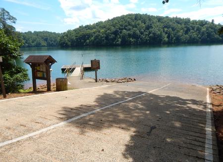
Horseshoe Point Campground is nestled on the shores of Philpott Lake in the rugged foothills of Virgina’s Blue Ridge Mountains. The park is located in a rural and sparsely populated part of Franklin County near the small community of Henry.

Philpott Lake’s clear water and natural shoreline make it a unique place for visitors to enjoy boating, fishing, hiking, picnicking and camping.

Click here for the Philpott Lake Virtual Tour: http://www.photographyoptions.net/images/philpott/tour.html

Recreation

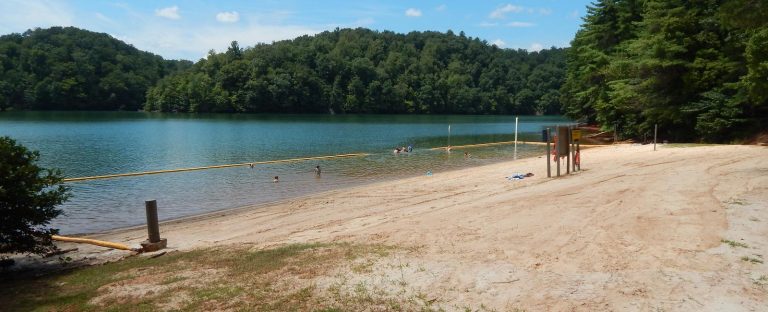
The lake provides visitors with great boating and swimming opportunities. Anglers enjoy fishing for large and smallmouth bass, walleye, bluegill, crappie and catfish.

Many miles of hiking and biking trails surround Philpott Lake, allowing visitors to get out and explore this scenic area.

Facilities

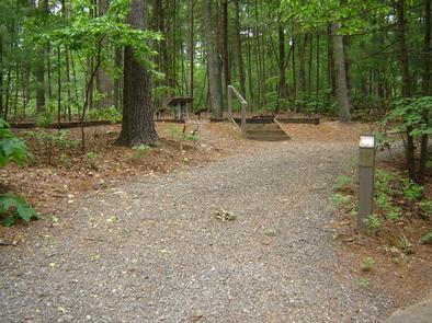
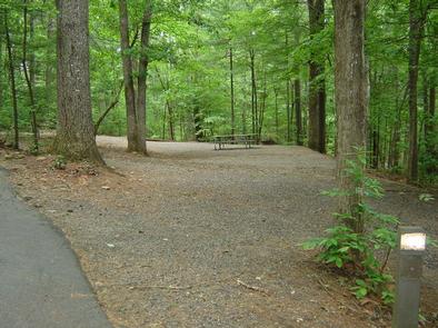
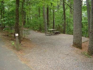
The park offers both camping and day-use facilities: 15 campsites with electric and water hookups are available, as well as 34 primitive sites without hookups.

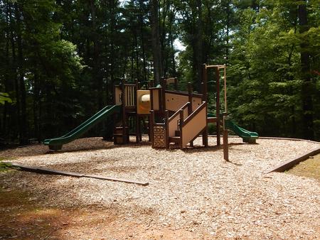
Amenities include flush toilets, showers, drinking water and a dump station. For additional family-friendly entertainment, a beach, boat ramp, dock, picnic shelter and playground are also on-site.

Natural Features

Philpott Lake covers 2,900 acres and has 100 miles of shoreline. The lake’s steep, rocky banks meet beautiful mixed forests of oak, maple, hickory, pine and cedar.

Wildlife is abundant throughout the area: Deer, turkeys, squirrels, raccoons, and a variety of songbirds and waterfowl are commonly viewed.

Nearby Attractions

The lake is adjacent to Fairystone State Park and Fairystone Farms Wildlife Management Area, which includes 5,300 acres of public recreational lands.

Reservation

More from CampingHiking.net:

GROUSE CREEK GROUP SITE, Washington Campground Images, Info & Reservations

Directions Grouse Creek Campground is located approximately 7 miles up the Forest Service Road 6200/Chiwawa River Road. There is a gated spur road just off the main paved road on the left. The campground is at the end of the road alongside Grouse Creek. Phone 509-763-0700 Activities BIKING, CAMPING, FISHING,

ALLEY CREEK CAMP, Texas Campground Images, Info & Reservations

Directions From Jefferson, TX, travel 3.8 miles northwest on Highway 49. Turn left onto FM 729 and continue for 12 miles to the park entrance on the left. Phone 903-755-2637 Activities BOATING, CAMPING, FISHING, HIKING, HUNTING, WATER SPORTS, WILDLIFE VIEWING, SWIMMING, BIRDING Keywords ACRC,LAKE OF THE PINES,LAKE O THE PINES,FERRELLS

RANCHERIA, California Campground Images, Info & Reservations

Directions From Clovis, take Highway 168 north 70 miles to Huntington Lake Campground office at Eastwood. Check in at office prior to setting up camp. Phone 559-893-2111 Activities BOATING, HISTORIC & CULTURAL SITE, CAMPING, INTERPRETIVE PROGRAMS, FISHING, HIKING, WATER SPORTS, DAY USE AREA, SWIMMING SITE Keywords RANC,HUNTINGTON LAKE,SIERRA NF –

DEMOTTE, Arizona Campground Images, Info & Reservations

Directions From Kanab, UT the facility is 40 miles (35 miles from Fredonia, AZ) south on U.S. Route 89A to AZ State Route 67, at Jacob Lake. Then south 25 miles on AZ State Route 67 to DeMotte campground. From Bitter Springs intersection of U.S. 89 and 89A. Take 89A

RUDDS CREEK REC. AR., Virginia Campground Images, Info & Reservations

Directions The physical location for Rudd’s Creek Park is: 16064 Highway 58, Boydton, VA 23917. It is located about 3 miles west of Boydton, VA. Phone IN RECREATION SEASON ONLY: (434) 738-6827; ALL OTHER INQUIRIES CALL VISITOR ASSISTANCE CENTER: (434) 738-6143 Activities BOATING, CAMPING, FISHING, HIKING, HUNTING, DAY USE AREA,

SANDY FLAT, California Campground Images, Info & Reservations

Directions From Highway 99, take Highway 178 east for 4 miles. Turn right on Borel Road, then right onto the Old Canyon Road. Continue about 2 miles, then turn right into Sandy Flats Campground. Phone 760-376-1815 Activities CAMPING, FISHING Keywords SANF,Sandy Flat Related Link(s) Rec Area Info & Images California