
Directions
From Hot Springs, Arkansas, take Highway 70 west to Kirby Landing Access Road. Turn left and continue into the campground.
Phone
870-285-2151
Activities
BOATING, CAMPING, FISHING, HUNTING, SWIMMING SITE
Keywords
KLAN,LAKE GREESON,KIRBY,CRUMP MARINA,LAKE GREESON
Related Link(s)
Arkansas State Road Conditions
Overview
Kirby Landing Campground is located on Lake Greeson on the beautiful Little Missouri River in Pike County, Arkansas.
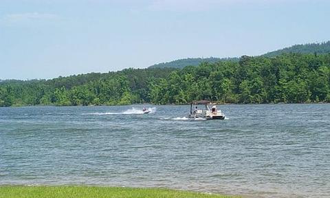
The lake is approximately 12 miles long with 7,260 surface acres of water for water sports, picnicking and hiking along the forested lake shore.
Recreation
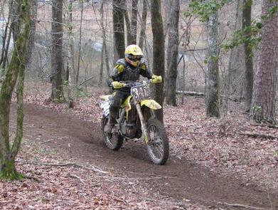
The Bear Creek Cycle Trail, located within the campground, is a draw for off-road enthusiasts. There are also 30 miles of walking, nature and cycling trails for public use.
Lake Greeson is recognized for its rich variety of game fish, including large mouth, stripped, spotted, small mouth and white bass, as well as flathead and channel catfish, black and white crappie, walleye and blue gill.
The clear waters offer an excellent opportunity for many boating activities including water skiing, tubing, personal water craft, cruising and fishing. Four marinas at Lake Greeson offer boaters fuel, boat rentals and picnic and fishing supplies.
The best opportunity for hunting lies within the Lake Greeson Wildlife Management Area. Deer, quail, turkey, squirrel and rabbits are the primary game.
Facilities
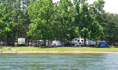
Kirby Landing offers more than 100 campsites, each with 50-amp electrical hookup and water. Each site provides a picnic table, ground grill, pedestal grill and lantern pole.
Other amenities include flush toilets, showers, drinking water, swim beach, playground, boat ramp and marina.
Natural Features
Central Arkansas is mild and somewhat humid in spring and fall, hot and very humid in summer and variable in winter, where temperatures may range from below freezing to the 60s.
Loblolly pine, shortleaf pine, sweet gum and oak are the dominant tree species on upland areas of the lake, while bottomland hardwoods are common along rivers, creeks and streams that enter the lake.
The public lands around Lake Greeson provide a variety of habitats for numerous species of wildlife, including white-tailed deer, wild turkey, geese, southern bald eagles, migratory waterfowl and songbirds. Bald eagles are an attraction for visitors each winter.
Nearby Attractions
Ouachita National Forest and Hot Springs National Park are within a two-hour drive from this facility. Crater of Diamonds State Park is within 30 miles of the campground. It is the only diamond-producing site in the world open to the public.