Plymouth Park, WA Campground Reservation, Info, Images, Map, Directions

Plymouth Park, Washington Campground Images, Info & Reservations

Listen

Directions

From Kennewick, Washington take US-395 South or 23 Miles to Exit 131. Merge onto State Route 14 West and continue for 1 mile. Turn south onto Plymouth Road and continue for 1 mile. Follow the curve to Christie Road. The campground is the first left and the day use area is the second left.

Phone

541-739-1135

Activities

BOATING, CAMPING, FISHING, WILDLIFE VIEWING, DAY USE AREA, SWIMMING SITE, KAYAKING, STAR GAZING, BIRDING, WATER ACCESS, TUBING

Keywords

PLYM,JOHN DAY LOCK & DAM,PLYMOUTH,PLYMOUTH PARK,Plymouth Park,Plymouth

Related Link(s)

Rec Area Info & Images

Washington State Road Conditions

Washington State Tourism

Overview

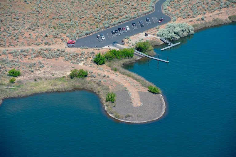
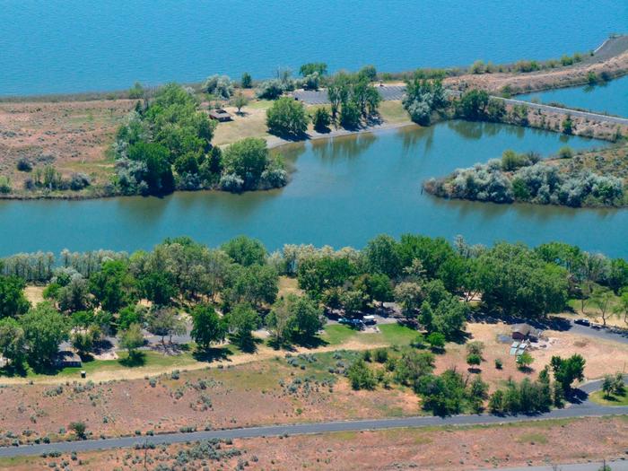
Plymouth Campground is located by the small town of Plymouth, Washington. The day use area and boat launch are on a small island on Lake Umatilla on the Columbia River.

Popular activities in the area include fishing, swimming, boating, water skiing and hunting.

Recreation

Visitors enjoy boating, water sports and swimming in the river.

Anglers fish for Chinook, steelhead, walleye, sturgeon, and shad. The boat ramp is located at the day use area for convenient river access.

Facilities

The campground offers 32 sites with electric hookups. Amenities include flush and pit toilets, showers, drinking water, a dump station and playground.

The day use area has a swim beach, boat ramp, flush toliets, vault toliet and courtesy dock.

Natural Features

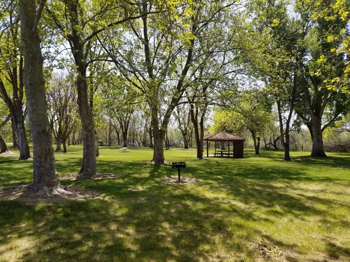
The park is situated in a high desert environment on an island on the Columbia River. The island is covered with tall sage and Russian Olive trees, but shade is limited.

Wildlife is abundant in the area, and mule deer, waterfowl and raptors are commonly seen.

Nearby Attractions

McNary Dam and Visitor Center and Lake Wallula are two miles upstream from the campground. The lake offers additional opportunities for boating, swimming and fishing.

Reservation

More from CampingHiking.net:

CEDAR RIDGE (TX), Texas Campground Images, Info & Reservations

Listen Directions From Interstate 35 in Temple, Texas take State Highway 36 west towards Gatesville. Turn left on Cedar Ridge Park Road and continue into the park and campground area. Phone 254-986-1404 Activities BOATING, CAMPING, SWIMMING SITE Keywords CEDR,BELTON LAKE,LAKE BELTON,BELTON LAKE Related Link(s) Rec Area Info & Images Texas

UPPER SAGE FLAT, California Campground Images, Info & Reservations

Listen Directions In Big Pine, on US Highway 395, turn west at the yellow flashing traffic light onto Crocker Street (Big Canyon Road). Continue on this road for 9 miles to campground, on your left. Phone 760-935-4339 Activities CAMPING, FISHING, HIKING, HORSEBACK RIDING, WILDLIFE VIEWING Keywords UPSF,UPPER SAGE CAMPGROUND,INYO NF

ANDERSON ROAD, Tennessee Campground Images, Info & Reservations

Listen Directions From downtown Nashville, TN, take I-40 east for 5 miles to exit 219. Turn right on Stewarts Ferry Pike and continue straight on Bell Road for 5 miles. Turn left on Smith Springs Road, then left on Anderson Road. The campground is ahead about 1 mile on the

HUNTERS SPRING CABIN, Montana Campground Images, Info & Reservations

Listen Directions From the south: From Hwy 12 take Forest Road 274 north for approximately 11 miles to Forest Road 6429 tturn right on 6479 just past Whitetail Campground. Go approximately .5 mies on road 6429 to the Hunter Springs Cabin turn off on the right. and the sign pointing

FORT SPOKANE, Washington Campground Images, Info & Reservations

Listen Directions Take State Highway 2 west of Spokane for 32 miles. Turn north on State Highway 25 at the town of Davenport and travel 24 miles. Follow the signs to the campground. Phone 509-754-7889 Activities BIKING, BOATING, HISTORIC & CULTURAL SITE, CAMPING, INTERPRETIVE PROGRAMS, FISHING, HIKING, PICNICKING, VISITOR CENTER,

CALAMITY, Idaho Campground Images, Info & Reservations

Listen Directions From Idaho Falls, Idaho, travel on Hwy. 26 for approximately 50 miles. Turn right off of Hwy. 26, (just before ascending grade to top of dam) and go ¼ mile, turn right and cross the river following signs to the campground. Distance is approximately 5 miles. Phone 208-270-0150