
Directions
From Lawrence, Kansas, take 6th Street/Highway 40 west for 4 miles. Take a left onto Douglas County Road 442 and go 5 miles to Stull, Kansas, then take another left onto Douglas County Road 1023 and go 6 miles to Douglas County Road 6. Make a left turn on 6 and go 4 miles to Douglas County Road 4. Make a right turn and go 1/2 mile and turn left on the first gravel road. Go 1/4 mile to the park entrance on the left.
Phone
785-843-7665
Activities
BOATING, CAMPING, FISHING, WATER SPORTS, SWIMMING SITE
Keywords
BLOM,CLINTON LAKE,CLINTON LAKE
Related Link(s)
Overview
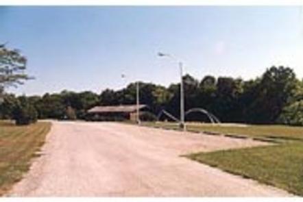
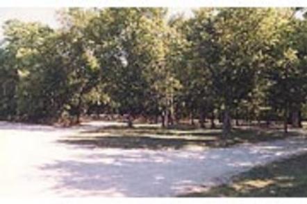
Bloomington West is a spacious group campground that sits under an umbrella of trees west of Clinton Dam and Lake in the hills of Kansas.
Recreation
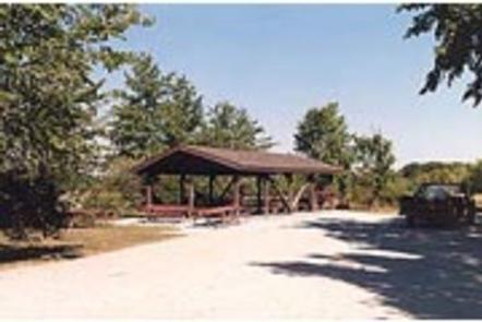
A horseshoe pit, sand volleyball court, playground and softball field are all provided at the campground, making it the perfect spot for entertaining large groups and family functions.
However, Clinton Lake is the main attraction, offering opportunities for boating, fishing, canoeing, jet skiing, swimming and countless other water sports.
The lake’s fish and wildlife resources provide sightseers, fishermen, and hunters ample opportunities for their sports, and Clinton Lake is well-stocked with crappie, walleye, channel catfish and white bass.
Wildlife viewing is also a popular activity, with bald eagles, white-tailed deer, Canada geese, wild turkey and other wildlife in abundance at Clinton Lake.
Three trail systems are located around Clinton Lake, including the North Shore, South Shore and the George Latham Trails. All offer hiking, biking and equestrian opportunities within a 20 minute drive.
Facilities
This spacious group site offers 25 individual sites, four with 20/30 Amp electric and water connections. This area has a total capacity of 150 guests. A boat ramp is located within a mile of the site, and grills, flush toilets, showers and drinking water provide a comfortable camping experience.
Natural Features
Congress authorized Clinton Lake in 1962, and the finished reservoir was filled in 1980. While the Dam and Reservoir were originally built for flood control, the area has now become a recreational oasis for millions of visitors to enjoy the beautiful green Kansas backdrop.
Clinton Lake’s beautiful setting of steep bluffs, wooded shoreline and clear water is unequaled among Kansas lakes. Shoreline development has been limited in an effort to preserve as much of the natural setting as possible.
Clinton spans 8 miles up the Wakarusa Valley and covers 7,000 surface acres. If the lake ever approaches the top of its flood pool, an additional 5,800 acres will be covered, extending the area to 13 miles along the valley floor.
Nearby Attractions
The Visitor Center, located on the northwest side of the dam, has several informative displays covering topics such as the history of the region, reasons for the dam and the wildlife in the area.