


Directions
From Boise, Idaho, take Highway 55 north about 35 miles to Banks, Idaho. Turn right (east) on Banks-Lowman Road and proceed 25 miles to the junction with Forest Road 555. Turn left (north) on Road 555 and proceed 9 miles to the junction of Forest Roads 555 and 555EC. Turn right on 555EC and proceed 3 miles to Deadwood Lookout Recreation Cabin at the end of the road.
Phone
541-351-1182
Activities
BIKING, CAMPING, HIKING, WILDLIFE VIEWING
Keywords
DEDW,BOISE NF – FS
Related Link(s)
Overview
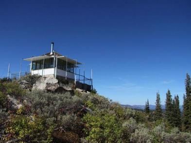
Deadwood Lookout Recreation Cabin is a historic Forest Service fire lookout on Deadwood Mountain. The structure provides sweeping panoramic views of the surrounding forest, making this a unique place to overnight.
At least two other lookouts have existed previously on Deadwood Mountain, but the current one was built in 1934 by the Civilian Conservation Corps. It was actively used as a fire lookout until 1972. It has since become one of the most popular rental cabins in Idaho.
The peak season is late June through mid-October. Guests can drive to the cabin, but high clearance vehicles are recommended for the dirt access road because it is narrow, steep and winding.
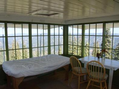
The cabin offers only a few basic amenities. Guests should be prepared to bring most of what they need to make themselves comfortable, but the views of the mountains by day and the stars at night guarantee a memorable and rewarding experience.
Recreation
Hikers and mountain bikers have access to three nearby trails: Scott Mountain, Julie Creek, and Nellie’s Basin. The Deadwood Ridge Trail is a popular destination for equestrians, hikers, mountain bikers, and off-road vehicle enthusiasts.
Facilities
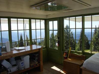
This rustic cabin is a 14×14-ft. room equipped with two single beds with mattresses that can be fastened together. A wood stove is available for heating and cooking. A wood counter with shelf and a table with two chairs complete the furnishings. A vault toilet, picnic table, and campfire ring are located outside and below the lookout. The cabin is surrounded by an exterior catwalk. No water, electricity or firewood is available. Guests must bring their own water supply, as well as trash bags to pack out garbage. Bedding, pillows, cookware, kitchen utensils, and tableware are not provided. Guests are expected to clean the lookout before leaving. A broom and dustpan are provided for this purpose.
Natural Features
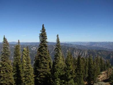
The cabin is perched atop Deadwood Mountain at an elevation of 7482 feet. A variety of colorful wildflowers bloom around the base of the cabin in the summer, and stands of conifers dot the landscape. Mornings bring unobstructed views of sunrises. Guests can watch the sun set each evening and then gaze out at an endless canopy of stars. Wildlife enthusiasts may spot elk, deer and bear in the surrounding area. Bull moose have occasionally been spotted along nearby trails. Guests may find swallows and other birds nesting just outside the lookout. Guests can also expect to see various types of snakes, including Gopher snakes, Garter snakes, Racer snakes, Bull snakes & Rattlesnakes, especially when temperatures reach 70-82 degrees fahrenheit outside.