SUTTON CAMPGROUND, OR Campground Reservation, Info, Images, Map, Directions

SUTTON CAMPGROUND, Oregon Campground Images, Info & Reservations

Directions

From Florence, Oregon, take Highway 101 north 5 miles to the Sutton Campground turnoff and go one mile to the campground.

Phone

541-997-2715

Activities

BOATING, CAMPING, FISHING, HIKING, WILDLIFE VIEWING, SWIMMING SITE, BERRY PICKING

Keywords

SUTT,SIUSLAW NF – FS

Related Link(s)

Rec Area Info & Images

Oregon State Tourism

Forest Service Concessionaire

Oregon State Road Conditions

Overview

Sutton Campground is located just off the Pacific Coast in Oregon, 1.5 miles from Sutton Beach and 2 miles from Sutton Lake. Hiking is the most popular activity, but visitors also enjoy swimming in Sutton Creek, and fishing and boating on Sutton Lake.

Recreation

Hiking is Sutton Campground’s main draw. A number of trails provide access to nearby Alder Dunes and Sutton Lake. Wild berries, vibrant rhododendrons and picturesque sand dunes are located along the trails.

The Holman Vista Day Use Area and Holman Vista Trail are one mile west of the campground, providing an accessible viewing platform for memorable sunsets of the world’s largest the ocean.

Boating, canoeing and fishing are popular activities at Sutton Lake. Anglers cast for yellow perch, largemouth bass, cutthroat trout and stocked rainbow trout. A boat ramp is located 2 miles away.

Facilities

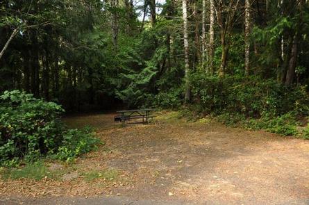
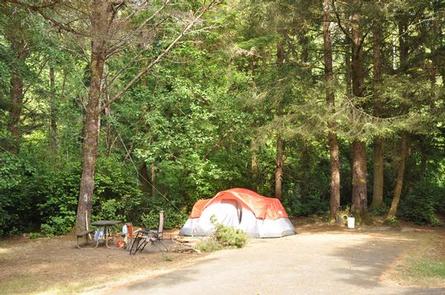
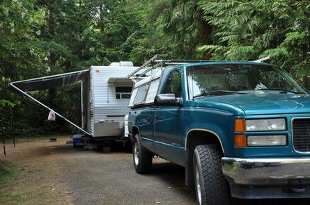
The campground offers single-family sites and group sites for overnight camping and day-use picnicking. Some sites offer electric hookups.

Picnic tables and campfire rings are provided, as are flush toilets and drinking water.

Natural Features

The campground is set among scenic coastal pine, Douglas-fir, spruce, wax myrtle and huckleberry trees within the Siuslaw National Forest. The Siuslaw extends across the lush forests of the coastal mountains to the Oregon Dunes and beaches of the Pacific Ocean.

Nearby Attractions

Oregon Dunes National Recreation Area begins 15 minutes south of the campground visitors will find 40 miles of wind-sculpted, shifting sand dunes. The area is known for its off-road opportunities, but it also offers accessible trails and beach access. Enjoy Darlingtonia State Natural Site, Heceta Beach, Sea Lion Caves and old town Florence, all within 10 miles of the campground.

Reservation

More from CampingHiking.net:

STONY POINT, Minnesota Campground Images, Info & Reservations

Directions From Walker, Minn., take Highway 200 east 6 miles to County Road 13. Go north 3 miles on County Road 13 to Forest Road 3793, then east 2.5 miles on FR 3793 to the campground. Phone 218-547-1044 Activities BOATING, CAMPING, FISHING, HIKING, SWIMMING SITE Keywords STOP,CHIPPEWA NF – FS

ARLIE MOORE, Arkansas Campground Images, Info & Reservations

Directions From Interstate 30, take exit 78 and merge onto State Highway 7 north for 9 miles. Turn left onto Arlie Moore Road and continue 2 miles to campground. Phone 870-246-5501 Activities BOATING, CAMPING, FISHING, HIKING, DAY USE AREA, SWIMMING SITE Keywords ARLI,DEGRAY LAKE,DEGRAY LAKE Related Link(s) Rec Area Info

ANCHOR PASS CABIN, Alaska Campground Images, Info & Reservations

Directions The cabin is approximately 50 air miles north of Ketchikan, located on the mainland shore of Anchor Pass across from the east end of Bell Island. It is accessible by floatplane or by boat. A mooring buoy is provided at the site on a first come-first serve basis. Refer

SANTA BARBARA ISLAND, California Campground Images, Info & Reservations

Directions Boat transportation can be arranged with Island Packers from Ventura Harbor. To park headquarters in Ventura, California: Highway 101, exit Victoria or Seaward to Ventura Harbor. Phone 805-658-5730 Activities BOATING, CAMPING, INTERPRETIVE PROGRAMS, FISHING, HIKING, PICNICKING, VISITOR CENTER, WATER SPORTS, WILDLIFE VIEWING, WILDERNESS, INFORMATION SITE, PHOTOGRAPHY, SWIMMING, SNORKELING, RANGER

CHALK LAKE, Colorado Campground Images, Info & Reservations

Directions From Buena Vista, Colorado, take Highway 285 south to Nathrop. Turn west on County Road 162 and travel 8 miles to the campground. Phone CAMPGROUNDS DO NOT HAVE PHONE SERVICE, CALLING TO CHECK AVAILABILITY PRIOR TO ARRIVAL IS NOT POSSIBLE. FOR RESERVATIONS CALL: 1-877-444-6777 Activities HISTORIC & CULTURAL SITE,

PONDEROSA PICNIC AREA, Utah Campground Images, Info & Reservations

Directions From Beaver, Utah, travel east on paved State Route 153, the Beaver Canyon Scenic Byway, for approximately 9 miles, to the picnic area. Phone 435-438-2436 Activities BIKING, CAMPING, FISHING, HIKING, DAY USE AREA Keywords POND,Ponderosa campground,Ponderosa,FISHLAKE NF – FS Related Link(s) Rec Area Info & Images Utah State Road