PIONEER PARK, WA Campground Reservation, Info, Images, Map, Directions

PIONEER PARK, Washington Campground Images, Info & Reservations

Directions

From downtown Newport, travel east on U.S. Highway 2 for 0.75 miles. Immediately after crossing the Pend Oreille River bridge, turn left on LeClerc Road and travel 2 miles north to the campground.

Phone

509-447-7300

Activities

BOATING, CAMPING, FISHING, HIKING

Keywords

PIOR,COLVILLE NF – FS,PIONEER

Related Link(s)

Rec Area Info & Images

Washington State Road Conditions

Washington State Tourism

Overview

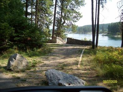
Pioneer Park Campground is located in northeast Washington on the Pend Oreille River. Visitors enjoy hiking, fishing, boating and swimming. The campground’s proximity to the city of Newport provides urban entertainment opportunities as well.

Recreation

The Pioneer Park Heritage Trail, a short trail that highlights the history of the Kalispel Tribe, is a favorite attraction in the campground. Twelve interpretive displays are dispersed along the 0.3-mile boardwalk trail, which boasts scenic views of the river below.

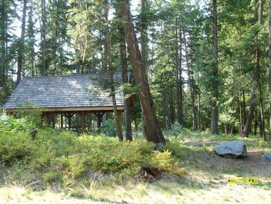
Excellent bass and trout fishing can be found in the Pend Oreille River. A boat ramp, picnic shelter and swimming area are located on-site.

Facilities

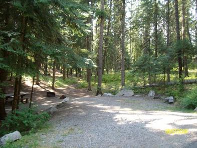
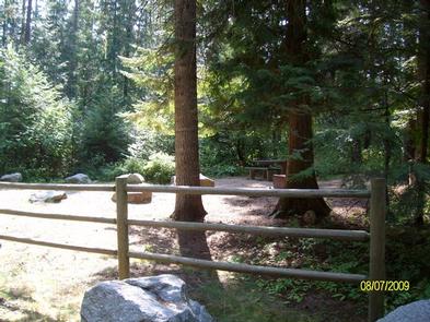
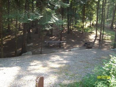
Each campsite is equipped with a picnic table, campfire ring and tent pad. Amenities include vault toilets and drinking water. Gravel parking spurs can accommodate any RV size.

Natural Features

The campground is surrounded by groves of ponderosa pine, white pine, hemlock and grand fir trees, and sits at an elevation of 2,000 feet. Campsites are spacious and shady, with an understory of wild roses and thimbleberry.

Pioneer is situated at the southern edge of Colville National Forest, near the Idaho border. The forest spans 1.1 million acres and encompasses the Okanogan, Kettle River and Selkirk Mountain Ranges.

Nearby Attractions

The city of Newport is conveniently close for a restaurant outing or summer entertainment. Children will enjoy the Little People’s Park in town.

Reservation

More from CampingHiking.net:

BULLTOWN CAMP, West Virginia Campground Images, Info & Reservations

Directions From North of Charleston, WV and I-79, take Exit 67 (Flatwoods) and travel north on U.S. Highway 19 for 10 miles. Follow signs into campground. From Clarksburg, WV and I-79, take Exit 91 (Roanoke), travel south on U.S. 19 for 28 miles. Follow signs into campground. Physical Address: Bulltown

New Fork Lake Group Campground, Wyoming Campground Images, Info & Reservations

Directions From Pinedale, take U.S. Highway 191 northwest 6 miles. Turn north onto State Highway 352 and travel just over 14 miles. Turn east onto New Fork Lake Road, which is gravel, and travel almost 4 miles to the campground. Phone 307-367-4326 Activities BIKING, BOATING, CAMPING, FISHING, HIKING, WILDLIFE VIEWING,

SITKOH LAKE (EAST) CABIN, Alaska Campground Images, Info & Reservations

Directions Accessible mid-April through October. Located 35 air miles northeast of Sitka on the southeast side of Chichagof Island, about 30 minutes by floatplane. Also accessible by boat (3-4 hours from Sitka) from Sitkoh Bay, then follow the Sitkoh Lake Trail (in poor condition) 4.3 miles to the cabin. For

FRANKLIN LAKE, Wisconsin Campground Images, Info & Reservations

Directions Drive approximately 8 miles east from Eagle River on Highway 70. Turn south onto Military Road/Forest Road 2178 and continue about 2 miles, to Butternut Lake Road/Forest Road 2181, and continue approximately 4 miles to the campground. Phone 715-479-2827 Activities BOATING, HISTORIC & CULTURAL SITE, CAMPING, INTERPRETIVE PROGRAMS, FISHING,

PEAVY CABIN, Oregon Campground Images, Info & Reservations

Directions North of Baker City, take U.S. Hwy 30 (Elkhorn Drive Scenic Byway) to Haines. At Haines, turn west on County Rd 1146, staying with the Scenic Byway to Anthony Lakes. Continue on the Scenic Byway (now Forest Service Road 73) past the Elkhorn Summit for approximately 8 miles. Turn