
Directions
From Asheville, North Carolina, take I-40 west to exit 27. Go west on U.S. 23/74 to Waynesville and take exit 102. Take U.S. 276 south and turn right on NC 215 south. Take SR 1756 (Charley’s Creek Road). Go 5 miles to the Balsam Lake Lodge (located on the left at Forest Service sign/gate).
From the Blue Ridge Parkway, take NC 215 south for 5 miles to SR 1756 (Charley’s Creek Road). Go west 5 miles to the lodge (Located on the left at Forest Service sign/gate).
Phone
828-524-6441
Activities
BOATING, CAMPING, FISHING, HIKING, HUNTING, WILDLIFE VIEWING
Keywords
BSLL,Meade Lodge,BALSAM LAKE CABIN,NFs IN NORTH CAROLINA – FS
Related Link(s)
North Carolina State Road Conditions
Overview
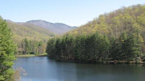
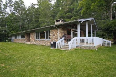
Balsam Lake Lodge is nestled in the center of the 39,000-acre Roy Taylor Forest within the Nantahala National Forest. The lodge overlooks Balsam Lake and offers spectacular mountain views.
The lodge opened its doors to the public when the Forest Service acquired the dwelling and lake in 1982. Since then groups have rented the lodge for meetings, recreation and environmental activities.
Recreation
Near the 8-acre lake are three short hiking trails, several fishing piers and a picnic area. The Robinson Trail, suitable for wheelchairs, leads to a dock and fishing pier. The Malonee Trail travels approximately a half-mile beside the lake to the day use area. The .3-mile Wolf Creek Trail continues beside a stream.
Anglers can fish for trout in Balsam Lake. It’s also open to non-motorized boating.
Facilities
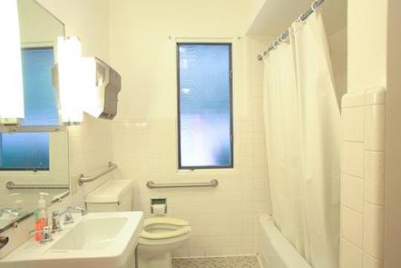
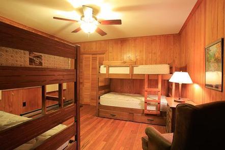
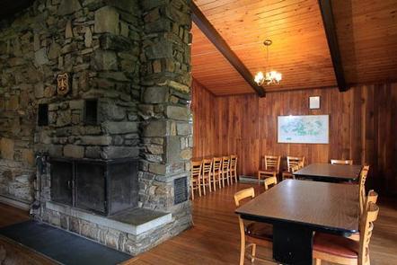
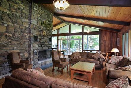
The lodge’s amenities include 16 twin beds (some bunks) complete with linens and pillows, and accessible kitchen with all utensils and appliances, outside grills, three bathrooms with flush toilets, one roll-in wheelchair shower, firewood, fireplace, gas heat and a phone for local or credit calls. The lodge has electricity.
Natural Features
Nestled in the Blue Ridge Mountains of North Carolina, Balsam Lake Lodge offers a haven in the Nantahala National Forest. This mountain getaway can be reserved for weekends and weekdays from early April through late November. Reservations will be open from early April through late November. A dense forest of mixed deciduous and conifer trees hugs the shoreline of this tranquil lake.
Nearby Attractions
Visitors to Balsam Lake Lodge can explore the rest of the Nantahala National Forest, which is especially known for its spectacular waterfalls. This includes Whitewater Falls, the highest falls east of the Rocky Mountains.
Charges & Cancellations
$170 per night sunday through Thursday. $200 per night friday and saturday.