

Directions
Take Highway 410 to milepost 88.4, then turn left on Bumping Lake Road and continue for 6 miles.
Phone
541-338-7869
Activities
BIKING, BOATING, CAMPING, FISHING, HIKING, HORSEBACK RIDING, VISITOR CENTER, WILDLIFE VIEWING
Keywords
COUG,BUMPING RIVER,NACHES,OKANOGAN – WENATCHEE NF -FS
Related Link(s)
Washington State Road Conditions
Overview
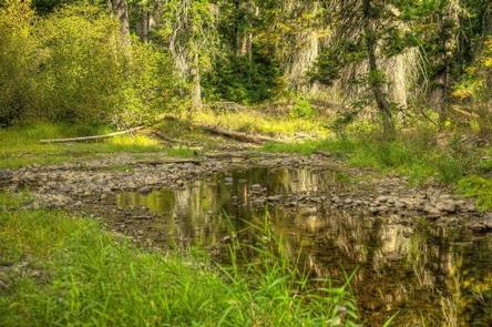
Cougar Flat Campground is nestled into a mountain forest northwest of Naches, Washington.
The campground offers an ideal setting for families and outdoor enthusiasts looking for a secluded camping experience in the beautiful Okanogan National Forest.
Recreation
In addition to being a prime location for hiking, fishing, hunting, horseback riding and mountain biking in summer and early fall, Cougar Flat offers excellent skiing, snowshoeing and snowmobiling in the winter months.
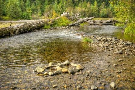
Nearby Bumping Lake offers visitors opportunities to boat, fish, swim or simply relax on its sandy beach.
The campground is a great base camp for day-hikers and overnight backpackers. Several access trails from the area give hikers the chance to create their own excursions.
The American Ridge Trail is a popular among hikers and equestrians, meandering through more than 26 miles of towering forests, mountain meadows and high elevation lakes from the Bumping River to Pacific Crest Trail.
Nature lovers may also want to explore the nearby Goose Prairie Trail.
Facilities
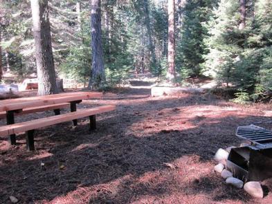
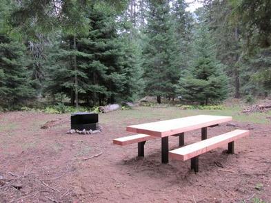
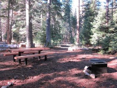
Adjacent to the Bumping River, this campground offers eight standard sites, and four walk-in, tent only sites.
Sites are equipped with picnic tables and campfire rings with grills. Vault toilets and drinking water are also available. A boat ramp is located at the nearby Bumping Lake campground
Natural Features
Encompassing more than 4 million acres and stretching north to south from the Canadian border to the Goat Rocks Wilderness, the Okanogan National Forest offers countless recreation opportunities.
Visitors are afforded stunning scenic views, with high, glaciated alpine peaks, valleys of old growth forest and rugged shrub-steppe country making up the diverse landscape. Elevations range from below 1,000 feet to more than 9,000 feet.
The surrounding undeveloped wilderness, clean streams and diverse forests support an abundance of wildlife, including deer, porcupine, native fish and migratory birds. Endangered and threatened species, including the Northern Bald Eagle, the Northern Spotted Owl, gray wolves and grizzly bears, also find havens in nearby ecosystems.
Nearby Attractions
In the fall thousands of visitors come to experience white water rafting on both the Tieton and American Rivers.
Visitors enjoy the Mt. Rainer National Park, where interpretive programs and exhibits offer education about the diverse landscape and history of the area.
The Pacific Crest Trail (PCT), one of the world’s premier National Scenic Trails, showcases some of North America’s most fantastic scenery, winding its way its way from Mexico to Canada through California, Oregon and Washington, and is accessible near the campground.