LAKE THREE, WI Campground Reservation, Info, Images, Map, Directions

LAKE THREE, Wisconsin Campground Images, Info & Reservations

Listen

Directions

34412 Mineral Lake Rd. (FR 198)

From Mellen, Wisconsin; Take County Highway GG west for about 8 miles. Turn right onto Forest Service Road 187/Mineral Lake Road and continue for 3 miles to the intersection with Forest Service Road 198/Pine Stump Corner. Turn right and continue less than a mile to the campground sign.

Phone

715-634-4821

Activities

BOATING, CAMPING, FISHING, HIKING, SWIMMING SITE

Keywords

LATH,CHEQUAMEGON-NICOLET NF – FS

Related Link(s)

Rec Area Info & Images

Wisconsin State Tourism

Wisconsin State Road Conditions

Overview

We apologize, this campground is currently closed.

Recreation

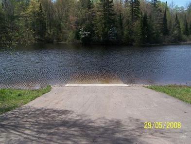
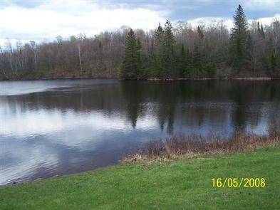
The lake is home to musky, bass and pan fish and offers an ideal spot to kayak, canoe, swim or enjoy a leisurely boat ride.

The North Country National Scenic Trail is adjacent to the campground, providing opportunities for visitors to enjoy day trips along the trail, which stretches approximately 4,600 miles from New York to North Dakota.

The surrounding area offers miles of off-road vehicle, hiking and mountain biking trails, along with several lakes, ponds and rivers to cast a line or launch a boat. Springbrook, a Class 1 brook trout stream, is nearby, and is popular among anglers.

Facilities

Natural Features

Nearby Attractions

While in the area, visitors are encouraged to visit Morgan Falls, St. Peter’s Dome, and the Penokee Overlook, all of which are just a short drive from the campground.

Reservation

More from CampingHiking.net:

Laurel River Lake Picnic Area, Kentucky Campground Images, Info & Reservations

Listen Directions From London, Kentucky, head west on HWY 192 for approximately 15 miles. Turn slight left onto KY-1193. Continue on KY-1193 until arrive at destination on left. Area is marked by "Laurel Dam Picnic Area" signs. Phone 606-864-6412 Activities HIKING, SWIMMING SITE Keywords Laurel River Lake Picnic Area,Laurel Picnic

PAINTED ROCKS, Colorado Campground Images, Info & Reservations

Listen Directions From the I-25 and Highway 24 intersection in Colorado Springs, Colorado, travel west on Highway 24 for about 18 miles to the junction with Highway 67 in Woodland Park. Turn right (north) on Highway 67 and drive about 7 miles to Painted Rocks Road and turn left (west).

NORDHEIMER GROUP SITES, California Campground Images, Info & Reservations

Listen Directions From Highway 96, turn onto Salmon River Road/Forest Highway 93 and continue about 13 miles to the campground. Phone 530-627-3291 Activities BIKING, BOATING, CAMPING, FISHING, HIKING, SWIMMING SITE Keywords NORD,Crystal Springs Group Sites,SIX RIVERS NF -FS Related Link(s) Rec Area Info & Images California State Tourism California State

COLD CREEK, California Campground Images, Info & Reservations

Listen Directions From Truckee, California, take Highway 80 north to Highway 89 approximately 20 miles. The campground is on the left side of the highway. From Sierraville, head south on Highway 89 approximately 5 miles, the campground will be on the right side of the highway. Phone (530) 994-3401 Activities

MINERSVILLE CAMPGROUND, California Campground Images, Info & Reservations

Listen Directions From Weaverville: take Highway 3 north for 15 miles. Turn right on Minersville/Bushtail Road for 1 mile. Phone 530-623-2121 Activities BOATING, CAMPING, FISHING, HIKING, WATER SPORTS, SWIMMING SITE Keywords Trinity Lake,Clair Engle Lake,Minersville Related Link(s) Rec Area Info & Images California State Road Conditions California State Tourism Forest

PEAK ONE, Colorado Campground Images, Info & Reservations

Listen Directions From I-70, take Frisco exit 203. Travel south on Highway 9 to Peninsula Recreation Area. Follow road approximately 2 miles to Peak One Campground. Please note that the new entrance to the campground is one-eighth mile south of the Frisco Peninsula Area. Phone 970-468-7681 Activities BIKING, BOATING, CAMPING,