
Directions
From Tellico Plains, Tenn., travel east on Highway 165 (Cherohala Skyway) for 5 miles. Turn right onto Forest Road 210 and continue 9 miles to the intersection of Forest Road 217 (North River Road). There will be a sign for the Donley Cabin and North River Campground. Turn left onto Forest Road 217 and proceed for 5.5 miles to the parking area on the right. The condition of the road may require slow travel. Follow the quarter-mile trail over North River to the cabin.
Phone
(423) 253-8400
Activities
BIKING, CAMPING, FISHING, HIKING, HUNTING, WILDLIFE VIEWING, FISH HATCHERY, SWIMMING, WATER ACTIVITIES, KAYAKING, CANOEING, SCENIC DRIVE, BACKPACKING
Keywords
DONL,CHEROKEE NF – FS
Related Link(s)
Tennessee State Road Conditions
Overview
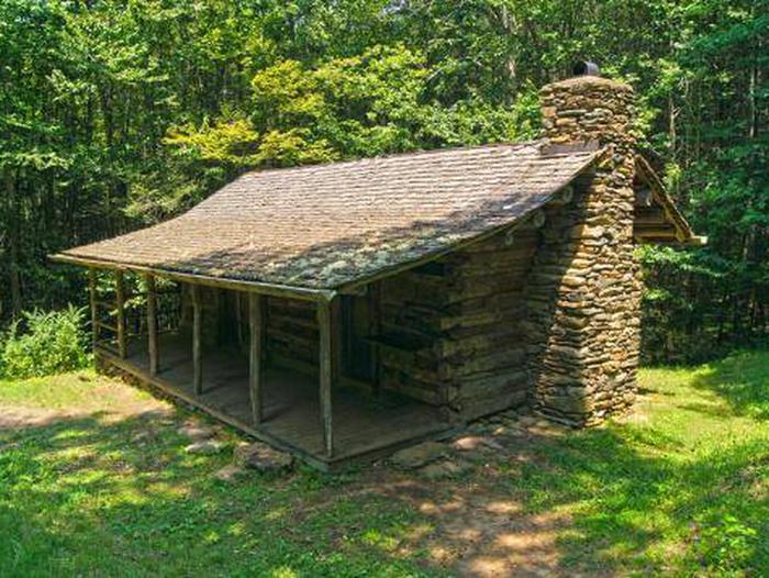
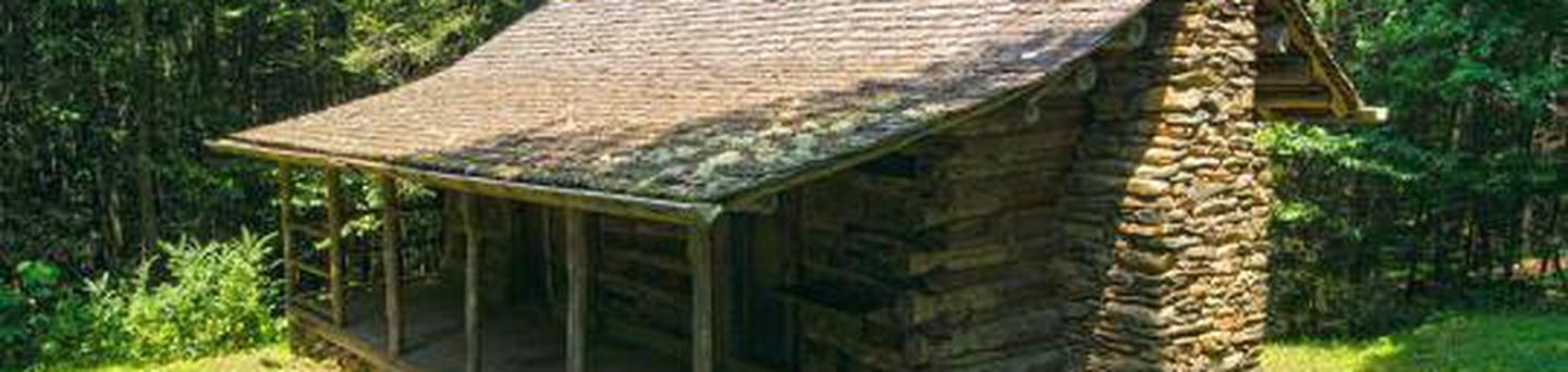
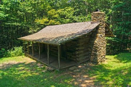
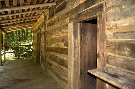
Donley Cabin is a primitive and historic structure in the heart of the Cherokee National Forest, offering visitors a glimpse of the past. The cabin does not have electricity, running water or locks on the door. Guests should be aware that visitors often frequent the cabin during tours of the area. It predates the Civil War and is among the oldest cabins available for rental in the Forest Service system. The cabin offers access to a variety of recreational activities, including numerous trails and streams. Visitors must walk a quarter-mile from the parking area, along a slight grade and over a bridge on the North River, to the cabin. All equipment must be carried in. Guests are responsible for their own travel arrangements and safety, and must bring many of their own amenities. No pets are allowed except for service animals. The cabin is available by RESERVATION ONLY. Walk-ins are not allowed.
Recreation
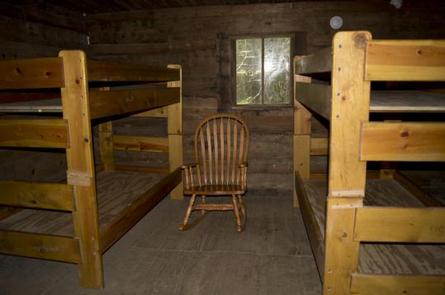
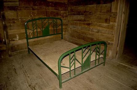
The one-room cabin contains a full-size metal bed and two bunk beds that can accommodate up to six people. All beds have bed frames but NO mattresses. There are hiking trails and fishing streams in close proximity to the cabin. The nearby Sycamore Creek Trail is a short drive north on Tellico River Road. The 2-mile trail starts near a picnic area and a fish hatchery and follows an old logging road and railroad bed along Sycamore Creek. Big Cove Branch, a tributary to the North River that contains two distinctive waterfalls and trout-fishing opportunities, is also not far from the cabin. Hunting is also a popular activity enjoyed by visitors to the area from September through December. Hunters and their dogs may frequent the nearby trails during that time.
Facilities
The one-room cabin contains a full-size metal bed and two bunk beds that can accommodate up to six people. There is a rustic fireplace, kitchen table and chairs as well as rocking chairs available to sit on the cabin’s front porch. An outhouse with a vault toilet, campfire ring and grill are available outside the cabin.
Guests must bring their own water for drinking, cooking and cleaning purposes, as well as lanterns or flashlights, bedding, towels, cooking and eating gear, food, garbage bags, toilet paper and other necessities. Firewood that is dead and down may be obtained from the surrounding forest.
Natural Features
The restored cabin sits in a wooded area of the forest’s Tellico River area, at an elevation of 2,000 feet. This part of the forest is known for its three rivers, their tributaries and waterfalls. The cabin is several miles north the 90-foot Bald River Falls. A variety of wildlife make its home in the area. The area is also known for its abundant brown, rainbow and book trout. Snakes and mice can be seen in the area as well. The surrounding foliage is beautiful in the fall.
Nearby Attractions
Driving in or out, guests can visit the mountain town of Tellico Plains, which is known for its arts and crafts. Guest can also enjoy the Cherohala Skyway, the 43-mile National Scenic Byway that stretches from Tellico Plains, Tennessee, to Robbinsville, North Carolina.