
Directions
From Interstate 40 west, take exit 47 and turn south onto Highway 191. Stay in the right hand lane and turn south again onto the Blue Ridge Parkway at the North Carolina Arboretum; enjoy the amazing views and nine tunnels along the Blue Ridge Parkway for 15 miles (24 km). You will pass the Mt. Pisgah Parking Area, the Country Store and the Pisgah Inn on the left. The campground is on the right immediately after the Pisgah Inn. From Waynesville, North Carolina, take Highway 276 for about 22 miles to The Blue Ridge Parkway. Turn north onto the parkway and continue four miles to the campground on the left.
Phone
828-648-2644 (MAY – OCTOBER)
Activities
CAMPING, INTERPRETIVE PROGRAMS, HIKING, WILDLIFE VIEWING, PHOTOGRAPHY, STAR GAZING, BIRDING, GUIDED INTERPRETIVE WALKS
Keywords
MPIS,MOUNT PISGAH CAMPGROUND,PISGAH CAMPGROUND,BLUE RIDGE PARKWAY NATIONAL PARK,BLUE RIDGE
Related Link(s)
North Carolina State Road Conditions
Overview
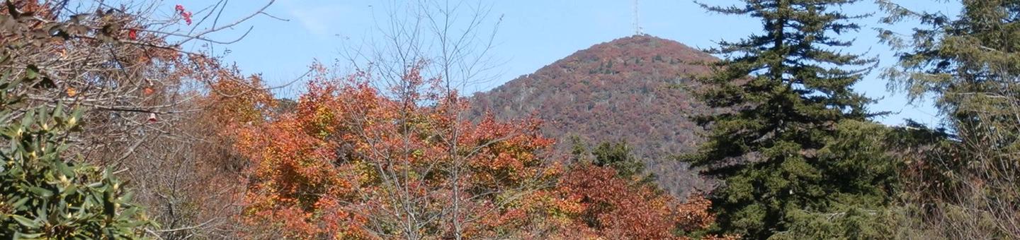
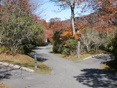
One of the most popular of the Parkway’s campgrounds, Mount Pisgah Campground is perched in the rolling mountains of western North Carolina on the southernmost end of the famous Blue Ridge Parkway. Surrounded by dense hardwood forests, it offers shady, cool respite from the summer heat.
Recreation
Several popular hiking trails, ranging from moderate to difficult, are easily accessible from the campground. The Frying Pan Trail leads adventurers 1.6 miles (2.6 km) south to the Fire Tower at Frying Pan Mountain. Hiking north on the trail you’ll arrive at the Pisgah Inn and from there, the Buck Skin Trail leads visitors through the thick hardwood forest and along rocky terrain to the Mt. Pisgah Parking Area. From the parking area it is a 1.6 mile (2.6 km) uphill trek to the top of Mt. Pisgah.
The Shut-In Trail is the original route from the Biltmore Estate to the Buck Spring Lodge, and heads north along the Blue Ridge Parkway toward Asheville. The Buck Spring Lodge was a mountain getaway for George Vanderbilt, owner of the famous Biltmore Estate.
The North Carolina Mountains to Sea Trail follows both the Buck Spring and Shut-In Trails, and connects to trails in Pisgah National Forest.
Facilities
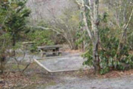
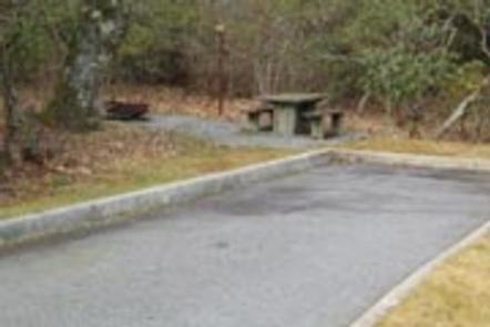
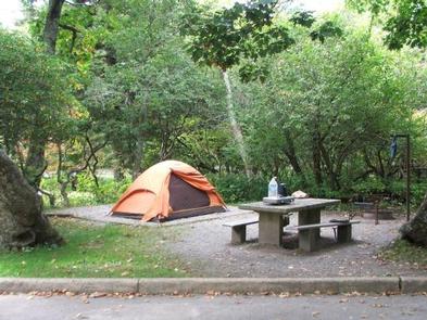
Both RV and tent sites are available at this roomy campground. Modern amenities like flush toilets, drinking water, dump station, and a country store create a comfortable camping experience. Sites come with picnic tables and fire rings, perfect for barbecues and marshmallow roasting.
In addition to the 53 sites available for advanced reservation, 71 campsites are available on a first-come, first-serve basis. Mt. Pisgah campground is oftentimes full each weekend.
Natural Features
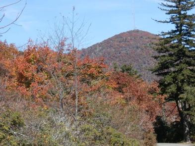
Mount Pisgah is part of the Appalachian Mountain Range, an area of the country with scenery that never disappoints, whether blanketed in wildflowers in the spring or bursting with red, orange, and yellow hues in the fall. The Blue Ridge Parkway is a scenic byway that follows the high crests of the central and southern Appalachians for 469 miles from Shenandoah National Park in Virginia to the Great Smoky Mountains National Park in North Carolina. At an elevation of 4,980 feet (1,518 m), Mount Pisgah offers moderate to cool temperatures during camping seasons.
Nearby Attractions
The beautiful Pisgah Inn is located adjacent to the campground and offers a restaurant and country store.
Additionally, historic Asheville, North Carolina is about 20 miles away, offering grocery stores, fuel and medical facilities.