
Directions
From Unity, Oregon: go northwest 2 miles toward John Day on Highway 26. Turn right (north) on State Road 245 and go past Unity Reservoir. Approximately 2 miles past the reservoir, turn left (north) on County Road 535 (which becomes County Road 529) and go 18 miles to the Antlers Guard Station on your right. Driving time from Unity is approximately 45 minutes.
From Baker City: take State Highway 7 south approximately 38 miles to County Road 529. Turn south at the old Whitney town site. Follow County 529 (approximately 2 miles) along the North Fork of the Burnt River to the Cabin on your left. Driving time from Baker City is one hour.
From John Day: take State Highway 26 east to Austin Jct., turn north on State Highway 7 to County Road 529. Drive approximately 15.5 miles, and then turn south at the old Whitney town site. Follow County Road 529 (approximately two miles) along the North Fork of the Burnt River to the cabin on your left. Driving time from John Day is approx. 1 hour.
Phone
541-894-2332
Activities
BIKING, HISTORIC & CULTURAL SITE, CAMPING, FISHING, HORSEBACK RIDING, HUNTING, WILDLIFE VIEWING, MOUNTAIN BIKING, BIRDING
Keywords
AGSC,WALLOWA-WHITMAN NF – FS
Related Link(s)
Overview
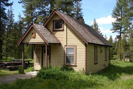
Antlers Guard Station was built in 1935 for the fire crews who patrolled Wallowa-Whitman National Forest. The Forest Roads were not yet well developed, and it was impractical for crews to travel daily between the remote parts of the forest and the ranger station. The Civilian Conservation Corps built this structure to allow crews to stay where they worked. Antlers Guard Station was listed on the National Register of Historic Places in 1991.
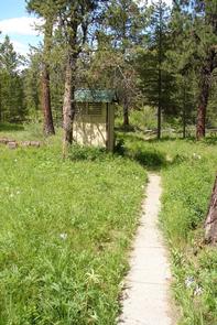
Guests who stay at Antlers Guard Station can still get away from it all while enjoying the basic comforts of home. The cabin is accessible by car.
Recreation
This cabin is popular with rock hounds, botanists, hikers, mountain bikers, hunters, and ATV riders. Anglers can fish for trout in the North Fork Burnt River.
Facilities
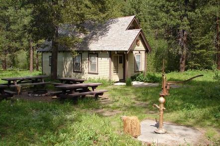
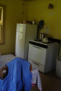
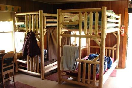
Antlers Guard Station is a cozy, rustic cabin with 2 small rooms. The combined living room and bedroom is furnished with a double futon and 2 sets of bunk beds that sleep 6 people comfortably. The kitchen has a table and chairs, a propane range and refrigerator, and utensils for cooking and eating.
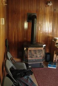
A propane fireplace for heating and propane lights are provided. An outhouse and garage are located near the cabin. Water is available from an outside hand pump, and there is a fire ring and picnic tables for outdoor dining.
Guests are required to bring garbage bags to pack out their trash, and they are expected to clean the guard station before leaving. Bedding, towels and emergency items like flashlights and first aid kits are not provided.
Natural Features
Antlers Guard Station sits at an elevation of 4,107 feet on the west bank of the scenic North Fork of the Burnt River. The surrounding forest is ponderosa pine.
Rattlesnakes, mountain lions and black bears inhabit this area (information on bear safety).
Nearby Attractions
The town of Whitney is 2 miles from Antlers Guard Station. This ghost town, once the home of railway and sawmill workers, fell into decline around 1918. Several long-abandoned buildings are still standing.
Charges & Cancellations
A $10.00 service fee will apply if you change or cancel your reservation. Late cancellations are subject to additional fees. For full details see NRRS Reservation Policy