JOHN W. FLANNAGAN DAY USE, VA Campground Reservation, Info, Images, Map, Directions

JOHN W. FLANNAGAN DAY USE, Virginia Campground Images, Info & Reservations

Listen

Directions

From VA-63, turn right onto State Route 614. Continue straight for approximately two miles.

Phone

276-835-9544

Activities

BOATING, CAMPING, FISHING

Keywords

JOHW,John W. Flannagan Dam,Spillway- Shelters 2 and 3,Below dam recreation area,The two smaller shelters below,JOHN W FLANNAGAN DAY USE,JOHN W FLANNAGAN DAM

Related Link(s)

Rec Area Info & Images

Virginia State Road Conditions

Virginia State Tourism

Overview

The John W. Flannagan Day Use Area boasts an expansive lake nestled in the rolling green Cumberland Mountains of southwest Virginia, offering visitors an oasis of recreation in the summer months. The nearby dam, built primarily for flood control for the Cranesnest and Pound Rivers, creates a breathtaking lake that is maintained at nearly 1,400 feet above sea level.

This day-use facility is an ideal spot for picnicking, water activities, and hiking.

Recreation

Flannagan’s reputation as a fisherman’s paradise is well-known. Visitors can enjoy secluded coves of deep, clean water that are well-stocked with bass, bream, walleye and trout. Boating, canoeing, whitewater rafting, and biking top the long list of activities available nearby.

Facilities

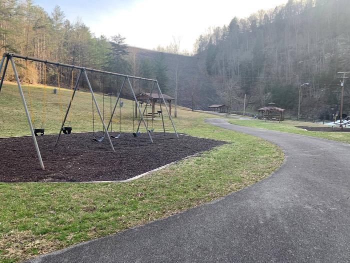
Picnic shelters with grills, electrical hookups, a playground, and horseshoe pits provide an ideal location for parties and other get-togethers.

Natural Features

The John W. Flannagan Dam, completed in 1964, carves out a 1,145-acre lake with nearly 40 miles of beautiful shoreline in the lush Virginia terrain.

Nearby Attractions

The Lower Twin, Cranes Nest and Pound River Campgrounds, located near the day-use area, offer overnight camping.

Breaks Interstate Park is nearby, offering lodging, dining, a museum, gift shop, rafting, canoeing, and other outdoor activities.

Reservation

More from CampingHiking.net:

DEARHAMER CAMPGROUND, Colorado Campground Images, Info & Reservations

Listen Directions From Basalt, travel east on Frying Pan River Road for approximately 20 miles, just past Ruedi Reservoir to Dearhamer Campground. Phone 970-927-0107 Activities BIKING, CAMPING, INTERPRETIVE PROGRAMS, HIKING, WATER SPORTS, WILDLIFE VIEWING Keywords Related Link(s) Rec Area Info & Images Forest Service Concessionaire Colorado State Road Conditions Colorado

THIBAUT POINT, Missouri Campground Images, Info & Reservations

Listen Directions From Highway 65, take Highway T west for 3 miles. Turn south on Georgetown Ave and follow for a mile, following signs into the park. Phone 660-428-2470 Activities BOATING, CAMPING, FISHING, FISH HATCHERY, SWIMMING SITE Keywords THIB,TRUMAN LAKE,TEBO,HARRY S TRUMAN Related Link(s) Rec Area Info & Images Missouri

BLEDSOE FERRY, Missouri Campground Images, Info & Reservations

Listen Directions From Highway 7, travel north on the Dam Access Road for 2 miles and follow signs to the day-use area. Phone 660-438-7317 Activities BIKING, BOATING, CAMPING, FISHING, HIKING, WILDLIFE VIEWING, MOUNTAIN BIKING, KAYAKING, CANOEING, BERRY PICKING, BIRDING, WATER ACCESS Keywords BLED,TRUMAN LAKE,BLEDSOE,HARRY S TRUMAN Related Link(s) Rec Area

FARNUM CREEK, Kansas Campground Images, Info & Reservations

Listen Directions Take I-70 to exit 295 then north on Highway 77. Drive 11 miles to park entrance. Phone 785-463-5791 Activities CAMPING, FISHING, WILDLIFE VIEWING Keywords None Related Link(s) Rec Area Info & Images Kansas State Tourism Kansas State Road Conditions Overview Farnum Creek is a quaint double-loop campground set

WOODS CABIN, Montana Campground Images, Info & Reservations

Listen Directions From Darby, Montana, continue north on Highway 93 for 4 miles. Turn west onto County Road 82/Lake Como Road. Follow signs to the Lake Como National Recreation Area and continue past the swimming area, to a gate at the third lot. Maps of the area can be purchased