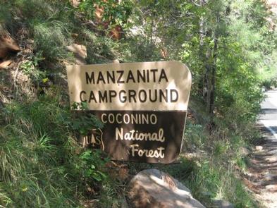
MANZANITA., AZ Campground Reservation, Info, Images, Map, Directions

MANZANITA., Arizona Campground Images, Info & Reservations

Directions

From Phoenix, take I-17 north to Exit 298 for Highway 179. Take 179 north to Sedona. Turn right (north) onto Highway 89A in Oak Creek Canyon and travel 6 miles to the campground.

From Flagstaff, take I-17 south and exit for Highway 89A toward Sedona. Travel 23 miles south on 89A (a winding mountain road) into Oak Creek Canyon. The campground is located just south of Slide Rock State Park.

Phone

928-204-2034

Activities

CAMPING, FISHING, SWIMMING

Keywords

MAN2,OAK CREEK,COCONINO NF – FS

Related Link(s)

Rec Area Info & Images

Forest Service Concessionaire

Arizona State Road Conditions

Arizona State Tourism

Overview

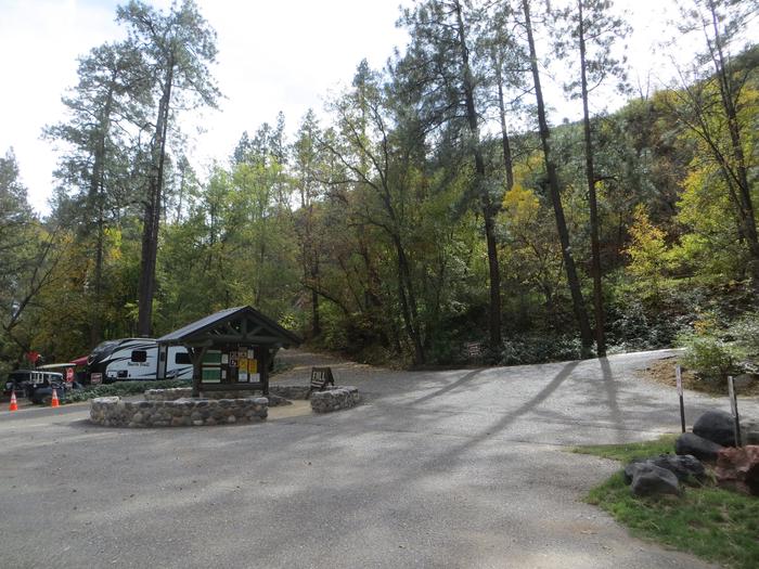
Manzanita Campground is a small, year-round, tent-only facility with campsites that fill up very quickly. Visitors enjoy the campground for its fishing and swimming holes along Oak Creek, beautiful scenery and excellent wildlife watching. Oak Creek Canyon is very crowded, especially on weekends; to get a campsite, it is best to reserve a weekday.

Recreation

Recreation and relaxation abound in Oak Creek Canyon. Camping, fishing, swimming, wading and hiking are some of the activities awaiting visitors. Anglers have the convenience of creekside campsites, where they can cast a line for trout.

Families love driving down the road to nearby Slide Rock State Park, one of Arizona’s most popular swimming spots, or trying out several nearby hiking trails.

Facilities

The campground is very easy to access and has paved parking. It is made up of single-family campsites that are fairly close together. Each site has a picnic table, campfire ring and grill. A campground host is available for visitor assistance. Firewood can be purchased on-site.
Coin-operated showers ($4 minimum) are available at Cave Springs Campground just up the road.

Campground has 7 first-come-first-serve sites which are often occupied. Campground host is unable to “hold” any first-come-first-serve sites for customers.

Natural Features

The campground borders Oak Creek in a lush, forested riparian zone with Arizona ash and box elders, gravel beaches and stream-bed boulders. Colorful songbirds add flashes of brilliance to the trees. The creek’s crystal clear waters are cool and refreshing on hot summer days.

Nearby Attractions

The well-known town of Sedona is popular for its red rock vistas, resorts and shopping. Slide Rock State Park is a great local spot for swimming and only a few minutes away.

Campers can also explore the 1.8 million-acre Coconino National Forest, which boasts a spectacular variety of scenery and outdoor activities.

Reservation

More from CampingHiking.net:

FAWN LAKES CAMPGROUND, New Mexico Campground Images, Info & Reservations

Directions From Red River, drive approximately 3 miles west on NM-38. Phone 435-245-6521 Activities CAMPING, FISHING, HIKING, HOTEL/LODGE/RESORT PRIVATELY OWNED Keywords CARSON NF- FS,Carson National Forest Related Link(s) Rec Area Info & Images Forest Service Concessionaire New Mexico State Road Conditions New Mexico State Tourism Overview Fawn Lakes Campground is

WOODCAMP CAMPGROUND, California Campground Images, Info & Reservations

Directions From Interstate 80, exit onto Highway 89 in Truckee. Follow Highway 89 north for 17 miles to the Jackson Meadows turnoff. Travel west for 18 miles, to Jackson Meadows Reservoir. Cross over the dam and continue to the junction. Turn left and continue to the Woodcamp Recreation Area. Phone

ALLAN POINT CABIN, Alaska Campground Images, Info & Reservations

Directions Cabin is located on Halleck Island in upper Nakwasina Sound, 16 miles north of Sitka. It is accessible by floatplane or boat from Sitka year round, weather permitting. Float plane or boat access can only occur at certain stages of the tide. Please check current conditions prior to your

SUNRISE CABIN, Virginia Campground Images, Info & Reservations

Directions From I-81, take exit 80 (Fort Chiswell) and go east on US 52 for about 1 mile. Turn right and drive south on VA 94 for about 12 miles to the intersection of the Virginia Highlands Horse Trail. Turn right onto a gravel road marked with orange diamonds (this

SPARROWFOOT, Missouri Campground Images, Info & Reservations

Directions From Highway 13, travel about a mile east on SE 450 Road and follow signs into the park. Phone 660-885-7546 Activities BOATING, CAMPING, FISHING Keywords SPAF,TRUMAN LAKE,HARRY S TRUMAN Related Link(s) Rec Area Info & Images Missouri State Road Conditions Missouri State Tourism Overview SPARROWFOOT CAMPGROUND WILL REMAIN CLOSED

EAGLE GUARD STATION, Montana Campground Images, Info & Reservations

Directions All mileage is approximate from the highway. From Helena, take Highway 287 for 26 miles southeast towards Townsend, Montana. Turn right on Indian Creek Road just before crossing the Missouri River. Travel for 3 miles, then turn left onto Forest Road #4031 (purple sign). Travel 5 miles to an