Directions
From Missoula, Montana, travel south on Highway 93 to Medicine Creek Road/Forest Service Road 370, which is approximately 36 miles south of Hamilton. Turn right and continue about 4 miles to the trailhead, which is located at Crazy Creek Campground. An easy, 6-mile hike leads to the cabin from the parking area.
The trail follows Warm Springs Creek until it intersects with two other creeks, and then follows Porcupine Creek about a mile to the cabin. Trails are open to hiking, horseback riding, mountain biking. Off-road vehicles are not allowed.
Phone
406-821-3913
Activities
CAMPING, FISHING, HIKING, HORSEBACK RIDING, WINTER SPORTS, WILDLIFE VIEWING, MOUNTAIN BIKING, BACKPACKING
Keywords
TWOC,BITTERROOT NF -FS
Related Link(s)
Overview
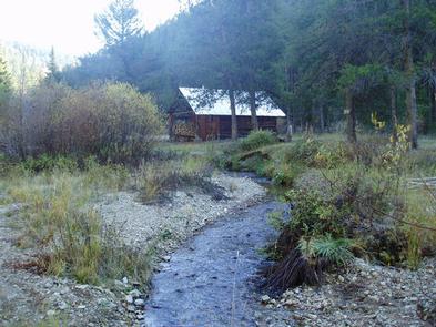
Twogood Cabin offers guests a unique chance to camp in the forest of western Montana, in a rustic, old-time setting. It is available between the end of May through the middle of October, as well as throughout December, providing access to the surrounding mountains’ best features and recreational attractions. Hiking, backpacking and horseback riding is popular during the warmer months and visitors enjoy cross country skiing and snowshoeing on the snow-covered terrain. Twogood Cabin is located 6 miles up a non-motorized trail.
Recreation
Fishing is popular in the adjacent stream and anglers might catch a variety of trout. At least two other mountain creeks are available in the area. The Warm Springs Creek is a larger stream and provides excellent fishing for cutthroat and other trout. Visitors also enjoy wading in the cool water. A variety of hiking, mountain biking and horseback riding trails follow the creek. The large, rolling meadows are a winter elk range. When the snow melts, moose and deer may be spotted in the meadows. The 6-mile hike includes several creek crossings. Off-road vehicles are not allowed on the trail, however, horses and other livestock are welcome. In the winter, the trails are popular for cross country skiing and snowshoeing.
Facilities
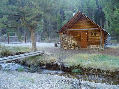
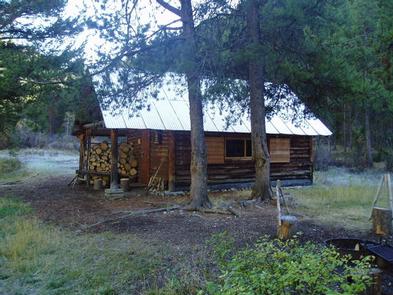
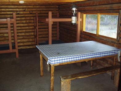
The one-room, 15-by-19 cabin can accommodate up to four people. It is equipped with two bunk beds, a table and chairs, counter space, a wood stove for heat and a propane stove for cooking. A propane lantern is also available. Guests will need to bring your own propane fuel canisters. Firewood is provided on the covered porch outside the cabin. Inside the cabin, pots, pans and basic cooking and eating utensils are available. An outdoor outhouse is provided. Guests will need to bring their own water for drinking, cooking and cleaning purposes. They will also need to bring bedding, towels, propane fuel canisters for cooking and for the lantern, as well as toilet paper and garbage bags. Water taken from the creek must be boiled, filtered, or treated prior to consumption. Guests are required to clean the cabin prior to their departure. Two hitch rails for stock are located within site of the cabin and can accommodate up to 12 head of stock. Grazing within one mile of the cabin is prohibited. Feed for stock must be certified weed-seed free. Access to Twogood Cabin is by forest road and trail. Winter conditions can prevent access by vehicle to the trailhead. Snowshoeing, cross country skiing or snowmobiling may be the only access to the trailhead in the winter time. Guests are responsible for their own travel arrangements and safety, and must bring several of their own amenities.
Natural Features
The rustic cabin is situated on Porcupine Creek, in a road-less area of the southern Bitterroot Mountains, at an elevation of about 5,600 feet. It was built in 1952 by Harry Twogood and Clifford Wetzsteon and was used throughout the 1970s as a range camp until it was opened to the public for recreation purposes.
The Bitterroot forest is home to many species of wildlife, from mule deer, whitetail deer, elk, bighorn sheep, mountain goats, black bear, mountain lions, and moose to many varieties of smaller animals and birds.


