LIVE OAK SOUTH, CA Campground Reservation, Info, Images, Map, Directions

LIVE OAK SOUTH, California Campground Images, Info & Reservations

Directions

From Bakersfield, take Highway 178 east to the town of Lake Isabella. From Lake Isabella, take Highway 155 north approximately 6 miles to Live Oak South campground.

Phone

760-376-1815

Activities

CAMPING

Keywords

LIOA,LIVE OAK,LIVE,OAK,OAK SOUTH,LIVE SOUTH,SEQUOIA NF – FS

Related Link(s)

Rec Area Info & Images

Forest Service Concessionaire

California State Tourism

California State Road Conditions

Overview

Reservations not being accepted. Live Oak South Campground is located across the road from Lake Isabella, a popular destination for boating, windsurfing, fishing and swimming. Lake Isabella sits within Sequoia National Forest, just 6 miles from the town of Lake Isabella.

Recreation

Water activities at Lake Isabella are popular and include swimming, water skiing, windsurfing and fishing. The lake is known for its trout fishing during the colder months. Other species include black and white crappie, bluegill, catfish and largemouth bass.

Facilities

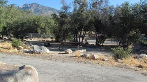
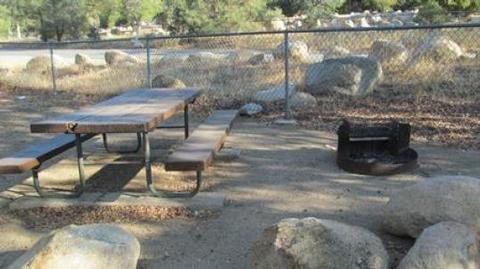
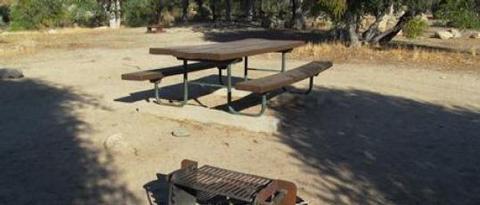
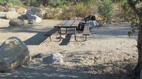
The campground offers sites for tent camping only. Each site is equipped with a picnic table and campfire ring. Flush toilets, showers and drinking water are provided.

Natural Features

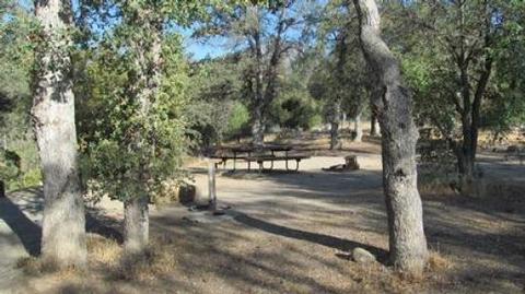
The campground is situated in a grove of scenic oak trees at an approximate elevation of 2,500 feet.

Lake Isabella sits at the southern end of the Sierra Nevada range. The 11,000-acre lake marks the division between the Upper Kern River and the Lower Kern River.

Sequoia National Forest is named for the giant sequoia, the world’s largest tree, which grows in more than 30 groves on the forest’s lower slopes. The forest comprises about 1.1 million acres. Elevations range from 1,000 to 12,000 feet, creating precipitous canyons and mountain streams with spectacular waterfalls such as Salmon Creek Falls and Grizzly Falls.

Nearby Attractions

Live Oak South provides a good base for day trips to Sequoia National Park. The Trail of a Hundred Giants and numerous sequoia groves can be found nearby within Giant Sequoia National Monument.

The Giant Sequoia Mercantile is just 5 miles away in Kernville, and offers a wide variety of books, maps, gifts and camping equipment.

Reservation

More from CampingHiking.net:

SHEEP BRIDGE, Oregon Campground Images, Info & Reservations

Directions From Bend, Oregon: Travel 26.8 miles south on Hwy 97 to Wickiup Junction, then 11.0 miles west on County Road 43, then continue 4.6 miles west on Forest Road 42 , and finally 0.8 miles south on Forest Road 4260. Phone 541-323-1746 Activities BOATING, CAMPING, FISHING, HIKING Keywords SHEEP

BONANZA CCC GROUP CAMPGROUND, Idaho Campground Images, Info & Reservations

Directions From Highway 75, turn onto Yankee Fork Road (Forest Road 013) at Sunbeam Dam overlook. Travel approximately seven miles north on Yankee Fork Road and turn left at the Bonanza Guard Station onto Forest Road 074. Continue for approximately half a mile to the campground. Phone 208-879-4100 Activities CAMPING,

SOWELL CREEK, Texas Campground Images, Info & Reservations

Directions From Comanche, Texas, take Highway 67/377 east for 12 miles to the town of Proctor. Turn left on FM 1476 west and continue 2 miles to Recreation Road 6. Turn left and continue for 1/2 mile to the park entrance. Phone 254-879-2322 Activities BOATING, CAMPING, FISHING, HIKING, SWIMMING SITE

FLATWOODS GROUP PICNIC AREA, Virginia Campground Images, Info & Reservations

Directions From Coeburn, VA, go south on State Route 72 for 2.3 miles. The Flatwoods Picnic Area will be on the right (west) side of Route 72. Phone 276-679-8370 Activities BIKING, FISHING, HIKING, PICNICKING, DAY USE AREA, PHOTOGRAPHY, SCENIC DRIVE Keywords Related Link(s) Rec Area Info & Images Virginia State

PINE MEADOWS CAMPGROUND, Oregon Campground Images, Info & Reservations

Directions From Eugene, Oregon: Traveling south on Interstate 5 to Exit 172. Take exit 172, turn left on 6th street / London Road, and drive approximately 3 miles. Take a left on Cottage Grove Reservoir Road and drive 2.5 miles to Pine Meadows Campground. From Roseburg, Oregon: Traveling north on

HOGAN CABIN, Montana Campground Images, Info & Reservations

Directions Travel west on Highway 43 from Wisdom, Montana for approximately 20 miles. Turn north on the Trail Creek Road #106, travel for approximately 6 miles to the cabin. It will be located on the left (west) side of the road. Access 1 This route takes off from the Chief