
Directions
From Bozeman, MT: Take US Highway 191 west to Four Corners, then south towards Big Sky/West Yellowstone for approximately 21 miles to the intersection with Storm Castle Road FS 132 which is on your left (east) and immediately crosses the Gallatin River on a single span concrete bridge. There are three options from this point: 1. Garnet Mountain Trailhead (This non-motorized trail is open to pedestrians, horseback riders, bicyclists and skiers): Drive 2 miles on Storm Castle Road FS 132 to the Storm Castle Trailhead. On the south side of the road take Trail 85. Stay left and avoid the right turn onto the Riverside Trail. Climb 4 miles on and 2,500 ft. on Trail 85 to the Lookout. 2. Rat Lake Trailhead. This motorized trail is open to ATVs less than 50″ wide, motorcycles and snowmobiles. Drive 6.8 miles on Storm Castle Road FS 132 to the intersection with FS Road 3112. Take the right fork onto FS Road 3112 and drive about a mile more to the primitive Rat Lake trailhead (the end of the road). From there travel Trail 416 for 6 miles to Garnet Mountain Lookout. Follow the signs to Garnet Mountain Trail 416 and avoid the Pioneer Lakes Trail 79. 3. Winter Route January 1 thourgh May 15: Storm Castle Road FS 132 is closed to all wheeled motorized vehicles 1/2 mile from US Highway 191. Parking is available at the Storm Castle winter trailhead 1/2 mile from Highway 191 just past the Forest Service Helibase. From the winter parking snowmobiles must follow Option #2 described above. The Lookout is approximately 12 miles via this route from the winter Trailhead. Skiers and snowshoers can follow option #1 for about a 6 mile route to the Lookout. ROAD CLOSURE INFORMATION: (Please refer to the Motor Vehicle Use Map ) Garnet Mountain Fire Lookout cannot be by accessed and is closed to vehicles wider than 50 inches. January 1 throuh May 15 Storm Castle Road FS 132 is closed to all wheeled motorized vehicles Cabin renters must park at the Storm Castle winter trailhead 1/2 mile from Highway 191 between January 1 through May 15. This is a groomed multi-use winter trail. Please obey traffic rules. Ride on the right side of the trail and ride with caution. Snowmobiles and bicycles must purchase a winter trail grooming pass to travel on groomed snowmobile routes. Contact Montana, Fish Wildlife and Parks for details. ALL WINTER USERS: Please read the Gallatin National Forest avalanche advisory: www.mtavalanche.com , or call (406) 587-6981.
Phone
406-522-2520
Activities
BIKING, CAMPING, HIKING, HUNTING, WINTER SPORTS, WILDLIFE VIEWING, FIRE LOOKOUTS/CABINS OVERNIGHT, OFF ROAD VEHICLE TRAILS
Keywords
GARM,GARNET,MOUNTAIN,FIRE,LOOKOUT,GALLATIN NF – FS
Related Link(s)
Overview
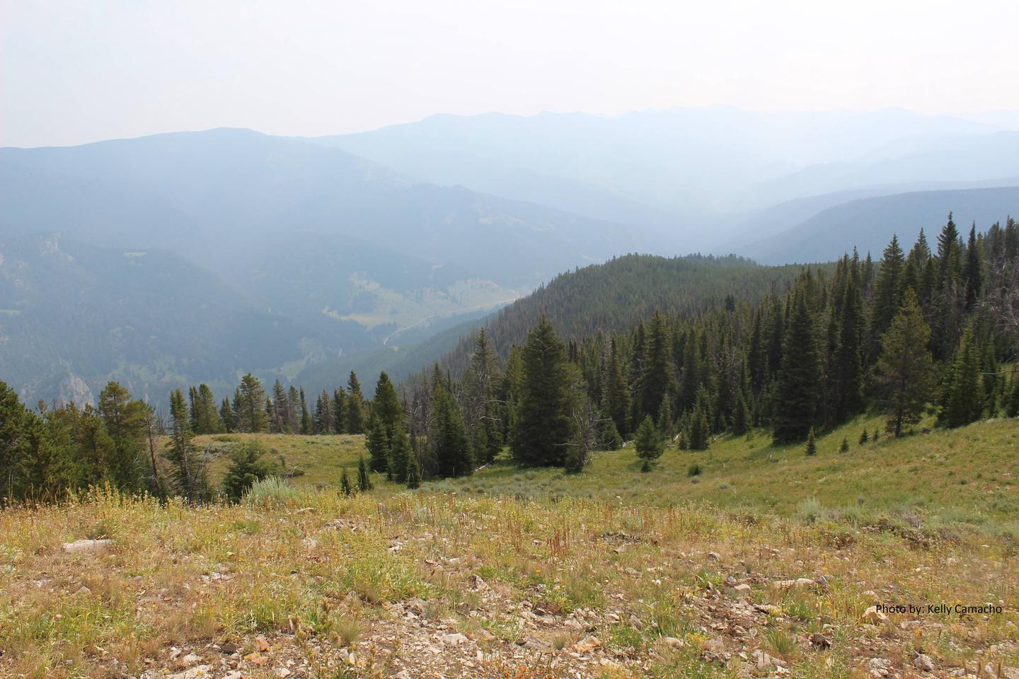
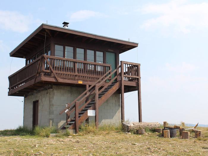
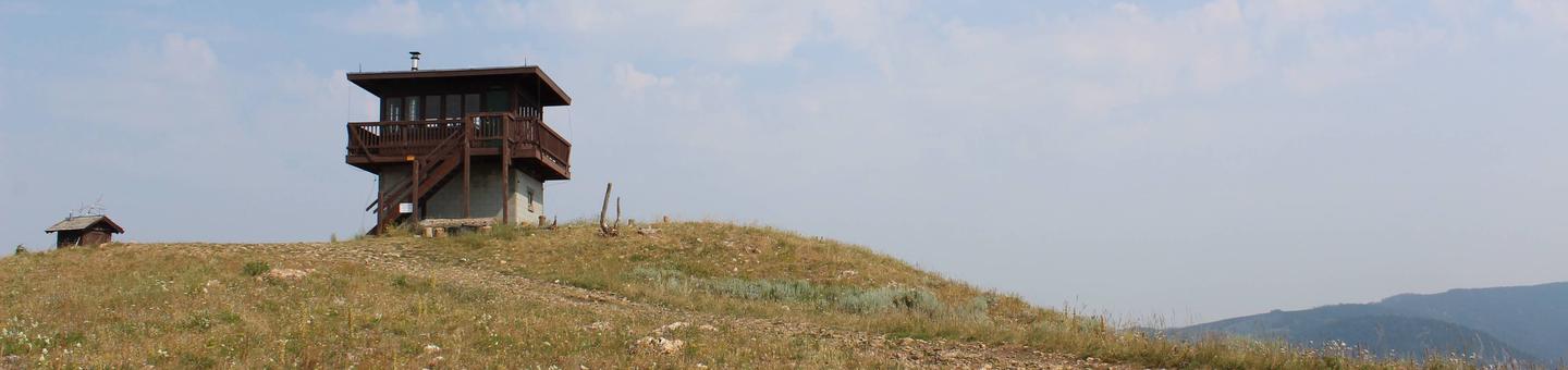
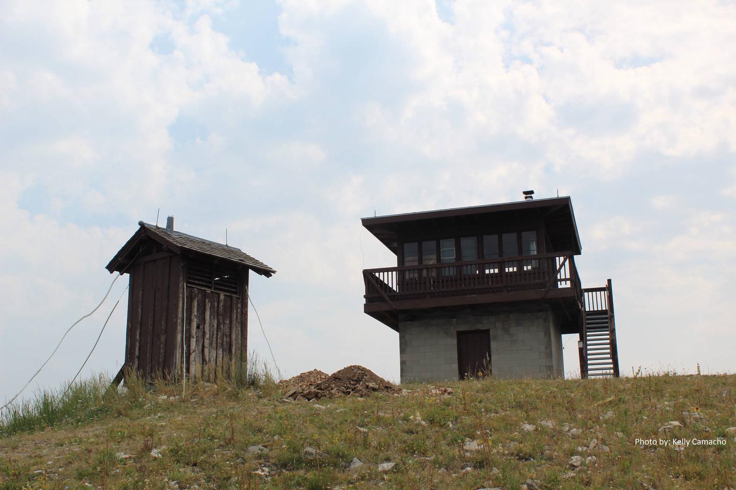
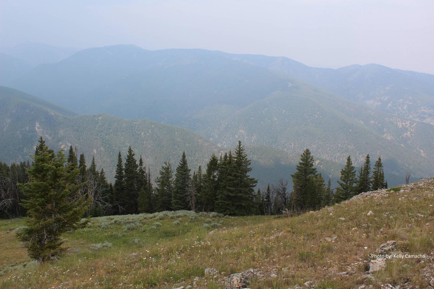
Garnet Mountain Fire Lookout sits on the apex of Garnet Mountain, at an elevation of 8,245 feet. The lookout provides a panoramic view of the surrounding peaks and valleys. Highlights include the Spanish Peaks to the west, the Gallatin Range to the south, the Hyalite Ridge to the east and the Gallatin River Valley to the north.
The structure can be accessed by hiking, horseback or mountain bike on the Garnet Mountain Lookout Trail in the summer. The 4.5-mile trail gains 2,800 feet along its path. Motorcycles and ATVs can access the lookout via the Rat Lake Trail from June 16 through December 1. During winter months, guests must plan on skiing, snowmobiling or snowshoeing up to 10 miles.
Guests are responsible for their own travel arrangements and safety, and must bring several of their own amenities.
Recreation
Hikers, mountain bikers and off-road vehicle riders can access the same trail used to get to the lookout. Snowy conditions offer abundant opportunities for cross-country skiing and snowshoeing. Big game hunting for bear, elk or moose is a popular autumn pastime around Garnet Mountain.
Facilities
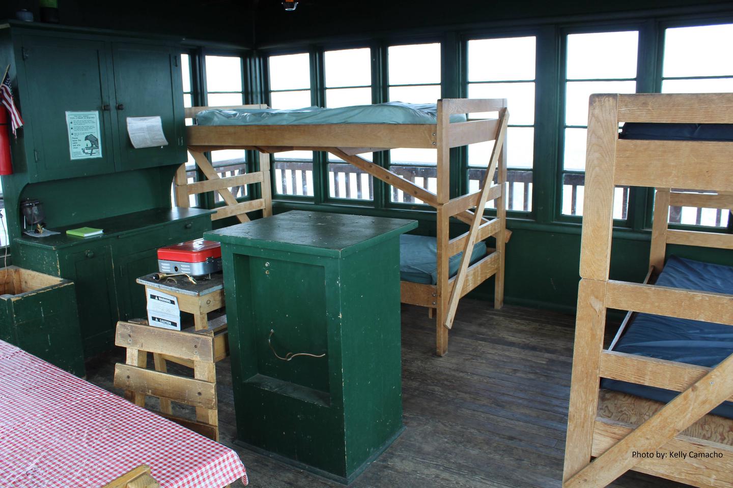
The lookout can sleep up to four people on provided bunk beds with mattresses. There is a wood stove for heat and propane stove for cooking. Other amenities include a table with chairs, basic cookware, dishes and utensils. A vault toilet is located outside the facility. Firewood is provided for the wood stove, and there is a campfire ring outside as well. Water and electricity are not available. Guests must bring their own water supply, as well as garbage bags for packing out trash. Items such as bedding, flashlights or lanterns, dish soap, extra toilet paper and first aid supplies are also not provided.
Natural Features
A fire lookout has existed on Garnet Mountain since 1930. The current structure was built in 1962. The lookout is available for reservation year-round. It is an excellent vantage point for watching sunrises and sunsets, or for gazing at the stars on a clear night. Grizzly bears are extremely common in this area, and gray wolves, mountain lions, deer, elk, moose, bighorn sheep and the Canada lynx also make their home here. A wide variety of bird species can also be seen.