

Directions
From Columbia Falls, travel north on Nucleus Avenue until the road ends at the intersection of Railroad Street. Turn right (east) on Railroad Street. Continue on Railroad Street; it becomes the North Fork Road. Continue north on the North Fork Road for 45 miles. Turn right on Road 308 just north of the Tepee Creek crossing. Follow Road 308 back across Tepee Creek to Ford Cabin.
North Fork Road is gravel and rough in spots. It is only intermittently plowed during the winter months, requiring four-wheel drive or chains for travel.
Phone
406-387-3800
Activities
BOATING, HISTORIC & CULTURAL SITE, CAMPING, FISHING, HIKING, WINTER SPORTS, WILDLIFE VIEWING
Keywords
FORD,FORD CABIN,FORD WORK CENTER,FLATHEAD NF – FS
Related Link(s)
Overview
Ford Cabin offers a cozy, rustic getaway along the appropriately named Wild and Scenic North Fork of the Flathead River. It is about 45 miles north of Columbia Falls, in northwestern Montana. Visitors enjoy a variety of recreational activities, including fishing, viewing wildlife and exploring the area’s many trails.
The cabin is available from May 25 to March 15. It can be access by vehicle, however four-wheel drive and chains are recommended during the winter. Guests are responsible for their own travel arrangements and safety, and must bring several of their own amenities.
Recreation
Rainbow and cutthroat trout fishing is pleasant. In fact, the Flathead River is renowned for its excellent fly fishing. Visitors can hike and mountain bike on various trails and roads, or float in the river from the Canadian border to Polebridge on Class I to II rapids.
Facilities
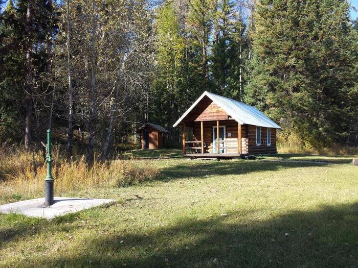
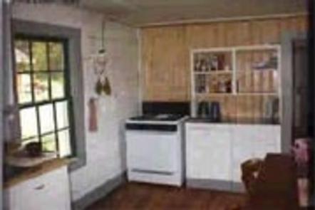
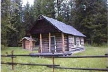
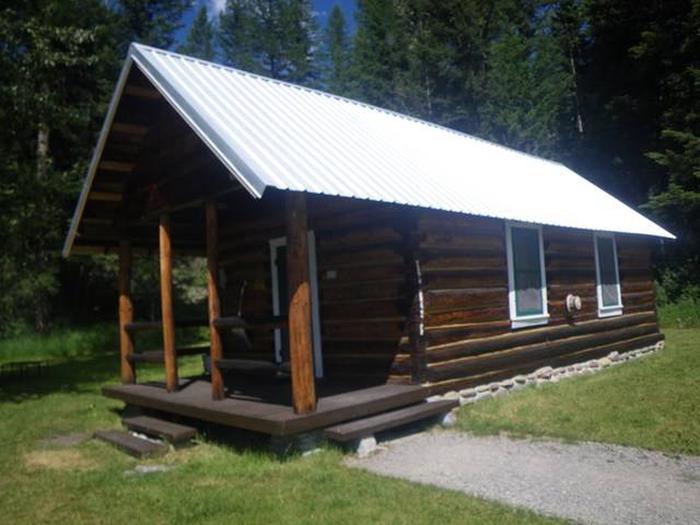
The rustic log cabin has a small, covered front porch and a vault toilet nearby. It is equipped with a propane stove, lights, a heater and limited cooking and eating utensils. Furnishings include two bunk beds and one double bed, to accommodate up to six people.
Water from a hand-pump system, is only available from April to November. In winter, visitors must bring their own water. Other items to bring include food, bedding, flashlights, a first aid kit and other basic camping gear. Click here for more cabin details.
Natural Features
The cabin is perched on a grassy field beside a stand of pine trees and near the North Fork of the Flathead River and Tepee Creek.
The surrounding Glacier View Ranger District is bordered on the east by the Middle Fork of the Flathead River and Glacier National Park. To the north is Canada and west is the Kootenai National Forest. A variety of wildlife live in the area, including elk, moose and bears.
Nearby Attractions
Polebridge Mercantile offers limited supplies, and is about a half-hour’s drive from the cabin.