

Directions
From Whitehall, travel south on Highway 55 for about 20 miles. Turn right off the highway just before crossing the Jefferson River, onto Forest Service Road 125, and continue west about 14 miles on a dirt road. Winter access varies with snow conditions. Guests may need to hike, ski or snowmobile to the cabin during winter months. Maps may be purchased by calling the Butte/Jefferson Ranger District.
Phone
406-494-2147
Activities
BIKING, CAMPING, FISHING, HIKING, HORSEBACK RIDING, HUNTING, WINTER SPORTS
Keywords
HELL,HELL’S CANYON CABIN,HELL’S,CANYON,GUARD,HELL S CANYON GUARD STATION,BEAVERHEAD-DEERLODGE NF -FS
Related Link(s)
Overview
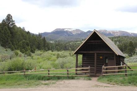
Hells Canyon Guard Station is a quaint log cabin located in the Highland Mountains of Montana’s Beaverhead-Deerlodge National Forest. It is most often used as a base camp by hunters and hikers. The area is replete with wildlife and provides access to scenic mountain views, as well as plentiful opportunities for recreation.
It was originally built in 1906 and used as a line cabin for ranchers before being donated to the Forest Service in 1910. The Forest Service has used the cabin as a guard station and now offers it for public enjoyment.
The cabin can be accessed by vehicle; however, during winter months, alternative resources may be required to reach the cabin. Guests are responsible for their own travel arrangements and safety, and must bring several of their own amenities.
Recreation
Hunters frequently use the cabin as a base camp. Fishing is also available in nearby Hells Canyon Creek.
Hiking, mountain biking and horseback riding are popular activities enjoyed by visitors to the Hells Canyon area. Off-road vehicles are allowed on designated trails. Off-road vehicles and motorcycles are also allowed in the area, but must be properly permitted and licensed to be on trails and roads.
During winter months, the area is popular for cross country skiing, snowshoeing and snowmobiling. Winter sports enthusiasts should carry and know how to use proper backcountry equipment, including a beacon, shovel and probe.
Facilities
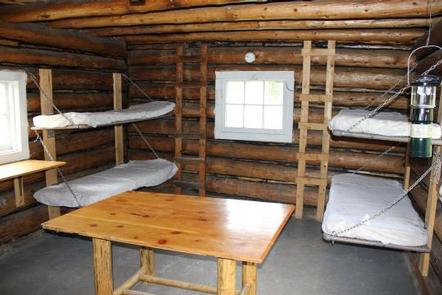
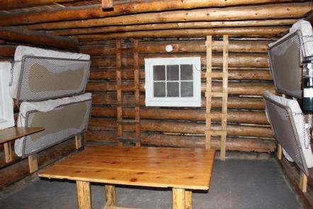
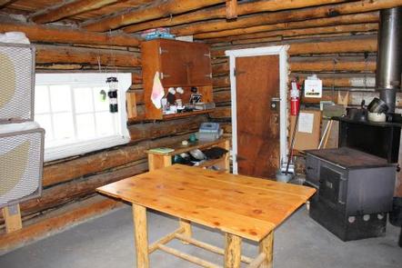
The large, single-room structure has bunk beds to sleep up to 4 people. It has drinking water, a propane cook top, a wood stove for heat and cooking, and a table and chairs. Basic cooking and eating utensils, pots and pans, as well as some cleaning equipment should be available inside. An outhouse with a vault toilet is nearby.
Electricity is not available at this cabin. There is a propane lantern you can use but propane is not provided. The propane is provided for the cook top that is located on the porch of the cabin. . Guests will need to bring their own bedding, including blankets and pillows, towels, soap, matches, garbage bags, food and propane fuel (for lantern) in 16-ounce canisters. Guests are required to pack out all trash and clean the cabin prior to leaving. Cell phone service is rare or nonexistent in the area.
Please remember that Hells Canyon Guard Station is considered a recreational area and shooting is not permitted around the cabin.
Natural Features
The cabin is in an idyllic setting, with pristine nature all around. It is situated along Hells Canyon Creek in a lush meadow of sagebrush and tall grasses.
The Beaverhead-Deerlodge National Forest is famous for its wide array of big game animals. Elk and deer are the most sought after by hunters on the forest and in the Hells Canyon area. Upland game birds are also in the area.