Directions
Summer directions from West Yellowstone: Proceed west on U.S. Highway 20 for approximately 6.5 miles. Turn right on Denny Creek Road and continue approximately two miles north. The cabin is located on the right side of the road.
Winter directions from West Yellowstone: Proceed west on U.S. Highway 20 for approximately 7.5 miles. Parking is available at the Buttermilk Trailhead, located approximately one mile up Highway 20 from Denny Creek Road, to the left. Guests will need to ski, snowmobile, or snowshoe one mile down Highway 20 from the Buttermilk Trailhead parking lot, and proceed along the two mile trail to the cabin.
During the spring and fall, guests are encouraged to call the Hebgen Lake Ranger District at (406) 823-6961 for road conditions and access to the cabin. Road conditions can vary greatly.
Phone
406-823-6961 (FOR CABIN AND ROAD INFORMATION – NO BOOKING, ALL RESERVATIONS ARE MADE THROUGH REC.GOV)
Activities
BIKING, BOATING, CAMPING, FISHING, HIKING, HORSEBACK RIDING, HUNTING, WINTER SPORTS, WATER SPORTS, WILDLIFE VIEWING
Keywords
BASN,GALLATIN NF – FS
Related Link(s)
Overview
Basin Station Cabin is a primitive, rustic, two-room structure located in the Hebgen Lake Ranger District of the Custer Gallatin National Forest. The cabin is open year-round. The adjacent road is heavily traveled. Winter guests can snowshoe, ski, or snowmobile to the cabin up to three miles from the nearest available parking. This cabin is parking accessible during warmer months.
Guests are responsible for their own travel arrangements and safety, and they must bring several of their own amenities.
Recreation
Basin Station is surrounded by hiking, horseback riding, and mountain biking trails as well as ATV/UTV and motorcyles routes subject to seasonal restrictions and delayed open dates. Please contact the Hebgen Lake Ranger District to obtain open dates. Horses are not allowed at the cabin. The horse corral is used administratively by the USDA Forest Service.
Winter activities in the area include cross-country skiing, snowmobiling, and snowshoeing.
Nearby Hebgen Lake offers opportunities for fishing, boating, and hunting. A public boat launch with two docks is located about two miles from the cabin at Lonesomehurst Campground and additional access to the lake is available through surrounding day use areas.
Facilities
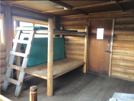
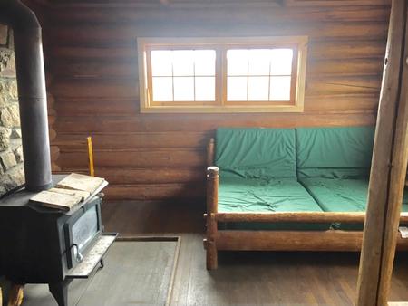
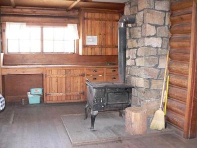
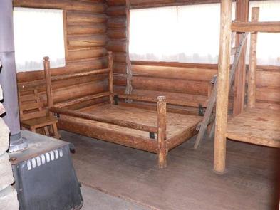
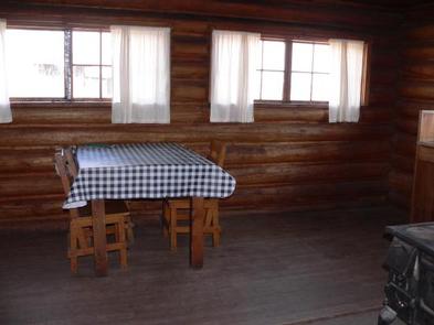
This is a primitive cabin. It sleeps four people and has a six persons maximum per group at cabin site. There is a seven day maximum stay per group. A wood stove is available for heat, and an old-fashioned wood cook stove is also available with firewood provided October 1st – May 31st for indoor use only. Basic amenities are provided such as an axe, shovel, and a table with chairs. The cabin is equipped with a double-bed platform and one set of bunk bed platforms, all equipped with mattresses.
No water or electricity is available at the cabin. Guests must either bring drinking water or treat water they retrieve from natural sources. It is also recommended that guests bring their own cooking stoves. Garbage bags are needed to pack out trash. Limited cookware, dishware, and utensils are provided. It is recommended that campers bring their own for use.
Items such as bedding, flashlights or lanterns, first aid supplies, and extra toilet paper are also not available at the cabin.
Natural Features
The cabin sits in an open meadow in the Upper Madison River Valley with views of distant evergreen forests and mountain peaks on all sides. It is situated within a couple miles of the South Fork Arm of the Madison River; just down the road from Hebgen Lake.
The area around Basin Station Cabin is grizzly bear habitat, it’s also home to bison, elk, pronghorn, and other wildlife.
Nearby Attractions
The cabin is approximately nine miles from West Yellowstone, MT, home of the West Gate to Yellowstone National Park.
Other attractions include; Hebgen Lake, Earthquake lake and the Earthquake Lake Visitor Center, and Henry’s Lake State Park across the Idaho Border.


