SARAH TOTTEN CAMPGROUND, CA Campground Reservation, Info, Images, Map, Directions

SARAH TOTTEN CAMPGROUND, California Campground Images, Info & Reservations

Listen

Directions

From I-5, take exit 786 to Highway 96 (Klamath River Highway). Follow Highway 96 west for about 35 miles. The campground entrance is on the right, about 1 mile east of Hamburg, CA.

Phone

530-493-2243

Activities

CAMPING, FISHING, SWIMMING, WHITEWATER RAFTING

Keywords

SATO,KLAMATH NF – FS

Related Link(s)

Rec Area Info & Images

California State Tourism

California State Road Conditions

Overview

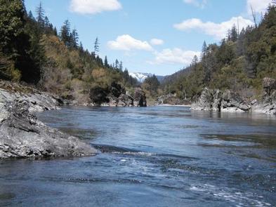
Sarah Totten Campground is located next to the Klamath Wild and Scenic River, about 33 miles east of the town of Happy Camp. The facility is popular with anglers, hikers and whitewater boaters.

Recreation

The class II-III Klamath River can be accessed from the campground, and lends itself to fishing, tubing, whitewater rafting and kayaking. Hiking trails are available in the vicinity.

Facilities

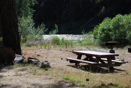
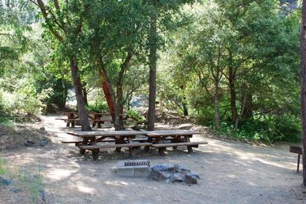
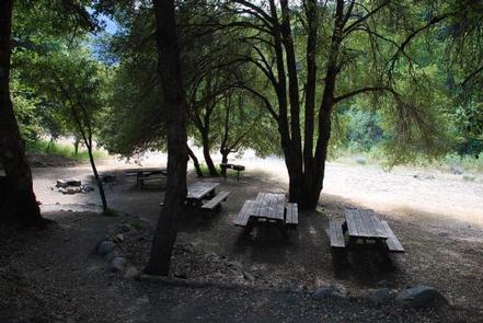
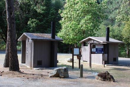
The campground offers two group sites and nine single-family sites. The group sites can accommodate a maximum of 30 people each. They feature an area for dispersed tent camping and several picnic tables and campfire rings with grills. Other amenities include accessible vault toilets, drinking water spigots, trash collection and a parking area for vehicles and trailers.

Natural Features

The campground sits in a shaded area next to the Klamath River at an elevation of 1,400 feet.

The Klamath National Forest encompasses nearly 2 million acres of land straddling the California-Oregon border. The Klamath contains a vast array of mountains, streams and lakes. With elevations ranging from 450 to 8,900 feet, the forest is home to diverse plant life and nearly 400 animal species.

Nearby Attractions

The campground is close to the historic town of Hamburg, once a stomping ground for wealthy fly fisherman and sportsmen, including author Zane Grey. Crumpled structures and rock foundations are all that remain of Hamburg’s erstwhile structures, including Johnston’s Store and Hotel, Bailey Post Office and Bucket of Blood Saloon.

Reservation

More from CampingHiking.net:

Soda Springs Campground, Washington Campground Images, Info & Reservations

Listen Directions Take Highway 410 to milepost 88.4, then turn left on Bumping Lake Road and continue for 5 miles to the campground. Phone 541-338-7869 Activities CAMPING, FISHING, HIKING, WATER SPORTS Keywords SOSP,Bumping River,OKANOGAN – WENATCHEE NF -FS Related Link(s) Rec Area Info & Images Washington State Tourism Washington State

FARNUM CREEK, Kansas Campground Images, Info & Reservations

Listen Directions Take I-70 to exit 295 then north on Highway 77. Drive 11 miles to park entrance. Phone 785-463-5791 Activities CAMPING, FISHING, WILDLIFE VIEWING Keywords None Related Link(s) Rec Area Info & Images Kansas State Tourism Kansas State Road Conditions Overview Farnum Creek is a quaint double-loop campground set

COON CREEK GROUP CAMPGROUND, California Campground Images, Info & Reservations

Listen Directions From San Bernardino, take I-10 to the Alabama exit in Redlands, California. Turn onto Lugonio Avenue (Highway 38). Head northeast on Highway 38 for approximately 31 miles to Forest Route IN02. Continue for approximately 6 miles to the campground. Phone 909-866-8550 Activities CAMPING, FISHING, HIKING, WILDLIFE VIEWING Keywords

FISH CREEK CABIN, Alaska Campground Images, Info & Reservations

Listen Directions The cabin is located approximately 20 air miles from Ketchikan, at the North end of Thorne Arm. Accessible by float plane or boat. A saltwater mooring buoy is available on a first-come, first-served basis. Refer to USGS topographic map for Ketchikan B-4, and check local tide tables if

HICKORY CREEK PARK, Arkansas Campground Images, Info & Reservations

Listen Directions From Rogers, AR, take Highway 264 east for 4.5 miles. Turn right on Cow Face Road. After a mile, turn left on Hickory Creek Road. The park entrance sign is on the right after about a mile. Phone 479-750-2943 Activities BOATING, CAMPING, FISHING, HIKING, SWIMMING SITE Keywords HIC2,BEAVER

BLOODY DICK CABIN, Montana Campground Images, Info & Reservations

Listen Directions From Dillon, travel south on I-15 for about 19 miles and exit at Clark Canyon Reservoir (Hwy 324). Travel 17 miles west on Highway 324 through Grant, MT. Proceed west and turn north onto Bloody Dick Road/Forest Road 181. Continue about 18 miles following road signs. The Bloody