
Directions
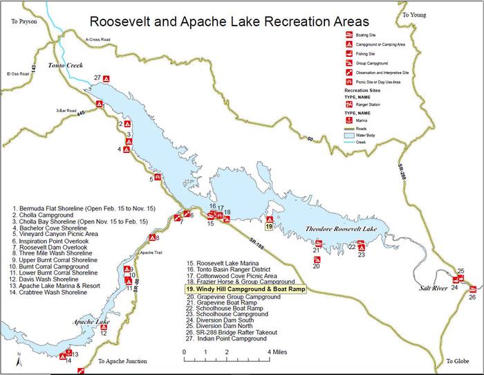
This site is 6 miles southeast of historic Roosevelt Dam. From Mesa: take State Route (SR) 87/Beeline Highway north for about 60 miles to its junction with SR 188. Turn right onto SR 188 for 33 miles to the junction of SR 88. Continue south on SR 188 for 4 miles to Forest Road (FR) 82 (Windy Hill Recreation Site entrance). Turn left and continue for 2 miles to the site. The entire route is paved.
From the Globe area: take SR 188 north for 25 miles to FR 82 (Windy Hill Recreation Site entrance), turn right and continue for 2 miles to the site. The entire route is paved.
Phone
TONTO BASIN RANGER DISTRICT (602) 225-5395
Activities
BOATING, CAMPING, FISHING, HIKING, PICNICKING, WILDLIFE VIEWING, PHOTOGRAPHY, PADDLING, KAYAKING, CANOEING
Keywords
Related Link(s)
Overview
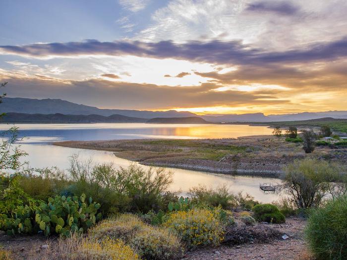
Located on central Arizona’s largest lake, Windy Hill offers great water recreation opportunities to the public. Because of its close proximity to the Lake, Windy Hill allows fishing, non-motorized and motorized boating, along with hiking trails. There are plenty of developed campsites available at Windy Hill, which allows for an easy, quick escape during any time of the year for families and individuals.
Recreation
Fishing is popular activity where anglers can expect to catch a variety of fish species, such as Largemouth and Smallmouth Bass; Crappie; Sunfish; Channel and Flathead Catfish. This campground is also situated right on the shore of Roosevelt Lake which is open to boating, kayaking, and other water-related activites. A fully accessible boat ramp and fishing dock are available for easy lake access, and maps and other important site details can be found at the kiosks at the entrance to the campground.
Facilities
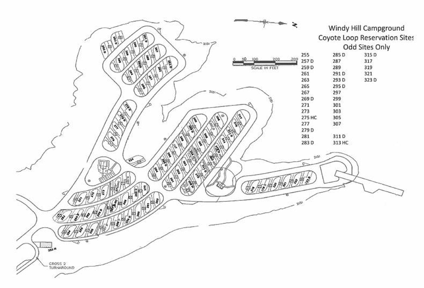
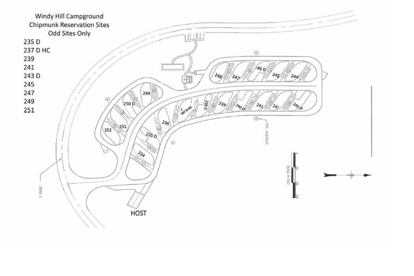
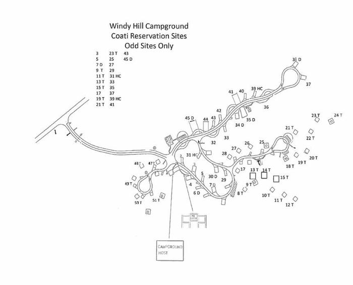
- 147 camp units with shade ramadas, fire rings with grills, picnic tables, and potable water hydrants.
- Toilets and showers are located throughout the camp loops.
- There are playgrounds and an amphitheater.
- Picnicking allowed only at the Blevins Picnic Site.
- Maximum occupancy per individual camp unit is 10. Maximum occupancy per double camp unit is 20.
- Maximum number of vehicles per individual camp unit is three. Maximum number of vehicles per double camp unit is six. All vehicles must completely fit within the designated parking area.
- Check-in time is 12:00 pm, and check-out time is 10:00 am
Nearby Attractions
Two National Scenic Byways (AZ Hwy 88 Apache Trail and AZ Hwy 288 Spines to Pines Highway). Roosevelt Dam, Tonto National Monument, the Arizona Trail, endless miles of jeep trails, Towns of Payson and Globe, Superstition, Sierra Ancha, and Four Peaks Wilderness’. Don’t forget to stop by the Tonto Basin Environmental Center learn about the history of the area.