SURRY MOUNTAIN LAKE BEACH, NH Campground Reservation, Info, Images, Map, Directions

SURRY MOUNTAIN LAKE BEACH, New Hampshire Campground Images, Info & Reservations

Listen

Directions

Surry Mountain Lake Beach is located on Route 12A in Surry, New Hampshire.

Phone

603-352-4130

Activities

BOATING, FISHING, HUNTING, PICNICKING, WILDLIFE VIEWING, DAY USE AREA, PHOTOGRAPHY, SWIMMING, KAYAKING, CANOEING, ICE FISHING

Keywords

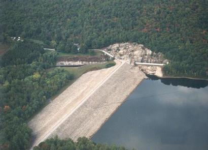
Surry Mountain Lake Beach,Surry Mountain Lake,Surry Mountain Dam

Related Link(s)

Rec Area Info & Images

New Hampshire State Road Conditions

New Hampshire State Tourism

Overview

Surry Mountain Lake Beach is a U.S. Army Corps of Engineers day use facility located on the Ashuelot River in Surry, New Hampshire.

Recreation

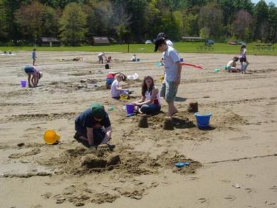
Swimming, sunbathing, picnicking, paddling and fishing are just a few of the favorite activities enjoyed at Surry Mountain Lake Beach. A boat ramp is available for small boats, kayaks and canoes. There are picnic tables and grills located throughout the park, as well as a playground.

Facilities

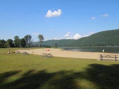
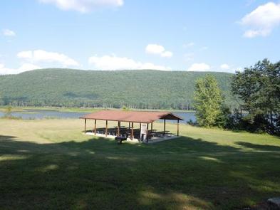
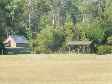
Surry Mountain Lake Beach has restrooms with flush toilets. There is a large sandy beach and swim area. Three picnic shelters are available in the park. Picnic tables, grills a boat ramp and a playground are located in the park.

Natural Features

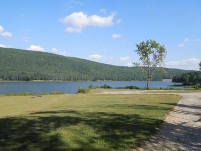
Surry Mountain Lake Beach provides a large sandy beach on the river and open grassy areas, with views of Surry Mountain.

Charges & Cancellations

If a customer cancels a group day use facility reservation within the 14 days of scheduled arrival date they will forfeit the total fee.

A $10.00 service fee will apply if you change or cancel your reservation outside of the 14 day scheduled arrival. The $10.00 service fee will be deducted from the refund amount.

Reservation

More from CampingHiking.net:

TURKEY RUN RIDGE GROUP, Virginia Campground Images, Info & Reservations

Listen Directions From Washington, D.C., and points north, take I-95 south to exit 150-B toward VA Route 619/Joplin Road. The park entrance is the second right. It is an additional 5-minute drive from the park entrance to Turkey Run Ridge Group Campground. From Fredericksburg, Virginia, and points south, take I-95

JOHN SPALDING REC AR, Missouri Campground Images, Info & Reservations

Listen Directions From Hannibal, MO, travel west on Highway 36 for 17 miles. Turn south on Route J, and travel 6 miles. Turn west on Oakland Drive and travel for 2 miles. Phone 573-735-4097 Activities BIKING, CAMPING, HIKING, SWIMMING SITE Keywords JOSR,CLARENCE CANNON DAM,SPALDING BEACH,MARK TWAIN LAKE,MARK TWAIN LAKE Related

TIONESTA REC. AREA CAMPGROUND, Pennsylvania Campground Images, Info & Reservations

Listen Directions From Tionesta, PA: Go 0.5 mile south on SR 36 and follow signs into the campground. Phone 814-755-3512 Activities BOATING, CAMPING, FISHING, HIKING, PICNICKING, WILDLIFE VIEWING, WILDERNESS, ENVIRONMENTAL EDUCATION, PHOTOGRAPHY, RANGER STATION, CANOEING, DISC GOLF, RECREATION PROGRAMS, SCENIC DRIVE Keywords TIONESTA DAM,TIONESTA LAKE,OUTFLOW CAMP LEFT BANK,TIONESTA OUTFLOW CAMPGROUND,TIONESTA

SAVENAC BUNKHOUSE, Montana Campground Images, Info & Reservations

Listen Directions From Missoula, travel west on Interstate 90 for 90 miles, to Exit 16 for Haugan. Turn right at the stop sign. At the frontage road turn right and take the first left across the cattleguard. Signs are present onsite to follow. Maps are available online or for purchase

WRIGHTS LAKE, California Campground Images, Info & Reservations

Listen Directions Take Highway 50 east of Placerville, California, for 11 miles. Turn left onto Ice House Road and continue for 9 miles, then turn right onto Wrights Lake tie road. After 2 miles, turn left onto Wrights Lake Road. Phone 831-245-6891 Activities CAMPING, FISHING, HIKING, DAY USE AREA, SWIMMING