
Directions
From Helena, MT: Head east along Co Rd 430/Canyon Ferry Rd from Helena, MT, continue for 38 miles to the Hellgate Campground and Group Use Shelter Area sign and turn right. Continue straight until you reach the campground.
From Townsend, MT: Head north on Hwy 284 for 21 miles and turn left at the Hellgate Campground and Group Use Shelter Areasign. Continue straight until you reach the campground.
Phone
406-475-3921
Activities
BOATING, CAMPING, FISHING, WATER SPORTS, WILDLIFE VIEWING, SWIMMING SITE
Keywords
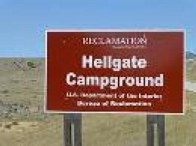
HELLGATE CAMPGROUND AND GROUP USE SHELTER AREA,HELLGATE CAMPGROUND,Canyon Ferry Reservoir
Related Link(s)
Overview
Hellgate Campground is located 30 miles east of Helena, Montana, along Montana Highway 284.
Hellgate Campground consists of 69 campsites and 3 sets of Group Use Campsites. Each standard campsite consists of a gravel camping pad, cement picnic table, and a firepit; one camping unit is permitted per site. (Double Sites are clearly marked and permit 2 camping units) There are also several ADA compliant campsites; these sites offer cement camping pads for increased accessibly.
Group Use Campsites:
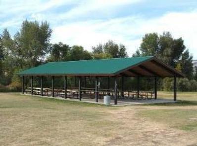
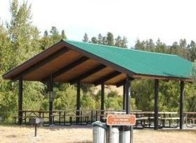
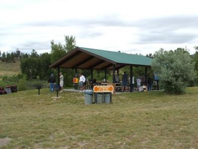
Lewis and Clark Group Use Campsites: Include 15 campsites, each with a fire ring and picnic table. The picnic pavilion is 30 X 60 with 12 picnic tables, 3 grills, and 2 group use fire rings. 3 pit toilets are easily accessible. (Formerly called Shelter A)
York Group Use Campsites: Include 10 campsites, each with a fire ring and picnic table. The picnic pavilion is 30 X 60 and contains 12 picnic tables, and 1 large communal fire pit. 1 Pit toilet is easily accessible. (Formerly called Shelter B)
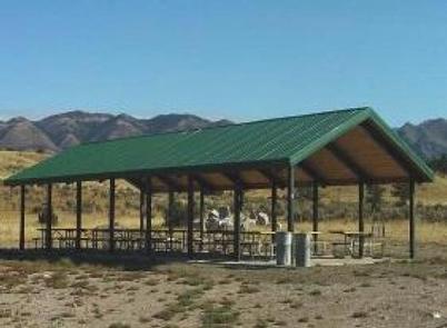
Hellgate Bay Group Use Campsites: Include 5 campsites, each with a fire ring and picnic table. The picnic pavilion is 30 X 36 and contains 7 picnic tables and 2 grills. There is a large fire ring near the pavilion. It is located near the boat ramp. 2 pit toilets are nearby. (Formerly called Shelter C)
** The price of Group Use Campsites include a set number of campsites and exclusive use of a picnic pavilion. **
Recreation
Canyon Ferry Reservoir offers a wide range of year-round recreational opportunities. Water related activities include everything from swimming and fishing to sailing and motor-boating. Canoeists and kayakers explore the many quiet backwater bays. Jet skiers, windsurfers and water skiers skim the summer waves, while winter draws ice fishermen and ice skaters.
Facilities
Hellgate Campground and Group Use Area Shelter is the largest developed campground on Canyon Ferry Reservoir with 69 campsites. The campground provides a mixture of single and double campsites, three group use shelter areas with electric, boat ramp, parking area for boat trailers and several day use picnic sites.
Natural Features
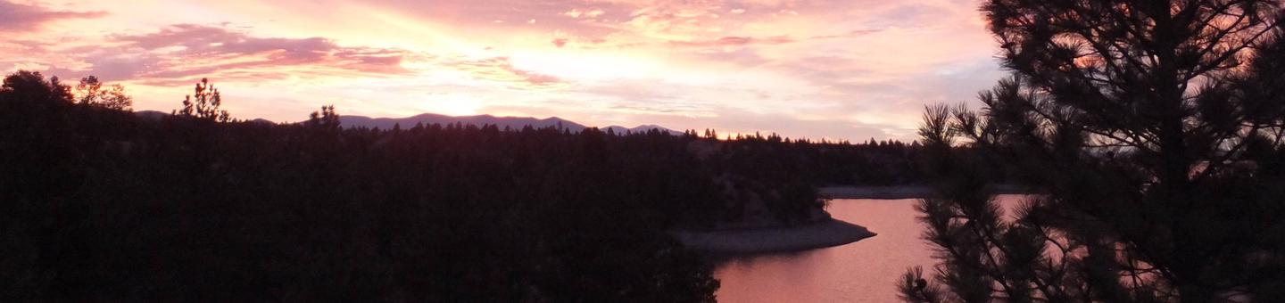
Hellgate Campground and Group Use Shelter Area sits along the banks of Canyon Ferry Reservoir in an open valley between the Big Belt and Elkhorns mountain ranges. Along the bank of the reservoir there is a narrow riparian canopy that provides partial shade.
In July of 1805 the Lewis and Clark Expedition traveled through the Canyon Ferry area exploring and mapping the Missouri River. When Lewis visited the area he described it as a beautiful and extensive plain country of about 10 to 12 miles wide which extended upwards further than an eye could see. In the 1850s the gold rush hit the Canyon Ferry area attracting miners from all over the United States in the hopes of striking it rich.
Nearby Attractions
Hellgate Campground and Group Use Shelter Area is located halfway between Yellowstone National Park and Glacier National Park. The city of Helena, Montana, the state capital, is 25 miles away and the city of Townsend, Montana, is 21 miles away. For up to date events visit, click here