

Directions
12600 E Lakeshore Drive Brimley Michigan 49715
From Bay Mills, travel west on County Road 42 (Whitefish Bay Scenic Byway) for approximately half a mile, then turn south on Forest Road 3699 to the campground entrance.
Phone
906-203-9872
Activities
BOATING, HISTORIC & CULTURAL SITE, CAMPING, FISHING, HIKING, WATER SPORTS, SWIMMING SITE
Keywords
MNLK,Point Iroquois Campground,HIAWATHA NF – FS
Related Link(s)
Michigan State Road Conditions
Overview
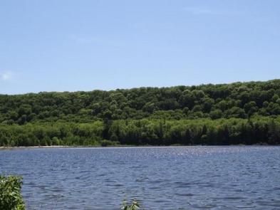
Monocle Lake Campground offers a a relaxing place to fish, swim and hike along the shores of scenic Monocle Lake just off Lake Superior. It is located in Michigan’s Upper Peninsula in the northeastern corner of the Hiawatha National Forest.
The campground is centrally located among many recreational opportunities in the Sault Ste. Marie area, including the Whitefish Bay National Scenic Byway and Tahquamenon Falls.
Recreation
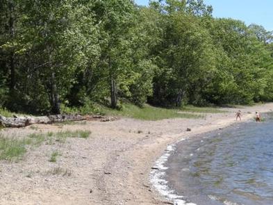
Monocle Lake is populated with walleye, smallmouth bass, pike and perch. Two man-made reefs lie just off the eastern shore next to the campground, where anglers typically have good luck.
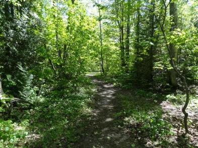
Swimming and boating are popular activities in the area. Visitors also enjoy hiking the 14.5-mile Monocle Lake Trail. Two miles of the trail have interpretive displays, and the first 1100 feet of the trail are along an elevated, accessible boardwalk. Additional trails are found in the surrounding area.
Facilities
The campground offers heavily shaded single-family sites for tent and RV camping. Some sites are available on a first-come, first-served basis. Each site is equipped with a table and campfire ring with grill. Accessible vault toilets and drinking water are provided. Hookups are not available.
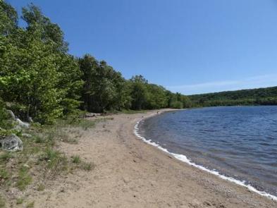
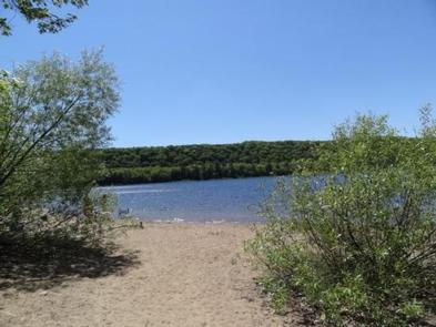
A day-use picnic area, adjacent to a fairly large parking area at the campground, provides easy access to a swimming beach. The picnic area is equipped with tables, grills and drinking water, as well as accessible vault toilets. A paved boat launch with a parking lot big enough to accommodate vehicles and trailers provides easy access to the beautiful all sports lake.
Natural Features
The campground surrounds the south end of 172-acre Monocle Lake, and is less than two miles from the historic Point Iroquois Lighthouse. It is nestled in a mixed hardwood forest of aspen, maple, birch and pine trees, providing scenic lake and forest views from anywhere in the campground. Private residences also surround the inland lake.
Nearby Attractions
The nearest town is Bay Mills, which is about 6 miles from Monocle Lake. The United States-Canada border, at Sault Ste. Marie, is about 25 miles from the campground.
Tahquamenon Falls, a series of beautifully brown-colored waterfalls on the Tahquamenon River, is located about 35 miles from Monocle Lake.
Charges & Cancellations
Please cancel 7 days in advance if you need to cancel your reservation. Reservation sites cannot be traded for walk-in sites.