SILESCA CABIN, CO Campground Reservation, Info, Images, Map, Directions

SILESCA CABIN, Colorado Campground Images, Info & Reservations

Listen

Directions

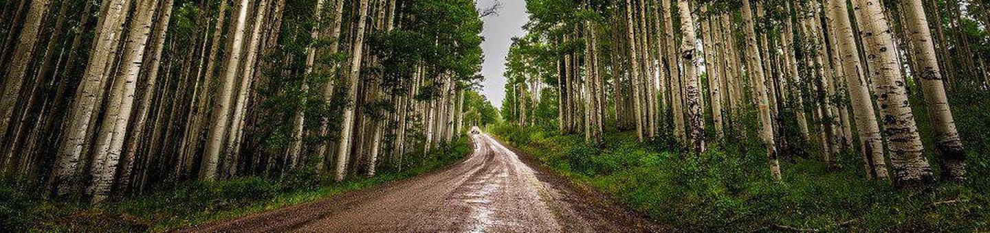
Follow Highway 90 southwest from Montrose. Watch for signs as the highway makes several turns as it weaves its way out of town. The pavement ends where the road begins to climb out of the Uncompahgre River Valley and enters lands administered by the Bureau of Land Management. In 20 miles, it enters the Uncompahgre National Forest. Silesca Cabin is about a half-mile further on the left side of the road.

Phone

(970) 240-5300

Activities

CAMPING, HIKING, HORSEBACK RIDING, HUNTING, WILDLIFE VIEWING, MOUNTAIN BIKING, OFF ROAD VEHICLE TRAILS, STAR GAZING, OFF HIGHWAY VEHICLE TRAILS

Keywords

Silesca Cabin,Silesca Historic Ranger Station,Silesca Guard Station,SILESCA CABIN (CO)

Related Link(s)

Rec Area Info & Images

Colorado State Tourism

Colorado State Road Conditions

Overview

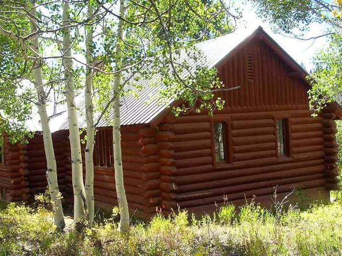
The historic Silesca Cabin, once used as a Ranger Station, is a semi-rustic dwelling with comfortable modern conveniences like electricity and refrigerator. Located 40 minutes west of the city of Montrose, the cabin is set back 100 feet from the main road, providing easy access with some privacy.

The cabin is accessible in the summer and fall by passenger vehicle, when the road is dry. Four-wheel drive vehicles are recommended when the road is wet.

Recreation

Hiking, mountain biking, single track dirtbiking, UTV & ATV riding, horseback riding, hunting and wildlife viewing are all available in the vicinity. Silesca Pond is a short walk north of the cabin. Silesca Cabin is located near a limited hunting area for Rocky Mountain Elk, Unit 61. 

Facilities

The rustic cabin accommodates up to six guests.

Amenities include three bedrooms with six twin beds, electricity, refrigerator and a wood stove. Limited cooking utensils, dishes and cleaning supplies are provided. A campfire ring and picnic table are located outside.

No drinking water is available. Items to bring include food, bedding, warm clothing, toilet paper, flashlights, towels, dish soap and toiletries. Click here for more cabin details.

Natural Features

The cabin is perched in a meadow surrounded by spruce and aspen trees at an elevation of 9,200 feet. 

Reservation

More from CampingHiking.net:

MANISTIQUE – RAPID RIVER DISPERSED CAMPSITES, Michigan Campground Images, Info & Reservations

Listen Directions All driving directions are listed by lake. Please check campsite details. Phone 906-474-6442 Activities BIKING, BOATING, CAMPING, FISHING, HIKING, HORSEBACK RIDING, WATER SPORTS, WILDLIFE VIEWING, DAY USE AREA, SWIMMING SITE Keywords Dispersed campsites,Manistique,Rapid River,lyman lake,swan lake,bass lake,bear lake,camp cook,carr lake,chicago lake,clear lake,crooked lake,east lake,gooseneck lake,ironjaw lake,jackpine lake,lake nineteen,leg

FERN BASIN, California Campground Images, Info & Reservations

Listen Directions From Idyllwild, travel north on State Route 243 about 4 miles. Turn right at the campground sign and continue to Forest Service Road 4S02. Turn left and proceed less than a mile to an intersection. Continue straight on the Forest Service Road and turn left into the campground.

BIG CREEK LAKES CAMPGROUND, Colorado Campground Images, Info & Reservations

Listen Directions From Walden, follow Route 125 north for 9 miles into Cowdrey. Turn left (west) onto CR 6W and travel 18 miles to Pearl. Turn onto Forest Road 600 and drive for 6 miles, following signs to campground. Phone 970-723-2700 Activities BOATING, CAMPING, FISHING, HIKING, WILDLIFE VIEWING Keywords BIGL,MEDICINE

SQUAW PEAK LOOKOUT, Oregon Campground Images, Info & Reservations

Listen Directions Starting in Jacksonville, drive on Highway 238 west 8 miles to the town of Ruch. Turn left on Upper Applegate Road and proceed 10.2 miles to Forest Road 20, (Beaver Creek Road). Turn left and go 4.1 miles to the junction of Forest Road 20 and Forest Road

SALT LICK CREEK, Tennessee Campground Images, Info & Reservations

Listen Directions From Carthage, go 4 miles west on SR-25, then north on SR-80, then east on SR-85 to Gladice. Turn right on Smith Bend Road and follow signs. Phone 931-678-4718 Activities BOATING, CAMPING, INTERPRETIVE PROGRAMS, FISHING, WILDLIFE VIEWING, WILDERNESS, SWIMMING SITE, PHOTOGRAPHY, PADDLING, SWIMMING, MOTOR BOAT, PADDLE BOATING, WATER