HAZELTON RECREATION AREA, ND Campground Reservation, Info, Images, Map, Directions

HAZELTON RECREATION AREA, North Dakota Campground Images, Info & Reservations

Listen

Directions

From Bismarck, ND, take University Drive south (road becomes Highway 1804). Continue 25 miles south. Recreation area will be on the right side of the road.

Phone

701-255-0015. FOR RESERVATIONS, PLEASE CALL 877-444-6777.

Activities

BOATING, CAMPING, FISHING, PICNICKING, PHOTOGRAPHY, WATER ACCESS, DISC GOLF

Keywords

HAZELTON RECREATION AREA (ND),HAZELTON CAMPGROUND,,HAZELTON RECREATION AREA (ND),,Lake Oahe

Related Link(s)

Rec Area Info & Images

North Dakota State Tourism

North Dakota State Road Conditions

Overview

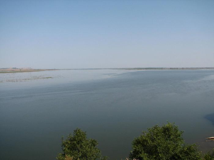
Hazelton Recreation Area is located on the east bank of the Missouri River on Lake Oahe just south of Bismarck, North Dakota. The lake is formed by the Oahe Dam in South Dakota, which was built during the Flood Control Act of 1944, commonly called the Pick-Sloan Plan. The lake and dam are named for the Oahe Indian Mission established in 1874 among the Lakota Sioux Indians.

Over 50 recreation areas are scattered around Lake Oahe, where camping, fishing, boating and hunting are popular activities. For more information, please visit the Oahe Dam & Lake website .

Recreation

Visitors enjoy coming to Lake Oahe for its great boating, water skiing, swimming and fishing opportunities. Many species of fish inhabit the lake, including walleye, northern pike and yellow perch.

Many acres of land around the lake are open to public hunting. A wide variety of small and large game animals inhabit the area, including deer, pronghorn, grouse, dove, pheasant, partridge, squirrel, rabbit and waterfowl.

Facilities

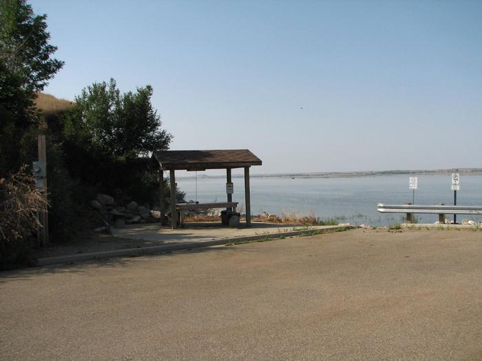
The campground offers 18 primitive sites and 12 sites with 50-amp electrical hookups. Picnic tables and campfire rings are provided.

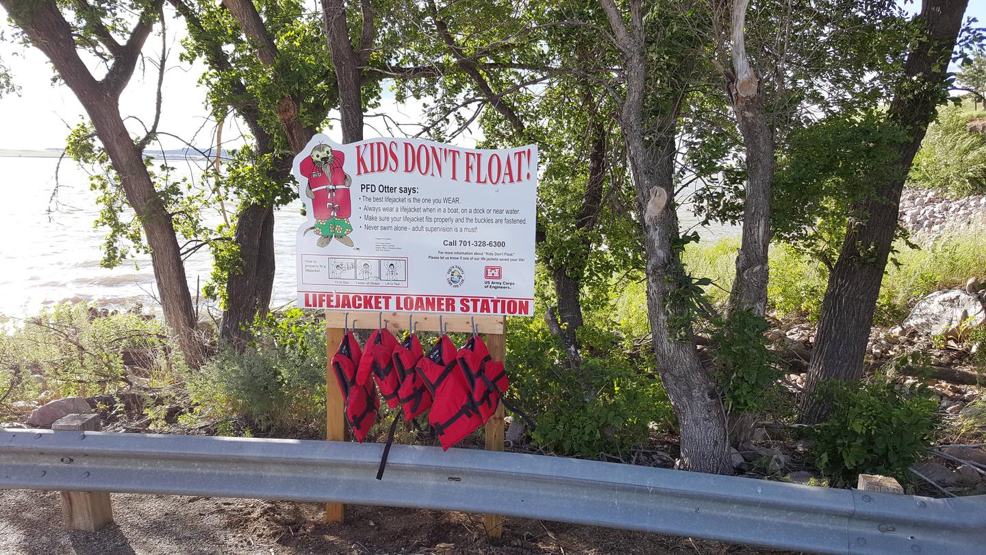
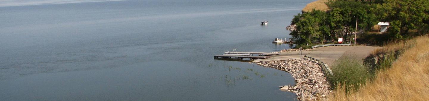
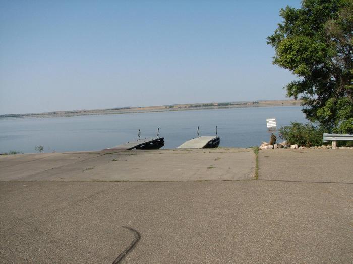
Amenities include vault toilets and a playground. A boat ramp is located on-site and has a large paved parking lot, adjacent picnic tables, a fish cleaning station and additional vault toilets.

Natural Features

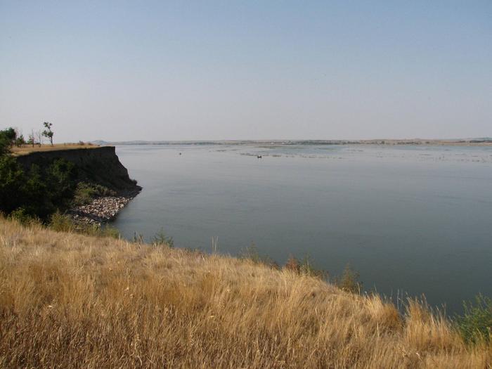
Lake Oahe extends from Oahe Dam near Pierre, South Dakota to Bismarck, North Dakota and is 231 miles long. Its 2,250 miles of shoreline are made up of mixed grass prairie dotted with trees that grow down to the shore in occasional steep draws.

Nearby Attractions

  • Lake Oahe

Charges & Cancellations

A $10 service fee will apply if you change or cancel your reservation. Late cancellations are subject to additional fees. For full details see R1S Reservation Policy.

Reservation

More from CampingHiking.net:

BIG SPRINGS WARMING HUT, Idaho Campground Images, Info & Reservations

Listen Directions From West Yellowstone, Montana, travel 22 miles south on Highway 20 to Mack’s Inn. Turn east on Big Springs Loop Road and travel 2 miles to the warming hut access road. Turn south into the warming hut parking area. Phone 208-558-7658 OR 208-270-0094 Activities CAMPING Keywords BISP,CARIBOU-TARGHEE NF

SPARROWFOOT, Missouri Campground Images, Info & Reservations

Listen Directions From Highway 13, travel about a mile east on SE 450 Road and follow signs into the park. Phone 660-885-7546 Activities BOATING, CAMPING, FISHING Keywords SPAF,TRUMAN LAKE,HARRY S TRUMAN Related Link(s) Rec Area Info & Images Missouri State Road Conditions Missouri State Tourism Overview SPARROWFOOT CAMPGROUND WILL REMAIN

PALISADES RANGER RESIDENCE CABIN, Arizona Campground Images, Info & Reservations

Listen Directions Driving Directions: From northeast Tucson, take East Tanque Verde Road to East Catalina Highway. Turn left (north) on East Catalina Highway, which becomes the General Hitchcock Highway, for approximately 23 miles to Organization Ridge Road and turn left (just before Palisades Visitor Center). The cabin is located approximately

MATTERHORN, Colorado Campground Images, Info & Reservations

Listen Directions From Telluride, travel approximately 7 miles south on Highway 145. Watch for campground signs; the turn off from the road is on the left. Phone 970-249-4552 Activities BIKING, CAMPING, FISHING, HIKING, HUNTING, WILDLIFE VIEWING Keywords MATT,MATTERHORN UNCOMPAHGRE N F,GUNNISON,GM,UNCOMP NF – FS Related Link(s) Rec Area Info &

PRAIRIE CAMPGROUND, Oregon Campground Images, Info & Reservations

Listen Directions From Bend, OR: Travel about 23.5 miles south on Highway 97 then 3 miles east on County Road 21 to the Prairie campground sign. Follow the short paved road to the campground entrance. Phone 541-383-5300 Activities CAMPING Keywords Related Link(s) Rec Area Info & Images Oregon State Road

PANGUITCH LAKE, Utah Campground Images, Info & Reservations

Listen Directions From Panguitch, Utah, take Highway 143 southwest 14 miles. Campground is on the north side of the highway. Phone 801-226-3564 Activities AUTO TOURING, BIKING, BOATING, CAMPING, FISHING, HIKING, WILDLIFE VIEWING, PHOTOGRAPHY, MOUNTAIN BIKING, OFF ROAD VEHICLE TRAILS, KAYAKING, CANOEING, STAR GAZING, SCENIC DRIVE, AMPHITHEATER Keywords PANG,DIXIE NF –