WHITEHORSE CAMPGROUND, CA Campground Reservation, Info, Images, Map, Directions

WHITEHORSE CAMPGROUND, California Campground Images, Info & Reservations

Directions

Physical Address:
Plumas NF – MT. Hough Road
39696 State Highway 70
Quincy, CA 95971

From Quincy: Take Oroville-Quincy Hwy west 15 miles to the campground which will be on your left. If you have a large RV you will need to take Oroville-Quincy Hwy, left onto Big Creek Road, right on Bucks Lake Road, and the campground will be on your right.

From Oroville: Take Oroville-Quincy Hwy 162 East. Left on Bucks Lake Road and campground will be on your right.

Phone

1-530-283-0555

Activities

BOATING, CAMPING

Keywords

WHITEHORSE CAMPGROUND

Related Link(s)

Rec Area Info & Images

California State Tourism

California State Road Conditions

Overview

Whitehorse campground is located within three miles of Bucks Lake in the northern Sierra Mountains on the Plumas National Forest. The Bucks Lake area offers year-round recreation activities including fishing, hiking, snowmobiling, skiing,snowshoeing and horseback riding.

Recreation

Bucks Lake provides fishing, boating, and canoeing. There are walking trails to the lake. A hiking trail runs from the campground and provides access to Buck Wilderness and the Pacific Crest Trail which runs adjacent to the campground.

Facilities

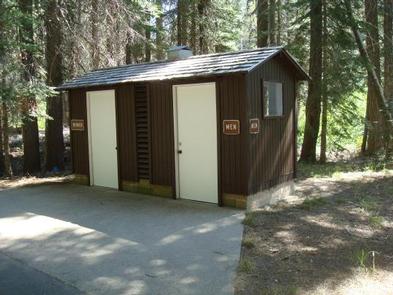
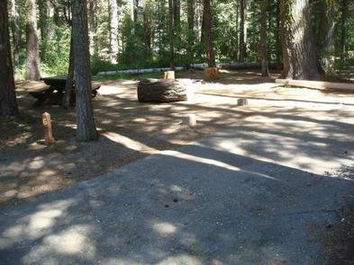
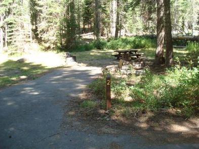
There are 19 total campsites suitable for RV and tent camping, 16 of which are standard non-electric sites and three are equestrian non-electric sites. Each site has a fire ring and picnic table. There are vault toilets and drinking water is available. Sites are walk-up May 24, 2019 thru June 30, 2019. Sites may be reserved July 1, 2019 thru September 8, 2019.

Natural Features

Whitehorse is set in fir and pine trees offering shade during the warm summer months. Situated at 5,500 feet in elevation, the campground is settled along a small creek that feeds into Bucks Lake.

Nearby Attractions

The nearby Bucks Lake Lodge has a bar, restaurant and store offering fishing supplies and groceries.

Reservation

More from CampingHiking.net:

PICKENSVILLE CG (PICKENSVILLE AL), Alabama Campground Images, Info & Reservations

Directions From Tuscaloosa, Alabama, take Highway 82 west to the junction with Highway 86. Turn left on 86 west to Pickensville. The entrance road to the campground is 2.5 miles from the yellow caution light. Phone 205-373-6328 Activities BIKING, CAMPING, INTERPRETIVE PROGRAMS, FISHING, HIKING, HUNTING, WILDLIFE VIEWING Keywords PICK,TENNESSEE- TOMBIGBEE

PLENTY CUTTHROAT CABIN, Alaska Campground Images, Info & Reservations

Directions Approximately 35 air miles from Ketchikan at the west end of Orchard Lake. Accessible by float plane or boat. A 1-mile trail from Shrimp Bay provides saltwater access. Mooring buoy for boat is located in Klu Bay. Refer to USGS Ketchikan D-5. In fall, winter, and early spring, the

WHITE RIVER, California Campground Images, Info & Reservations

Directions From Highway 99, turn east onto J22. Proceed on J22 through California Hot Springs to the "T" intersection. Turn right at intersection M56 through Pineflat. Go 3 miles on the gravel road and turn directly across the bridge. The entrance is a quarter-mile past the bridge on the right

DALE HOLLOW DAMSITE, Tennessee Campground Images, Info & Reservations

Directions From Celina, Tennessee, take Highway 53 North for 2 miles. Turn right on Dale Hollow Dam Road, then take the second right on Campground Road. Follow signs to Dale Hollow Dam Recreation Area. It is recommended that visitors do not rely soley on GPS or Mapquest to reach the

WHITNEY PORTAL, California Campground Images, Info & Reservations

Directions From U.S. Highway 395 in California, travel to the town of Lone Pine. The campground is 13 miles west of Lone Pine on Whitney Portal Road. Phone 760-937-6070 Activities CAMPING, FISHING, HIKING Keywords WHTP,INYO NF – FS Related Link(s) Rec Area Info & Images California State Road Conditions Forest