SYCAMORE FLATS PICNIC SHELTER, NC Campground Reservation, Info, Images, Map, Directions

SYCAMORE FLATS PICNIC SHELTER, North Carolina Campground Images, Info & Reservations

Listen

Directions

The facility is located along Hwy 276 (Forest Heritage National Scenic Byway) approximately 1 mile from the intersection of Hwy 280 and US 64 in Pisgah Forest, NC, and approximately 15 miles from the Blue Ridge Parkway.

Phone

828-877-3265

Activities

CAMPING, FISHING, WATER SPORTS

Keywords

Related Link(s)

Rec Area Info & Images

North Carolina State Road Conditions

North Carolina State Tourism

Overview

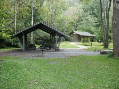
Sycamore Flats Picnic Shelter is located along the Davidson River on the Pisgah National Forest. This picnic area was named for the sycamore trees which line the banks of the river.

Recreation

Sycamore Flats Picnic Area offers excellent swimming and wading, trout fishing, and tubing opportunities on the Davidson River. There is an accessible fishing pier.

Facilities

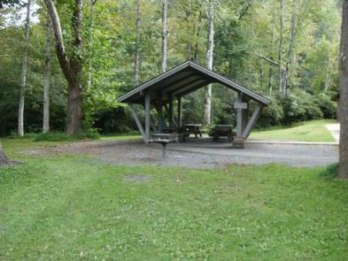
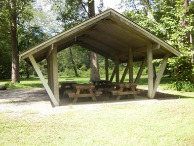
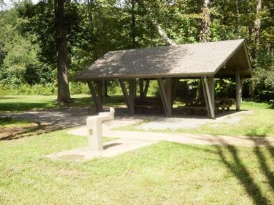
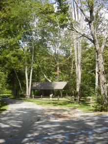
This large picnic area has 40 picnic tables with grills nearby. The reservable shelter has four picnic tables for use, plus one grill. There are two restrooms available; one is wheelchair accessible.There is a large, open field beside the picnic shelter for games and fun.

Natural Features

Sycamore Flats is a beautiful, shaded picnic area that sits in the bend of the Davidson River. This picnic area is surrounded by lush hardwood forest and rhododendron.

Nearby Attractions

Pisgah National Forest offers nearly 400 miles of trails — many are for biking, hiking and several for equestrian use. Throughout the area, visitors will discover the many beautiful waterfalls the forest is known for. Pisgah Visitor Center is just 1.5 miles up on Hwy 276 from the Sycamore Flats Picnic Shelter and offers interpretive displays, a gift shop, and a wealth of information and maps. Further up Hwy 276 is the birthplace of forestry in America–The Cradle of Forestry. Nearby is the Pisgah Fish Hatchery and Pisgah Center for Wildlife Education.

Reservation

More from CampingHiking.net:

ANSEL WATROUS, Colorado Campground Images, Info & Reservations

Listen Directions From Fort Collins, take Highway 14 northwest for 13 miles. Phone 970-295-6700 Activities BIKING, BOATING, CAMPING, FISHING, HIKING, WILDLIFE VIEWING, MOUNTAIN BIKING, KAYAKING, CANOEING, BIRDING, RAFTING Keywords ANSE,ANSEL,WATROUS,ANSEL WATROUS,ARAPAHO AND ROOSEVELT NF – FS Related Link(s) Rec Area Info & Images Colorado State Road Conditions Forest Service Concessionaire

BASSAM GUARD STATION, Colorado Campground Images, Info & Reservations

Listen Directions From Salida travel north on Highway 285 to the junction with Highways 24/285 near Johnson’s Village. Turn right onto Hwys 24/285, passing through Johnson’s Village. Stay on this highway for 5 miles, then watch for a sign on the left for County Road 307 (next to private property

MANZANITA LAKE, California Campground Images, Info & Reservations

Listen Directions From Redding, California drive 48 miles east on State Highway 44. Turn right into Lassen Volcanic National Park and continue one mile south to Manzanita Lake Campground. Phone 530 595-6121 Activities BOATING, HISTORIC & CULTURAL SITE, CAMPING, INTERPRETIVE PROGRAMS, FISHING, HIKING, PICNICKING, VISITOR CENTER, DAY USE AREA, SWIMMING

SYCAMORE CABIN, Arizona Campground Images, Info & Reservations

Listen Directions From Phoenix, take I-17 north about 80 miles to Exit 268, the Dugas/Orme Road exit. Go east toward Dugas. You will be on Forest Service Road 68. Travel east 8 miles continuing past Dugas for half a mile and then turn right (south) at the "Sycamore A.S." (Forest

LUNCH PEAK LOOKOUT, Idaho Campground Images, Info & Reservations

Listen Directions From Sandpoint take Hwy 200 east 12 miles to Trestle Creek Road; turn left onto Trestle Creek Road #275 and go 12 miles to Lunch Peak Road #1091; turn left onto Road 1091 and go 4 miles to the lookout. Phone 208-263-5111. WEEKDAYS 8:00AM TO 4:30PM. CLOSED ON