DEVIL CREEK CAMPGROUND, MT Campground Reservation, Info, Images, Map, Directions

DEVIL CREEK CAMPGROUND, Montana Campground Images, Info & Reservations

Directions

From Hungry Horse head east on US Hwy 2 approximately 45 miles. From East Glacier Park, take US Hwy 2 west for approximately 19 miles to campground.

Phone

406-752-7924 FOR RESERVATIONS CALL: 1-877-444-6777

Activities

BIKING, CAMPING, FISHING, WATER SPORTS, WILDLIFE VIEWING

Keywords

Related Link(s)

Rec Area Info & Images

Montana State Tourism

Montana State Road Conditions

Overview

Devil Creek Campground is located 32 miles southeast of West Glacier, Montana, and six miles west of Marias Pass, a high mountain pass located in Glacier National Park.

Recreation

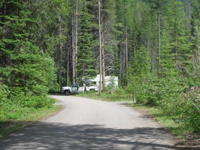
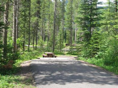
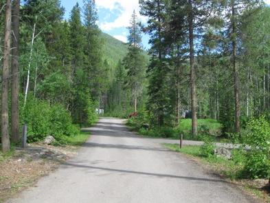
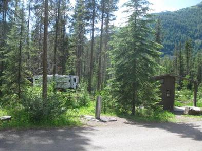
The campground is adjacent to US Highway 2 in a heavily wooded conifer forest. Traveling to the campground on Highway 2 offers stunning scenery and opportunities for wildlife viewing. Devil Creek Trail #167 provides access to Spotted Bear Wilderness.

Facilities

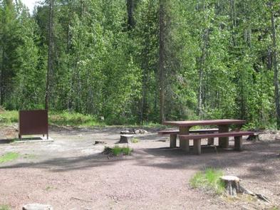
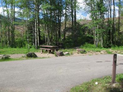
The campground offers 13 overnight sights for tent and RV camping. Each campsite is equipped with a table and campfire ring with grill. Accessible vault toilets and drinking water are provided. Water is not a fill station. Please come with your RV water full. Campground roads and parking spurs are paved.

Natural Features

In the heart of the Rocky Mountains, west of the continental divide and just south of the Canadian border, lies the 2.4 million acre Flathead National Forest. Home to lynx, grizzly bear, and bull trout and with numerous lakes streams and rivers to enjoy, the forest is a premiere destination for visitors. The campground lies between East Glacier and West Glacier.

Nearby Attractions

The campground is just six miles east of Marias Pass, and 32 miles southeast of West Glacier, the west entrance to Glacier National Park.

Charges & Cancellations

Cancellations made within 14 days of arrival will be “considered” for a refund, by the concessionaire, of Camping fees only and will automatically forfeit the first nights fee. Day of Arrival cancellations must be turned in by calling 1-877-444-6777, then followed up with a call to Cheryl at 406-752-PWAI (7924) or 406-404-4164 to get the information to the campground and to be considered for any refund.  

Reservation

More from CampingHiking.net:

LAKES BASIN, California Campground Images, Info & Reservations

Directions In Graeagle, CA, at the intersection of State Rt. 89 and Forest Rt. 24 (Gold Lakes directional sign), turn onto Rt. 24 and go 6.9 miles to campground sign. Turn right onto the single-lane road and proceed 0.3 miles. The campground will be on the right. Phone CAMPGROUND/CAMPSITE STATUS

WAR EAGLE CAMPGROUND, Arkansas Campground Images, Info & Reservations

Directions Take Highway 412 East from Springdale and for about 8 miles. Turn left on Nob Hill Loop, then continue onto County Rd 95/War Eagle Blacktop Rd and travel about 3 miles. Turn left onto War Eagle Park Road, which is the entrance of the Park. Phone 479-750-4722 Activities BOATING,

BLACK BUTTE CABIN, Montana Campground Images, Info & Reservations

Directions From Ennis, travel south on Highway 287 for about 32 miles to the West Fork Rest Area. Turn right onto West Fork Road/Forest Road 209 and continue for about 2 miles. Turn right onto Standard Creek Road/Forest Road 237 and travel 18 miles to the cabin. Maps may be

MAPLE SPRINGS, Kentucky Campground Images, Info & Reservations

Directions Directions from the North: Take Interstate 65 to Exit 53 (Cave City Exit). Turn right onto KY-70. Follow 70/255 as it becomes the Mammoth Cave Parkway in the park. Follow the Mammoth Cave Parkway towards the Visitor Center. Turn left on the Green River Ferry Road. Cross the ferry

DORIS CREEK CAMPGROUND, Montana Campground Images, Info & Reservations

Directions Turn off U.S. Highway 2 at milepost 144 and follow the West Side Hungry Horse Reservoir (Forest Road #895) across the Hungry Horse Dam. The campground is 3 miles south of the Dam. The road is paved to the campground. Phone 406-752-7924 FOR RESERVATIONS CALL: 1-877-444-6777 Activities BOATING, CAMPING,

NORTH SHORE, Texas Campground Images, Info & Reservations

Directions From Texarkana, take U.S. Highway 59 south approximately 10 miles. Turn right on Farm-to-Market (FM) Road 2148 and travel approximately 1.5 miles to the Wright Patman Lake sign. Turn left and follow park signs to the entrance. Phone 903-838-8781 Activities BOATING, INTERPRETIVE PROGRAMS, FISHING, WATER SPORTS, SWIMMING SITE, SWIMMING