NORTH TWIN LAKE CAMPGROUND, Oregon Campground Reservation, Info, Images, Map, Directions

NORTH TWIN LAKE CAMPGROUND, Oregon Campground Images, Info & Reservations

Directions

From Bend, OR: Travel 26.8 miles south on Highway 97 to Wickiup Junction, then 11.0 miles west on County Road 43, then continue 4.6 miles west on County Road 42, and finally 0.2 miles south on County Road 4260.

Phone

541-383-5300

Activities

CAMPING

Keywords

Related Link(s)

Rec Area Info & Images

Oregon State Tourism

Oregon State Road Conditions

Overview

North Twin Lake Campground islocated just north of the South Twin Resort on North Twin Lake.

Recreation

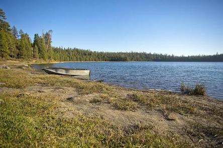
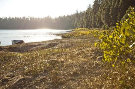
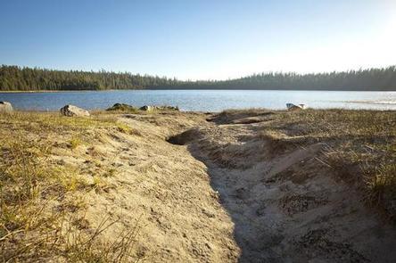
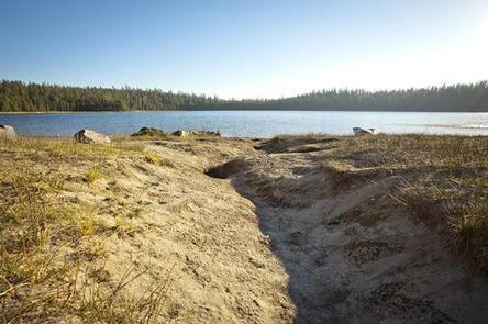
Located on North Twin Lake, this campground offers a small beach at the shallow end of the lake that is great for wading and swimming. Fishing is also quite popular though motorized boats are prohibited on this body of water.

Facilities

North Twin Lake Campground can accommodate RV, trailer or tent-campers, however, water and electric hookups are not available. Campers will need to bring their own water supply. All sites are equipped with a picnic table and campfire ring with grill and the campground has vault toilets available. There is an RV dump station just after the entry of the nearby Gull Point Campground

Natural Features

North Twin Lake was formed about 20,000 years ago when rising magma encountered groundwater. This resulted in violent steam explosions which formed a broad shallow crater that later filled with water. Nearby peaks, lava flows and old-growth forests provide visitors with a varied landscape.

Nearby Attractions

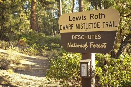
Twin Lakes Trail #5.1 is an interpretive trail leaving the campground near the water that informs visitors about “dwarf mistletoe” infecting the ponderosa pine trees in the area.

Visitors can explore wilderness areas, rivers, lakes and reservoirs, and approximately hundred of miles of trail. Newberry National Volcanic Monument, approxiately 45 minutes by vehicle, is a great starting point for visitors to learn about the diverse landscape and history of the area through interpretive programs and exhibits. Visitors can explore Lava River Cave, the longest continuous lava tube in Oregon. Visitors enjoy traveling the Cascade Lakes Scenic Bywaywhich climbs 66 miles through the Cascade Range, weaving past snow-capped peaks and alpine lakes.

Reservation

More from CampingHiking.net:

TWELVE MILE FLAT, Utah Campground Images, Info & Reservations

Directions Travel east up Twelve Mile Canyon on Forest Development Road 22 for approximately 20 miles, or travel west up Ferron Canyon on Forest Development Road 22 for 31 miles. Phone 435-384-2372 Activities BIKING, CAMPING, HIKING, HUNTING, WILDLIFE VIEWING Keywords TWEM,MANTI-LASAL NF -FS Related Link(s) Rec Area Info & Images

MUSTANG, Texas Campground Images, Info & Reservations

Directions From FM 1187 Crowley Plover Road, turn north on Winscott Plover Road for a mile (0.6 km) to the park entrance. Phone 817-292-2400 Activities BOATING, CAMPING, FISHING, PICNICKING, SWIMMING SITE Keywords MUS2,BENBROOK LAKE Related Link(s) Rec Area Info & Images Texas State Tourism Texas State Road Conditions Overview Mustang

WASHUNGA BAY, Oklahoma Campground Images, Info & Reservations

Directions From Kaw City, Oklahoma, travel nearly 3 miles east on Highway 11, turn north onto County Road. Follow signs for about 5 miles to the campground. Phone 580-762-5611 Activities BOATING, CAMPING, FISHING, WILDLIFE VIEWING Keywords WABA,KAW LAKE,KAW LAKE Related Link(s) Rec Area Info & Images Oklahoma State Road Conditions

KADAKE BAY CABIN, Alaska Campground Images, Info & Reservations

Directions Access is by boat (13 miles from Kake), or float plane (39 miles from Petersburg). Float planes generally land near the mouth of the bay and require up to a 2-mile hike across the tide flat. An 18-foot or higher tide is required for direct boat or float plane

OBSIDIAN FLAT, California Campground Images, Info & Reservations

Directions From U.S. Highway 395 and State Highway 203 (Mammoth Lakes Junction), travel 8.2 miles north on 395. Turn west onto Deadman Road and follow for 3.2 miles to Upper Deadman Campground. Turn on the Group Campground turnoff on the right, across the road. Continue one mile to the campground

TIMPOONEKE, Utah Campground Images, Info & Reservations

Directions From Salt Lake City, Utah, take I-15 to the Alpine-Highland exit 284. Travel east on Highway 92 for 5 miles to the junction of Highway 92 and the North Fork of American Fork Canyon. Keep going straight east up the South Fork. Continue on the Alpine Scenic Loop for