
Directions
From Buffalo, WY, take US Hwy 16 west 24 miles to County Rt. 3 (Hazelton Road). Turn left onto Hazelton Rd., and go 6.2 miles to campground turn off. Turn left and go 0.3 miles.
Phone
406-587-9054
Activities
BIKING, BOATING, CAMPING, FISHING, HIKING, WILDLIFE VIEWING, OFF ROAD VEHICLE TRAILS, KAYAKING, NON-MOTORIZED BOATING, SCENIC DRIVE
Keywords
DOYLE CREEK CAMPGROUND,BIGHORN NATIONAL FOREST,DOYLE CREEK
Related Link(s)
Overview
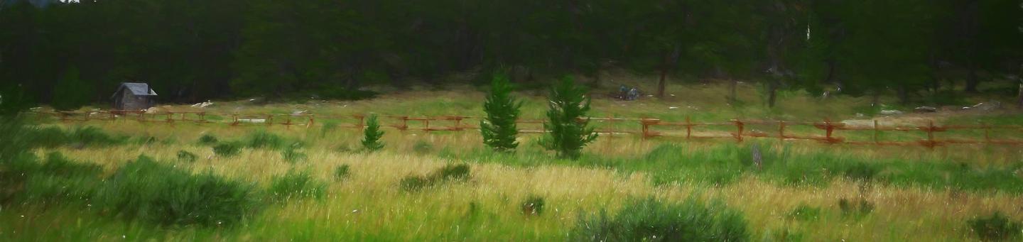
Doyle Creek Campground is located 30 miles west of Buffalo, Wyoming, on the east side of scenic Cloud Peak Skyway, near the Cloud Peak Wilderness area. Located in the Bighorn National Forest, visitors to the area enjoy a wide variety of activities, including hiking, fishing, scenic driving and a number of historic sites. The area offers excellent habitat for a wide variety of wildlife species. The administering organization is Gallatin Canyon Campgrounds; e-mail: gccampgrounds13@gmail.com
Recreation
Scenic off-highway driving is available on nearby Elgin Park, Pole Creek and Crazy Woman Canyon Roads. Hiking and mountain biking are allowed on these roads as well. ATV trails are adjacent to camp. Many additional hiking trails are available in the Cloud Peak Wilderness. Fishing is popular in the campground and nearby streams and lakes.
Facilities
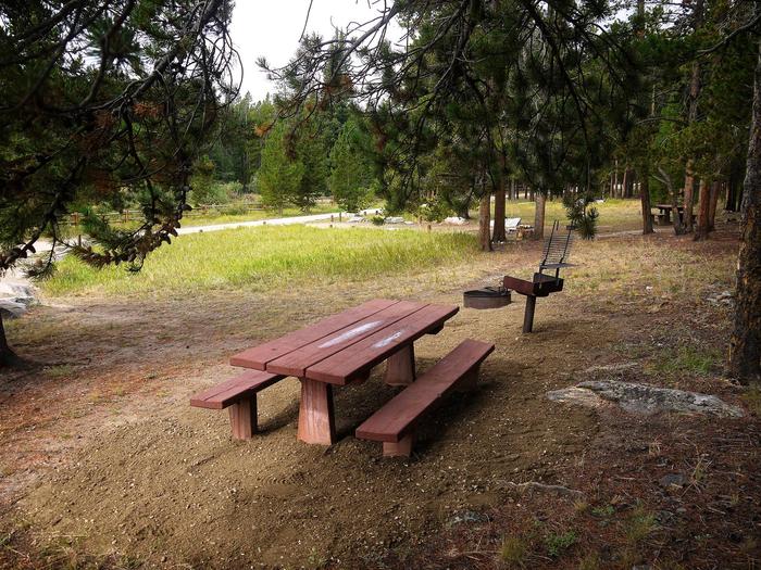
The campground offers several single-family sites each equipped with a picnic table and campfire ring with grill. Vault toilets, drinking water from a hand pump and trash collection are provided. The nearest dump station is 20 miles away on Powder River Pass.
Natural Features
Located at 8,100 feet in elevation, the campground is situated in a densely forested area of lodgepole pine. Campsites are located on a creek and meadow in a peaceful and remote setting. Temperatures can drop significantly once the sun goes down. Summer daytime temperatures range from the 60s-90s, with nighttime temperatures down to the 50s. June is sometimes rainy while the rest of the summer has fair, clear, sunny days. Thunderstorms and snowstorms can arise at any time. Autumn temperatures are cool with frosts by mid-September.
Nearby Attractions
Scenic driving on Cloud Peak Skyway.
Charges & Cancellations
Refunds: Refund requests made through www.recreation.gov will be charged a $10 processing fee. This cancellation processing fee is retained by the reservation service contractor along with the non-refundable reservation fee. All requests for the return of the non-refundable reservation fee and the cancellation processing fee will be declined by the campground concessionaire as they did not receive these fees (these are the fees retained by the reservation contractor, a different entity).