

Directions
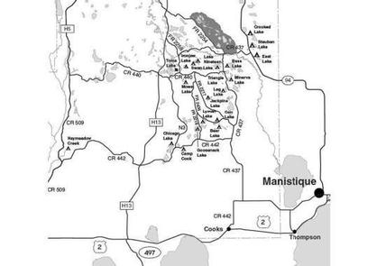
From Manistique drive north on M-94 23 miles to CR 437. Turn left (west) on 437 and drive 4.7 miles to FR 2734. Turn right (west) and drive 0.3 mile to site #1. To reach Site 2 drive 4.2 miles on CR 437 to FR 2452. Turn right (west) on FR 2452 and drive about 0.7 mile to the campsite.
Phone
906-474-6442 OR 906-387-2512
Activities
CAMPING
Keywords
Dispersed campsites,Manistique,Rapid River,lyman lake,swan lake,bass lake,bear lake,camp cook,carr lake,chicago lake,clear lake,crooked lake,east lake,gooseneck lake,ironjaw lake,jackpine lake,lake nineteen,leg lake,little bass lake,minerva lake,mowe lake
Related Link(s)
Michigan State Road Conditions
Overview
The campsites on the Rapid River/Manistique Ranger District are located on inland lakes and are in a rustic forest environment with few, if any amenities. The rustic environment offers a wonderfully serene and peaceful setting for your next campout.
Recreation
Visitors will be able to enjoy swimming, berry picking, and fishing at these dispersed campsites. Licenses are required for fishing in Michigan waters. Some of these campsites offer only one site on these inland lakes allowing for a very peaceful and wilderness-like experience.
Facilities
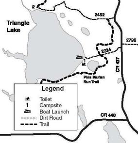
Located in the heart of the Ironjaw Semi-Primitive Area, Triangle Lake is managed for both motorized and non-motorized uses and our management efforts seek to provide for quiet, peaceful recreation opportunities in a semi-primitive setting. Both campsites on Triangle Lake (169 acres) are located on the non-motorized Pine Marten Run Trail and horse camping is allowed.
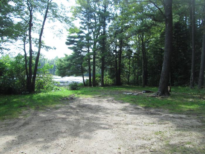
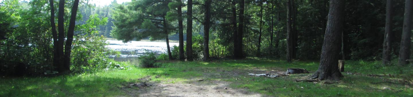
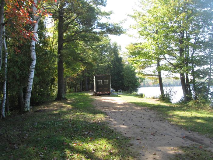
Site #1 is a long, narrow site located on a level, sandy strip of land between the lake and a small wetland pond. The site is about 100 ft. by 30 ft. and is suitable for three families and trailers. There is good access via Forest Road 2734 however turn-around space is limited. A primitive toilet is located at this site. There is excellent swimming at this campsite. Access to the Pine Marten Run trail is via FR2734, where the trail intersects the road approximately 0.2 mile east of the campsite.
Site #2 is located in a wooded lowland. It is 40 ft. by 40 ft. and is suitable for one family. Although the access road is in fair condition, trailers are not recommended because of the limited turn-around space. Swimming at this site is not recommended. Access to the Pine Marten Run trail is via FR2452, just east of the campsite.
A boat access and parking area for day use is located at Site #1. This access is very sandy and turn-around space is limited. Carry-in access is recommended. There is no boat access at site #2. Triangle Lake is a good fishing lake with a nice population of northern pike, small mouth bass, bluegills, crappie and perch.
| Lake Name | Number of Sites | Maximum number of people per site | Toilets | Boat Access | Lake Size (acres) |
|---|---|---|---|---|---|
| Triangle Lake | 2 | Site 1 (24) Site 2 (8) | Yes | BI | 169 |
| Site | Number of Horses Allowed |
|---|---|
| Triangle Lake site 1 | 4 horses |
| Triangle Lake site 2 | 2 horses |
Natural Features
All of these sites are nestled in hardwood trees and pines. All of them are on small inland lakes, which offer a wide variety of fishing opportunities. There is one exception; Camp Cook, which is close to the Fishdam River and provides opportunities for good brook trout fishing.
Nearby Attractions
There are a number of horse, bike, and hiking trails within minutes of several of the sites. In over a mile from these campsites, visitors can expect to find: bait shops, general and grocery stores, gas, a pay phone, trailheads, a fishing pier, biking, and kayak/canoe rentals.