HARPETH RIVER BRIDGE CAMPGROUND (TN), TN Campground Reservation, Info, Images, Map, Directions

HARPETH RIVER BRIDGE CAMPGROUND (TN), Tennessee Campground Images, Info & Reservations

Listen

Directions

From Ashland City, Tennessee, head northwest on S Main Street toward Cumberland Street. Take the first left on TN-49W/ Cumberland Street and continue to follow TN-49W for 5 miles. Campground will be on your right directly before the Harpeth River Bridge.

Phone

615-792-4195

Activities

CAMPING

Keywords

Related Link(s)

Rec Area Info & Images

Tennessee State Road Conditions

Tennessee State Tourism

Overview

The relaxing family friendly atmosphere at Harpeth River Campground will have campers wanting to return as often as possible. Harpeth River Bridge Campground is located about 10 miles northwest of Ashland City, TN and is a 30 minute drive to Nashville.

Recreation

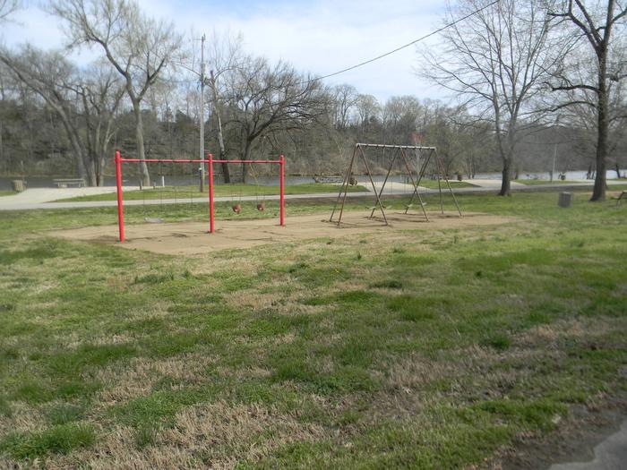
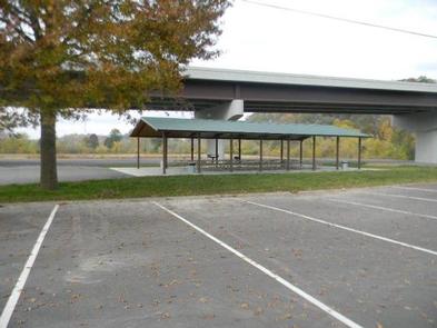
The temperate climate here allows for a lengthy recreation season, including boating, canoeing, and fishing. There is a large playground for the children and horseshoe pits for the adults. A large pavillion will be great for big family get togethers.
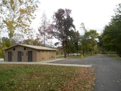
Facilities

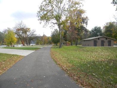
Weather you plan on using a tent or an RV, all sites have water and 50-amp electric hookups. Additional amenities include hot showers, new boat ramp, large picnic shelter, playground, concreted sites and a dump station.

Natural Features

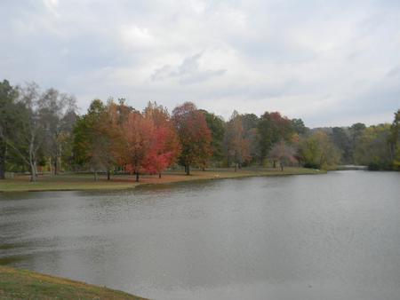
Harpeth River Bridge Campground is located on the right bank of the Harpeth River. The water wraps almost all the way around the campground so that every site can be considered a water site. Beautiful old trees litter the area and provide cool shade on even the hottest days.

Nearby Attractions

Nearby attractions include Cheatham Lake Wildlife Management Area, Doziers Dock, and Pardue Recreation Area. All the sights and sounds of Nashville, TN are just a 30 minute drive away.

Reservation

More from CampingHiking.net:

MOUNT FLEMER CABIN, Alaska Campground Images, Info & Reservations

Listen Directions The cabin is located on the south shore of the Stikine River within the Stikine-LeConte Wilderness. It is two miles downriver from the border between the United States and Canada. Distance from Wrangell is 32 miles by shallow draft boat. Low river levels can affect access; consult local

WHITE LEDGE CAMPGROUND, New Hampshire Campground Images, Info & Reservations

Listen Directions From Conway, New Hampshire, follow State Route 16 south for 5 miles. The campground is on the right. Phone 603-447-5448 Activities BIKING, CAMPING, FISHING, HIKING, PICNICKING Keywords WHIL,WHITE MOUNTAIN NF -FS Related Link(s) Rec Area Info & Images New Hampshire State Tourism Forest Service Concessionaire New Hampshire State

EAGLE ROCK CAMPGROUND, Oregon Campground Images, Info & Reservations

Listen Directions From Roseburg, Oregon, travel east on Highway 138 East (North Umpqua Highway)/ NE Diamond Lake Blvd. for 50.5 miles. Turn left into Eagle Rock Campground. Once in the campground, just after the fee kiosk turn right for the reservable sites and left for the first come first serve

SLY GUARD CABIN, California Campground Images, Info & Reservations

Listen Directions Sly Guard Cabin is located off U.S. Highway 50 in Pollock Pines, approximately 16 miles east of Placerville. Take Exit 60 (Sly Park Road) and travel south approximately 6.2 miles. Arrive at 5561 Sly Park Road on the left. Phone 530-644-2324 Activities BOATING, HISTORIC & CULTURAL SITE, CAMPING,

STEAMER BAY CABIN, Alaska Campground Images, Info & Reservations

Listen Directions Steamer Bay Cabin is located on the northwest corner of Etolin Island on the east side of Steamer Bay. The cabin is accessible by boat or float plane only, and is 27 miles by boat or 25 miles by air from Wrangell. Use caution when anchoring the boat