
Directions
Traveling westbound on Interstate 70: Take Utah State Highway 24 west towards Hanksville (exit 149). Stay on Highway 24 for 80 miles to reach the park Visitor Center.
Traveling on Interstate 15: Take US Highway 50 east at Scipio (exit 188) towards Salina for 30 miles. At the junction with Utah State Highway 89/259, turn right (south) and travel 8 miles. Turn left (east) onto Utah State Highway 24 towards Sigurd. Continue on Highway 24 for 82 miles to reach the park Visitor Center.
Phone
(435)425-4172(MON-THUR) OR (435)425-3791(FRI-SUN)
Activities
HISTORIC & CULTURAL SITE, CAMPING, INTERPRETIVE PROGRAMS, HIKING, DAY USE AREA
Keywords
Related Link(s)
Overview
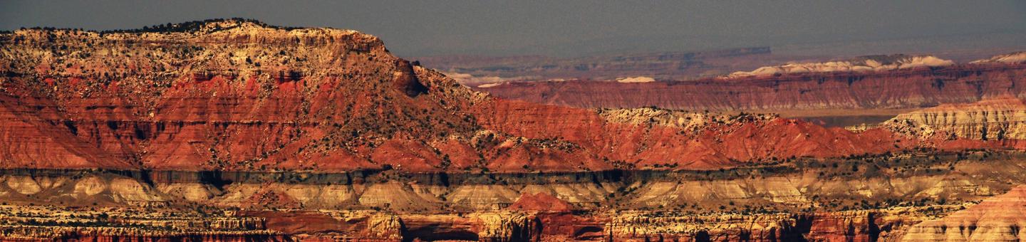
Located in south-central Utah in the heart of red rock country, Capitol Reef National Park is a hidden treasure filled with cliffs, canyons, domes and bridges in the Waterpocket Fold, a geologic monocline (a wrinkle on the earth) extending almost 100 miles.
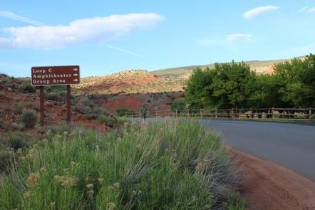
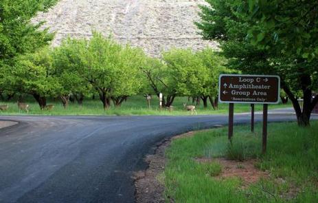
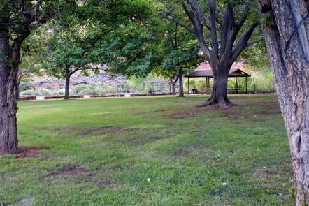
The Fruita Campground area is located one mile south of the visitor center and is often described as an oasis within the desert. The Group Campsite is near Loop C of the Fruita Campground. It is a semi-shaded, grassy campsite and is located in the Fruita Historic District of the park.
Recreation
Walk to historic inscriptions on the Capitol Gorge Trail and stroll the Goosenecks Trail. Visitors looking for longer trails can explore Cohab Canyon, Chimney Rock, and Cassidy Arch.
Enjoy the geology and view the Fremont petroglyph panels along Hwy 24. In addition, the Scenic Drive will introduce you to the fascinating cultural and geological history of Capitol Reef National Park. The drive includes a portion of the original road through the Waterpocket Fold. The road passes through parts of the Fruita Historic District and follows the western faces of the Waterpocket Fold, and spur roads allow exploration into beautiful Grand Wash and Capitol Gorge.
Check at the visitor center for a current schedule of interpretive programs, which may include geology talks, Fremont culture talks, evening programs, star gazing, moonwalks, and geology hikes. Stop in at Ripple Rock Nature Center to experience interactive exhibits, games, activities, and free educational programs.
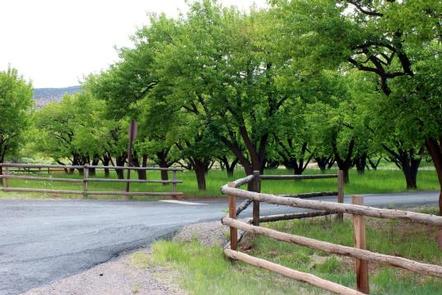
Wander through the historic Fruita orchards and pick fresh fruit when in season. The orchards contain approximately 3,100 trees including cherry, apricot, peach, pear, apple, plum, mulberry, almond, and walnut.
Discover Mormon pioneer history at the historic Gifford House store and museum.
Facilities
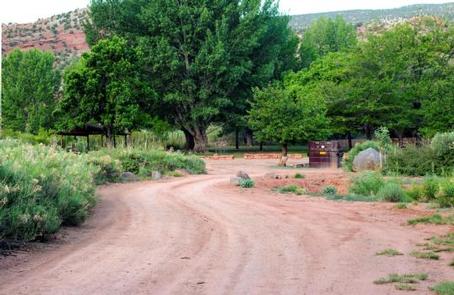
Sheltered picnic areas are provided at the group campsite and there is a large grassy area for tents and activities. Campers will enjoy the fire pit for relaxing evenings around the campfire and the above-ground grill for cooking. Amenities also include restrooms with flush toilets, a utility sink, drinking fountain and potable water faucets centrally located. There is no electricity available.
Natural Features
At Fruita Group site, large deciduous trees provide a shaded setting among beautiful and striking red rock cliffs. The group site sits adjacent to the Fremont River at approximately 5,500 feet elevation and is surrounded by unique historic orchards.
Nearby, the Waterpocket Fold defines Capitol Reef National Park. The varied topography, geology, elevations, and precipitation patterns along the fold have resulted in a diversity of microhabitats and niches for plant species to inhabit. Seventeen geologic formations are exposed within the Waterpocket Fold, each with unique combinations of minerals, soil types, aspect and slope.
Nearby Attractions
The group site is a short walk from the main campground, amphitheater, picnic areas, hiking trails, the historic Gifford house and orchards.