Grandview Shelter 4, WV Campground Reservation, Info, Images, Map, Directions

Grandview Shelter 4, West Virginia Campground Images, Info & Reservations

Listen

Directions

To reach Grandview from Beckley follow I-64 East five miles to Exit 129 B. From Lewisburg follow I-64 West forty miles to Exit 129. From either exit, turn right and follow Route 9 North six miles to Grandview.

Phone

304-465-0508

Activities

PICNICKING, DAY USE AREA

Keywords

Grandview State Park

Related Link(s)

Rec Area Info & Images

West Virginia State Tourism

West Virginia State Road Conditions

Overview

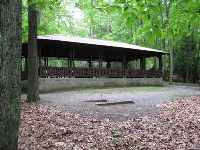
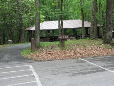
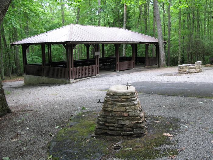
Grandview Shelter #4 is a medium size shelter located under the canopy of the forest. It can accommodate up to 64 people inside and 26 people outside the shelter for a total of about 90 people.

Recreation

The Grandview area of New River Gorge National River features five hiking trails, overlooks, a seasonal visitor center, ranger-led activities, summer outdoor dramas (Theatre West Virginia), playgrounds, volleyball court, baseball field, and basketball court.

Facilities

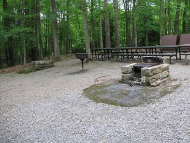
Shelter #4 offers one electrical outlet, and two charcoal grills. Playground equipment, horse shoe pit, drinking fountain with side spigot, and a handicapped accessible restroom are nearby. This shelter is handicapped accessible but the asphalt walkway ends prior to the shelter (10 – 15′). Additional chairs, tables, and canopy tents are allowed.

Natural Features

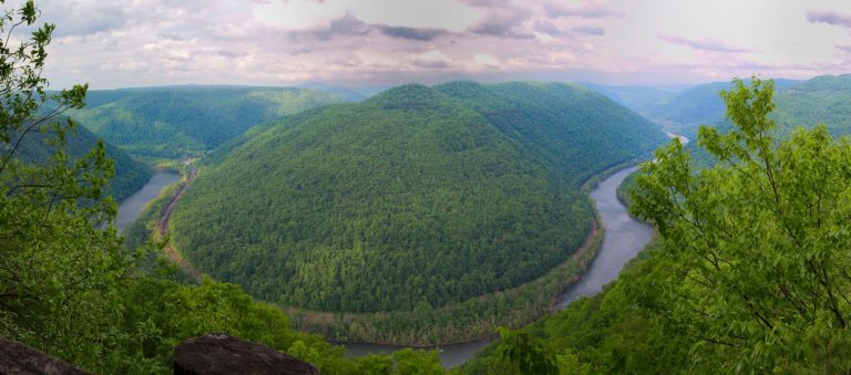
Grandview became part of New River Gorge National River in 1990, after more than 50 years as one of West Virginia’s most popular day use state parks. The area offers spectacular views of the New River and beautiful displays of rhododendron. At the Main Overlook, 1,400 feet above the river, you see an active railway and the town of Quinnimont, where the first coal was shipped out of the gorge in 1873.

Nearby Attractions

The city of Beckley is approximately 12 miles from Grandview. It offers a wide variety of shopping, restaurants, and hotels. Popular attractions include a children’s museum, and Exhibition Coal Mine.

Reservation

More from CampingHiking.net:

KADAKE BAY CABIN, Alaska Campground Images, Info & Reservations

Listen Directions Access is by boat (13 miles from Kake), or float plane (39 miles from Petersburg). Float planes generally land near the mouth of the bay and require up to a 2-mile hike across the tide flat. An 18-foot or higher tide is required for direct boat or float

CADIZ, Kentucky Campground Images, Info & Reservations

Listen Directions From Nashville, Tennessee,or St. Louis take I-24 to the Cadiz, Exit 65, travel west on St. HWY 68/80 6 miles. Turn right onto KY 139 for 1.5 miles. turn left on Jefferson St Phone 270-362-4236 Activities BOATING, FISHING, PICNICKING, DAY USE AREA Keywords CADI,LAKE BARKLEY,BARKLEY LOCK & DAM

SCHNAUS CABIN, Montana Campground Images, Info & Reservations

Listen Directions From Columbia Falls, travel north on Nucleus Avenue and turn east on Railroad Street at the stop sign. This becomes North Fork Road as it travels over the railroad overpass. Continue north on this gravel road for 42 miles to the intersection with Forest Road 10372 and look

FISHHOOK PARK, Washington Campground Images, Info & Reservations

Listen Directions From Pasco, Washington, take Highway 12 east. After crossing the Snake River Bridge, take the first exit and head east on State Route 124. Continue for 19 miles, then turn left, heading north on Fishhook Park Road. Follow for 4 miles to the park entrance; the campground is

MORAINE PARK CAMPGROUND, Colorado Campground Images, Info & Reservations

Listen Directions Take Highway 36 west from Estes Park, CO or Highway 34 east from Grand Lake, CO. Off the main park road, take the Bear Lake Road, which is near the Beaver Meadows Entrance Station, and follow the signs to the campground. Phone 970-586-1206 Activities CAMPING, FISHING, HIKING, HORSEBACK

FRIENDSHIP PARK, Texas Campground Images, Info & Reservations

Listen Directions From I-35 take Highway 79 east to Highway 95. Go North to FM 1331 then go East on FM 1331 for approximately 7 miles to the entrance of Granger Dam. Turn left and continue across Dam. Turn left on FM 971 go for approximately 1.5 miles and turn