

Directions
From Iron River, Michigan:
Travel west on US Highway 2 to M 73. Turn left (south) on M 73 and travel approximately 3/4 mile to Lake Ottawa Road. Turn right (west) on Lake Ottawa Road and travel approximately 4 miles to the Lake Ottawa Recreation Area. Follow the signs to the day use area.
Phone
906-358-4724
Activities
PICNICKING, SWIMMING
Keywords
Related Link(s)
Michigan State Road Conditions
Overview
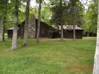
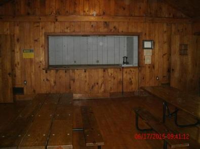
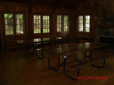
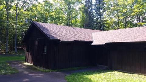
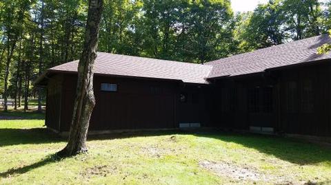
The Lake Ottawa Pavilion, located within the Lake Ottawa Recreation Area, sits in a beautiful north woods setting; along the shore of Lake Ottawa. The Civilian Conservation Corps-era pavilion provides a large indoor gathering area complete with picnic tables, limited seating and a fireplace.
Recreation
Lake Ottawa is a clear lake with a natural sandy bottom, providing excellent swimming opportunities. Just a short walk from the pavilion is the Lake Ottawa campground and trailhead for the Ge Che hiking trail. The Ge Che trail provides approximately nine miles of hiking opportunities; winding through the campground, day use area and surrounding northern hardwood forest. Spend the night in the Lake Ottawa campground. Choose from campsites located along the lakeshore or those nestled in a forest setting. The boat landing has ample parking and provides anglers with access to this fishery. Anglers enjoy fishing for trout, bass, walleye, and pan-fish.
Facilities
The Lake Ottawa pavilion offers an enclosed pavilion with a fireplace. Surrounding the pavilion is a very large picnic area complete with water bubblers, picnic tables and grills. The area also has a swimming beach and athletic field for family fun. Co-located within the pavilion are flush toilets and change rooms.
Natural Features
Lake Ottawa is almost completely surrounded by National Forest System Land, providing a lovely view of the shoreline and forest.
Nearby Attractions
Lake Ottawa campground offers 32 campsites, paved access roads, pressurized water system, flush toilets, a trailer dump station, and a picnic shelter with two stone fireplaces and original log picnic tables which were constructed by the Civilian Conservation Corps in the late 1930s. Each campsite has natural vegetation providing some privacy from neighboring sites. Located in the general area is Lake Ottawa, Brule Lake, Hagerman Lake, Brule River, Bass Lake, and miles of hiking trails. Lake Ottawa is a deep cold water lake that provides fishermen with a good variety of game fish. There is a boat landing with ample parking to access Lake Ottawa. The Ge Che hiking and ski trail and the Historic Mile Post Zero/Treaty Tree trail provide hiking opportunities through northern hardwood forests. The almost one million acres of the Ottawa National Forest are located in the Western Upper Peninsula of Michigan. The forest extends from the south shore of Lake Superior to the Wisconsin border. The area is rich in wildlife viewing opportunities; breathtaking views of rolling hills dotted with lakes, rivers and waterfalls; and spectacular fall colors.