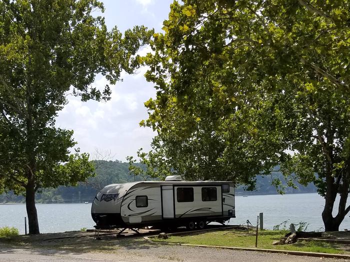
ELK CREEK LANDING, OK Campground Reservation, Info, Images, Map, Directions

ELK CREEK LANDING, Oklahoma Campground Images, Info & Reservations

Directions

From Tahlequah, OK, go 14 miles southeast on Highway 82, then turn right and go a mile on the paved access road.


Phone

918-487-5252

Activities

BOATING, CAMPING

Keywords

ELCL,TENKILLER LAKE,TENKILLER FERRY LAKE,TENKILLER FERRY

Related Link(s)

Rec Area Info & Images

Oklahoma State Tourism

Oklahoma State Road Conditions

Overview

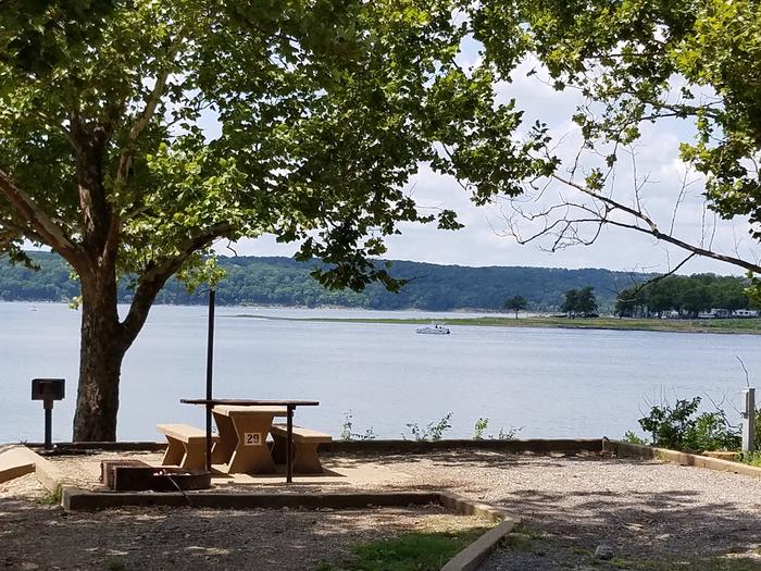
Elk Creek Landing Park is a nice, quiet, enjoyable campground on Tenkiller Ferry Lake. It has modern facilities and handy access to the lake. The region features breathtaking views of 200-foot limestone bluffs rising from the lake.

Recreation

Fishing, boating, water skiing, hiking, and swimming are some of the activities enjoyed by visitors. Prevailing winds and secluded coves create an ideal environment for sailing. Scuba divers enjoy the lake’s clear waters and high visibility. Fishing is good for black bass, white bass, striped bass, crappie and catfish. The trout stream below the dam is one of only two year-round trout fisheries in Oklahoma, and is regularly stocked with rainbow trout. Hunting is also permitted in parts of the lake area, in accordance with federal and state laws.

Facilities

About half the campsites are equipped with electric hookups, and the two group shelters are nonelectric. The park has flush toilets, hot showers, water hydrants, dump station and a boat ramp. A marina with concessions is near the campground. Of the ten marinas with concessions located on the lake, most offer boat and jet-ski rentals, and several have floating restaurants.

Natural Features

Tenkiller Ferry Lake is often referred to as “Oklahoma’s clear water paradise.” The 12,500 acre lake is sourced by the Illinois River and the Baron Fork, which are both designated as Oklahoma Scenic Rivers. It is nestled in the foothills of the Ozark Mountains in the northeastern part of the state. This area, known as Green Country, is surrounded by dense oak-hickory forests, tall bluffs, and rolling hills. The lake has 130 miles of shoreline with plenty of wildlife such as deer and turkey. It serves as one of the flyways of migratory birds, including bald eagles, common loons, and white pelicans.

Nearby Attractions

Visit the Tenkiller State Park for its nature center and scuba diving park, the Sequoyah National Wildlife Refuge near Vian, or the historic city of Tahlequah – the capital of the Cherokee Nation. The scenic upper Illinois River near Tahlequah is great for canoeing and rafting, and the lower Illinois near Gore offers prime trout fishing.

Reservation

More from CampingHiking.net:

Loft Mountain Campground, Virginia Campground Images, Info & Reservations

Directions From Washington, D.C., metro area, travel west on Interstate 66 to exit 43A. Take US Highway 29 south approximately 55 miles to Ruckersville, Virginia, then take US Highway 33 west to Shenandoah National Park and Skyline Drive Swift Run Entrance. Follow Skyline Drive south approximately 15 miles and turn

STORM MOUNTAIN, Utah Campground Images, Info & Reservations

Directions From I-215, take the 6200 South exit and travel a mile east to Wasatch Blvd. Take Wasatch Blvd a mile south to junction with Big Cottonwood Canyon/Highway 190. Make a left at the junction and travel up Big Cottonwood Canyon 2.8 miles to the picnic area. Phone SALT LAKE

LINDER POINT CAMPGROUND, Iowa Campground Images, Info & Reservations

Directions From Interstate 80 (Iowa City, Iowa), take Exit 244 towards Dubuque St./North Liberty. Travel north on Dubuque St. for 3 miles and turn right onto West Overlook Rd. NE. Travel on West Overlook Rd. NE for 0.7 miles. The entrance to the Linder Point Campground will be located on

WHITE SULPHUR SPRINGS CABIN, Alaska Campground Images, Info & Reservations

Directions Accessible year round, weather permitting. Located 65 miles northwest of Sitka on Chichagof Island within the West Chichagof-Yakobi Wilderness Area. Boat access is possible with anchorage in Mirror Harbor, where 0.9-mile White Sulphur Springs Trail leads to the cabin; however, local knowledge is recommended before attempting anchorage there. White

ANDERSON ROAD, Tennessee Campground Images, Info & Reservations

Directions From downtown Nashville, TN, take I-40 east for 5 miles to exit 219. Turn right on Stewarts Ferry Pike and continue straight on Bell Road for 5 miles. Turn left on Smith Springs Road, then left on Anderson Road. The campground is ahead about 1 mile on the left

REYNOLDS CREEK, Texas Campground Images, Info & Reservations

Directions From I-35, take exit 330B Hwy 6 N toward Meridian for about 7 miles. After passing over the Lake on the Twin Bridges, take the Speegleville Road exit (second exit after the bridges). Turn right on Speegleville Road. After 1 mile you will reach a 4-way stop. Continue straight