Directions
From Moab, drive north on Highway 191 to the junction of State Route 128. Drive two miles on SR 128 to the entrance to Goose Island campground. The group sites are at the far end of the campground.
Phone
435-259-2100
Activities
AUTO TOURING, BIKING, CAMPING, PHOTOGRAPHY, MOUNTAIN BIKING, SCENIC DRIVE
Keywords
Related Link(s)
Overview
The two sites at Goose Island are ideal for groups wishing to be close to the town of Moab and Arches National Park. The area offers outdoor enthusiasts many options for hiking, mountain biking, whitewater rafting, and four-wheel drive tours. The town of Moab is 10 minutes away and has dining, shopping, sports rentals, tour companies and museums.
Recreation
From Goose Island Campground, a paved bicycle trail leads to Arches National Park, the Bar M Mountain Bike Trailhead, the town of Moab, or up State Route (SR) 128 along the Colorado River. Arches and Canyonlands National Parks are nearby and have many scenic overlooks, hiking trails, and four-wheel drive roads. The SR 128 river corridor is filled with red rock canyons, hiking and equestrian trails, river access and activites, and scenic vistas.
Facilities
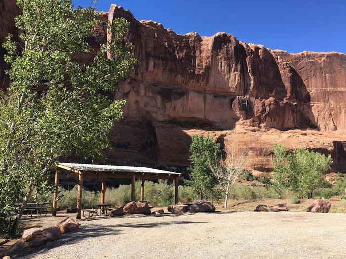
The group sites have fire grates, picnic tables, vault toilets and shade shelters. The group sites do not have water, dump stations or electric hook-ups. When you enter Goose Island the group sites are at the far end of the loop past the individual sites.
Natural Features
Goose Island is beside the Colorado River with cottonwood trees providing much sought after shade in the desert and striking canyon views. Across the river, the red cliffs of Arches National Park glow in the afternoon light.
Nearby Attractions
Goose Island is only 10 minutes from Arches National Park. Canyonlands National Park and Dead Horse Point State Park are within a half-hour drive. For people looking for guided tours or rentals, the town of Moab is only five minutes away.


