KATY BRANCH, TENNESSEE Campground Reservation, Info, Images, Map, Directions

KATY BRANCH, Tennessee Campground Images, Info & Reservations

Listen

Directions

From Greeneville travel east to 11E to TN State Road 107. Travel approximately 14.5 miles to the gate at Katy Branch located on the right. (Landmarks will include Clark Creek Road on the right and Jackson Bridge Road on the left.) Unlock the gate and travel about .5 miles to the pavilion.

Phone

(423) 638-4109

Activities

WILDLIFE VIEWING, STAR GAZING, CULTURAL ACTIVITIES, RECREATION PROGRAMS, BADMINTON, SOCCER FIELDS

Keywords

KATY BRANCH

Related Link(s)

Rec Area Info & Images

Overview

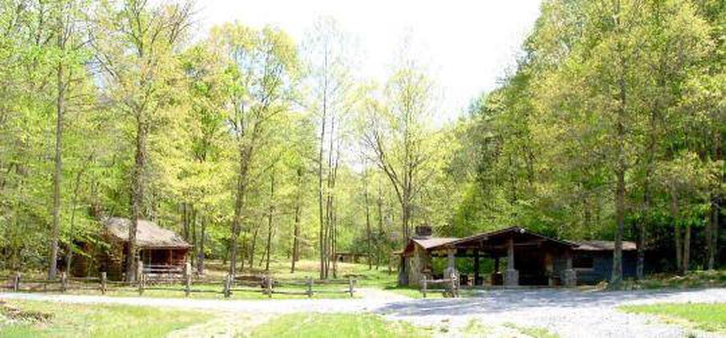
Katy Branch, a former Youth Conservation Corp Camp, is a private outdoor pavilion surrounded by beautiful Tennessee woodlands in the Cherokee National Forest.

Recreation

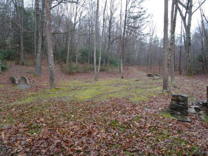
Forested land is available for hiking and exploration and an open area is available for group activities.

Facilities

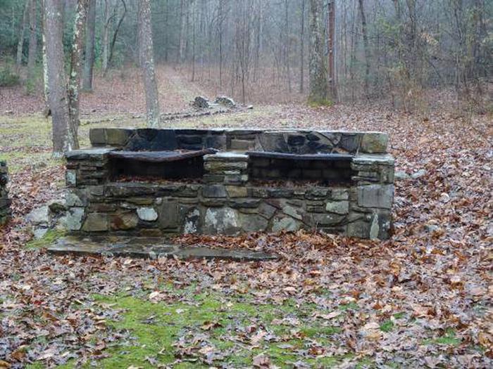
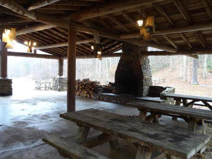
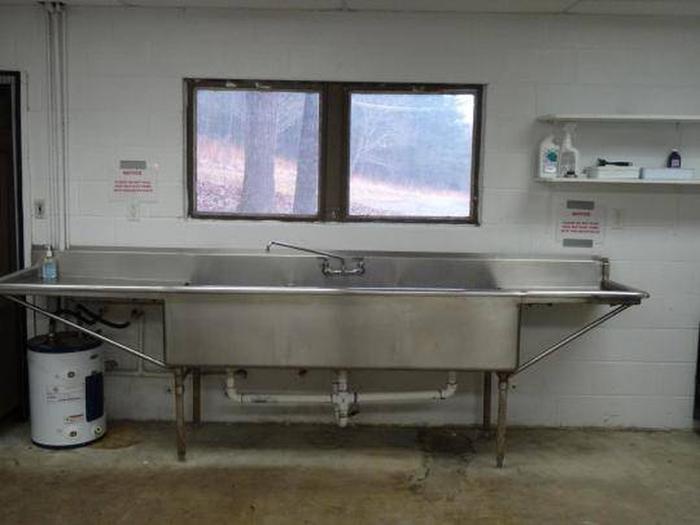
Rental facilities include an open pavilion with fireplace and three large picnic tables. The pavilion is attached to a building that contains two accessible restrooms and a “kitchen” area with stainless steel sink, microwave and refrigerator. A large outdoor charcoal grill and five folding tables and 80 folding chairs are also available with the rental. The pavilion is located about .5 miles on a gravel road, closed to the public.

Natural Features

Katy Branch is located in open woodland. A more heavily forested area and an open area, part of which is used for parking, is adjacent to the pavilion area.

Nearby Attractions

Katy Branch is located about half-way between the towns of Greeneville and Erwin. Though it is not located on the Nolichucky River, the river is only about .5 miles away.

Reservation

More from CampingHiking.net:

FOX CREEK HORSE CAMP, Virginia Campground Images, Info & Reservations

Listen Directions From exit 45 on I-81, take State Route 16 South for approximately 17 miles to State Route 603 at Troutdale, Va. Turn right on State Route 603. Campground is approximately 4 miles down 603 on the right. Phone 800-628-7202 Activities CAMPING, FISHING, HORSEBACK RIDING, HUNTING, WILDLIFE VIEWING Keywords

LONGWOOD PARK, Virginia Campground Images, Info & Reservations

Listen Directions The physical address for Longwood Park is: 13500 Hwy 15, Clarksville, VA 23927. It is located 7 miles south of Clarksville, VA. Phone 434-374-2711 IN SEASON ONLY; ALL OTHERS CALL 434-738-6143 Activities BOATING, CAMPING, FISHING, PICNICKING, WILDLIFE VIEWING, SWIMMING SITE, CANOEING Keywords LONG,BUGGS ISLAND,JOHN H KERR DAM Related

ANGEL CREEK, Nevada Campground Images, Info & Reservations

Listen Directions Take Interstate 80 to the West Wells exit. Turn south on Angel Lake Road (State Route 231) and travel 8 miles to Angel Creek. Turn left and follow the road for one mile to the campground. Phone 775-752-3357 Activities BOATING, CAMPING, FISHING, HIKING, HORSEBACK RIDING, WILDLIFE VIEWING Keywords

TWIN LAKES DAY USE AREA, Georgia Campground Images, Info & Reservations

Listen Directions From Interstate 85, take exit 14 to Highway 187 north. Immediately after passing Clemson Research Center, turn left on Fants Grove Road and follow directional signs to the park. 189 SHELTER DRIVE, Pendleton, SC 29670 Phone 888-893-0678 HARTWELL PROJECT OFFICE Activities BOATING, FISHING, PICNICKING, DAY USE AREA, SWIMMING

CLEARWATER CAMPGROUND, Wyoming Campground Images, Info & Reservations

Listen Directions From Cody, Wyo., follow Sheridan Avenue west through Cody until the road leaves town, and becomes the Buffalo Bill Cody Scenic Byway (U.S. Highway 14/16/20). The campground is 32 miles west of Cody, on the south side of the highway and next to the river. Phone 307-527-6921 –