CRAIG CREEK RECREATION AREA, VA Campground Reservation, Info, Images, Map, Directions

CRAIG CREEK RECREATION AREA, Virginia Campground Images, Info & Reservations

Directions

From New Castle: Follow US 615 east for 11 miles to SR 817 in Oriskany. Turn right on SR 817, go 1/2 mile then take right at sign for Craig Creek. Continue straight. Veer right for the camping area gate, while the left fork leads to the day use parking area.

Phone

540-552-4641

Activities

FISHING, HIKING, WATER ACTIVITIES, CANOEING

Keywords

Related Link(s)

Rec Area Info & Images

Virginia State Tourism

Virginia State Road Conditions

Overview

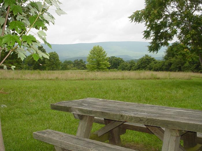
Craig Creek Recreation Area provides old-fashioned, rustic group camping for those that require few amenities. The large open field is great for groups that wish to picnic and tent camp together. There is a day-use area adjacent to the campground that is not reservable. Overnight camping is prohibited in the day-use area.

Recreation

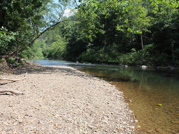
Craig Creek has a small swimming hole and canoes may access the creek as well. The creek is stocked with trout and can provide good fishing opportunites for anglers. A two-mile loop trail is located within the recreation area.

Facilities

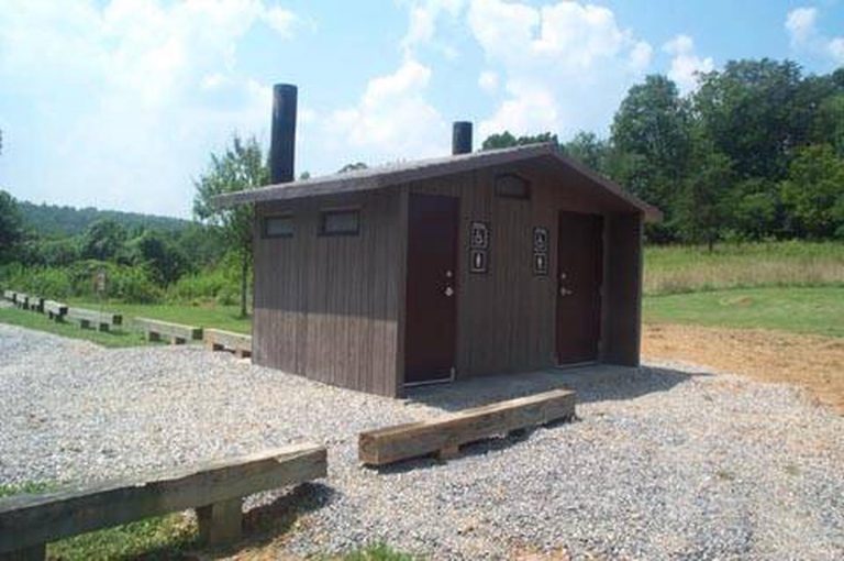
Craig Creek may be reserved for groups of 30 or less. There is an an entrance gate, group fire ring, picnic table and vault toilet. There is no potable water and no camping hookups. The field is for tent camping only.

Natural Features

The recreation area is located in a narrow valley, flanked by National Forest land. The open field used for tent camping and is edged with large, shade trees.

Nearby Attractions

Craig Creek is located 20 minutes from New Castle, VA.

Reservation

More from CampingHiking.net:

GROUSE CREEK GROUP SITE, Washington Campground Images, Info & Reservations

Directions Grouse Creek Campground is located approximately 7 miles up the Forest Service Road 6200/Chiwawa River Road. There is a gated spur road just off the main paved road on the left. The campground is at the end of the road alongside Grouse Creek. Phone 509-763-0700 Activities BIKING, CAMPING, FISHING,

MONTY CAMPGROUND, Oregon Campground Images, Info & Reservations

Directions From Sisters, OR: Travel 5.6 miles northwest on Highway 20, then 20.8 miles north on Forest Road 11, then 5.0 miles east on Forest Road 1170, and then 7.2 miles northwest on County Road 64. Phone 503-464-8515 Activities CAMPING, FISHING, WILDLIFE VIEWING Keywords Related Link(s) Rec Area Info &

STEEL CREEK GROUP CAMPGROUND, Idaho Campground Images, Info & Reservations

Directions From Dubois, Idaho: Travel north on I-15 to the Stoddard Creek Exit (Exit 184). Go east on West Camas-Miners Creek Road (FR 006) for approximately 14 miles to Steel Creek Road (FR 478), turn right and continue 0.75 miles to the campground entrance. From the Kilgore Store: Travel west/northwest

COW MEADOW CAMPGROUND, Oregon Campground Images, Info & Reservations

Directions From Bend, OR: Travel about 45 miles south on Cascade Lakes Highway (46), 0.5 mile east on Forest Road 40, then 2 miles south on Forest Road 4000-790. Phone 541-323-1746 Activities CAMPING Keywords Related Link(s) Rec Area Info & Images Oregon State Tourism Oregon State Road Conditions Overview Cow