BEAR LAKE CAMPGROUND, WI Campground Reservation, Info, Images, Map, Directions

BEAR LAKE CAMPGROUND, Wisconsin Campground Images, Info & Reservations

Listen

Directions

From Wabeno, drive north 5.5 miles or from Laona drive 3.0 miles to County Road T. Turn east and drive 3 miles to County Road H. Turn right (north) drive 0.75 miles to Goodman Park Road (FR2136). Turn right (east) and drive 4.1 miles to FR3770. Turn right (south) on FR3770 and drive 0.4 miles to the campground.

Phone

(715) 674-4481

Activities

CAMPING

Keywords

Related Link(s)

Rec Area Info & Images

Wisconsin State Tourism

Wisconsin State Road Conditions

Overview

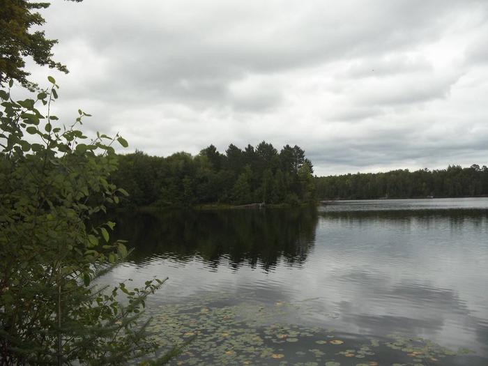
If you are interested in a quiet campground and excellent pike fishing, Bear Lake Campground is for you. Campsites are situated along the wooded shore and ridge with outstanding views of the lake.

Recreation

The Chequamegon-Nicolet National Forest has an abundance of outdoor recreation opportunities. Those most enjoyed at Bear Lake are fishing, swimming, kayaking, and canoeing. The Rat River trail is a good nearby hiking opportunity.

Facilities

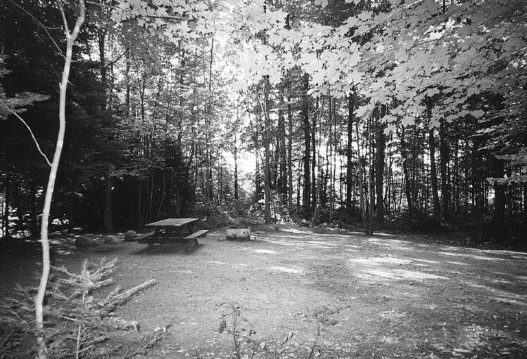
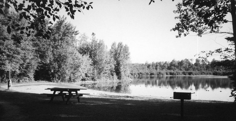
Bear Lake Campground has 27 sites. A majority of campsites can accommodate campers as long as 30 feet and longer. The campground also has five tent-only walk-in sites on a wooded peninsula jutting into the lake. Drinking water, vault toilets, swim beach, picnic area, and a boat landing are also provided at this location. All roads are paved with blacktop.

Natural Features

This campground sits on the southwest corner of 68-acre Bear Lake. The campground is a mix of hardwoods and pine. The water quality of the lake is moderate at a maximum depth of 20 feet. Fish species found in the lake are northern pike, panfish, and largemouth bass. This campground is also popular with grouse hunters and fall color enthusiasts.

Nearby Attractions

Bear Lake is in close proximity to the Rat River Hike and Bike Trail. Trout fishing opportunities are also nearby on the Peshtigo and Rat Rivers.

Reservation

More from CampingHiking.net:

SKATERS CABIN SHELTER, Alaska Campground Images, Info & Reservations

Listen Directions This Skater’s Cabin Shelter is approximately 13 miles from downtown Juneau. Access is via the Alaska Marine Highway or via Alaska Airlines. By ferry: Turn right out of the Ferry Terminal parking lot. Drive 1.7 miles to DeHart’s Store above Auk Bay marinas. Take a left turn onto

LAKE HILL, Utah Campground Images, Info & Reservations

Listen Directions Located approximately 5 miles east of Ephraim, Utah on Forest Highway 8 in Ephraim Canyon. Phone 435-283-4151 Activities BOATING, CAMPING, FISHING, HIKING Keywords LAKH,MANTI-LASAL NF -FS Related Link(s) Rec Area Info & Images Utah State Tourism Utah State Road Conditions Overview Lake Hill Campground is situated next to

SANDY BEACH CAMP, Iowa Campground Images, Info & Reservations

Listen Directions From Interstate 380 (Shueyville, Iowa) take Exit 10 towards Shueyville. Travel east on 120th St. NW for 1.2 miles. At the stop sign, turn right onto NE Curtis Bridge Rd. Travel south on NE Curtis Bridge Rd for 1.1 miles. Turn left onto Sandy Beach Rd. NE and

FALLS CAMPGROUND, Idaho Campground Images, Info & Reservations

Listen Directions From Idaho Falls, travel 45 miles east on Highway 26. Turn off right before the Snake River Bridge and continue 3.5 miles on a gravel road to the campground. Phone 208-270-0150 OR 541-351-1182 Activities BIKING, BOATING, CAMPING, FISHING, HIKING, WILDLIFE VIEWING, SWIMMING SITE Keywords FAID,CARIBOU-TARGHEE NF – FS

BENNY CREEK GROUP AREA, Arizona Campground Images, Info & Reservations

Listen Directions From Show Low, Arizona, take Highway 260 southeast 42 miles to Highway 373. Follow 373 south for 2.5 miles to the Benny Creek Campground entrance on the left. Phone 928-735-7313 Activities CAMPING, FISHING, HIKING Keywords BENN,APACHE-SITGREAVES NF-FS Related Link(s) Rec Area Info & Images Arizona State Road Conditions

CALABASAS, Arizona Campground Images, Info & Reservations

Listen Directions From Tucson, Arizona, take I-19 south for about 56 miles. Exit onto AZ 289 (Exit 12). Turn right (west) onto AZ Highway 289 (Ruby Road) and continue to the Pe Blanca Recreational Area. From Nogales, Arizona, take I-19 north for about 4.4 miles. Exit onto AZ 289 (Exit