WHISKEY SPRINGS CAMPGROUND, OR Campground Reservation, Info, Images, Map, Directions

WHISKEY SPRINGS CAMPGROUND, Oregon Campground Images, Info & Reservations

Listen

Directions

From Butte Falls, OR, take County Rt. 821 south 9 miles to campground sign. Turn left after sign onto Forest Rt. 3065 and go 0.3 miles to another campground sign. Turn left at sign and go 0.3 miles to campground.

Phone

541-560-3900

Activities

CAMPING, FISHING, HIKING, VISITOR CENTER, DAY USE AREA

Keywords

Related Link(s)

Rec Area Info & Images

Oregon State Road Conditions

Oregon State Tourism

Overview

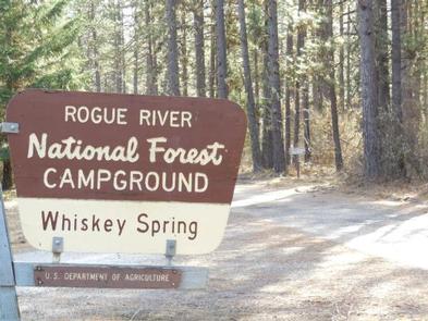
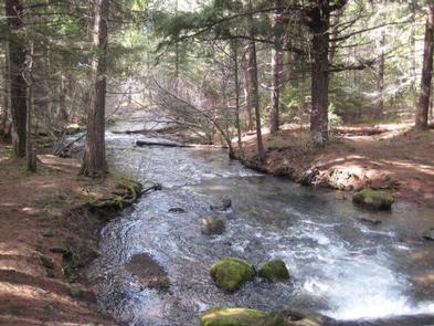
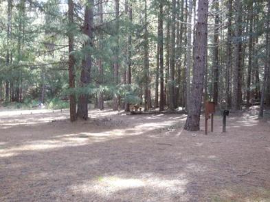
The campground is a large bisected loop in a dense stand of Douglas fir, cedar and other conifers next to Whiskey Springs Pond. The dense canopy from the Douglas fir trees filters the sunlight providing a good environment for a variety of ground covers. Tall shrubs and young conifers provide privacy between campsites. This campground has a classic "forest feel" to it. Beavers are said to live in the pond.

Recreation

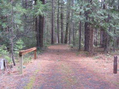
The trailhead for the Whiskey Springs Interpretive Trail is located within the campground.

Facilities

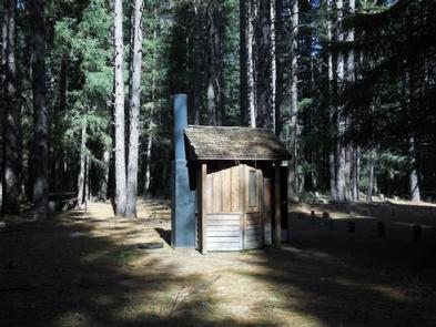
This small campground contains a variety of campsites to accommodate all types of visitors and campers, including group, family and single campsites. Drinking water is available. The campground has vault toilets. Firewood is available for purchase from the host.

Natural Features

Quiet and secluded this campground is located on the site of the original supply road (Old Military Road) for Fort Klamath.

Nearby Attractions

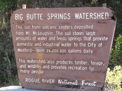
The campground is quiet and secluded located in the City of Medford, OR, watershed. This remote and picturesque campground is a short distance from Willow Lake and Fish Lake, and nearby to Four Bit Ford Campground.

Reservation

More from CampingHiking.net:

HICKORY CREEK, Texas Campground Images, Info & Reservations

Listen Directions Due to construction on the I-35E bridge, the directions to the campground have changed if approaching from the north. Take I-35E south to Exit 460 – Meadow Oaks Rd/ Corinth Parkway. Stay on the I-35E access road heading south, go through the red light at Swisher Rd. Turn

OLIVE RIDGE, Colorado Campground Images, Info & Reservations

Listen Directions The campground is located on the west side of Colorado Highway 7, between Allenspark and Meeker Park at mile-marker 14. It is approximately six miles north of the intersection of Colorado Highways 7 and 72 (which is 21 miles west-north-west of Lyons), 15 miles south of Estes park,

CANEY CREEK, Oklahoma Campground Images, Info & Reservations

Listen Directions From Hwy 32 in Kingston, OK, take Donahoo Road south. Follow signs 6 miles on paved access road to the campground. Phone 580-564-2632 Activities CAMPING, HIKING Keywords CAEK,TEXOMA LAKE,TEXOMA LAKE Related Link(s) Rec Area Info & Images Oklahoma State Tourism Oklahoma State Road Conditions Overview Caney Creek Campground

TUOLUMNE MEADOWS, California Campground Images, Info & Reservations

Listen Directions Take Highway 41 north from Fresno, Highway 140 east from Merced, Highway 120 east from Manteca or west from Lee Vining (State Route 395) into Yosemite National Park. Tuolumne Meadows Campground is located 5 miles from the Tioga Pass Entrance station (Hwy 120 from the east), and is