LAKE GILLETTE CAMPGROUND, WA Campground Reservation, Info, Images, Map, Directions

LAKE GILLETTE CAMPGROUND, Washington Campground Images, Info & Reservations

Listen

Directions

From Colville, WA: Head north on N Maple St toward E 2nd Ave for 0.1 miles. Turn right at the 2nd cross street onto WA-20 E/E 3rd Ave Continue to follow WA-20 E for 24.5 miles. Turn right onto NF-200/Pendoreille Lake Rd for 0.4 miles. Turn left and continue for 236 feet. Destination will be on the right.

Phone

435-245-6521

Activities

BIKING, BOATING, CAMPING, FISHING, HIKING, WILDLIFE VIEWING, DAY USE AREA, SWIMMING SITE

Keywords

Related Link(s)

Rec Area Info & Images

Washington State Tourism

Washington State Road Conditions

Overview

Lake Gillette campground lies on the east shore of Lake Gillette, a popular spot for boating and fishing.

Recreation

With plentiful trails, visitors to the area will enjoy hiking and bicycling and those looking for water recreation can access swimming and boating in nearby Gillette Lake.
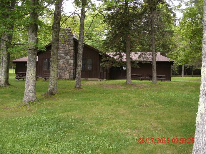
Facilities

Lake Gillette campground has 14 campsites, vault toilets, drinking water and a bear proof garbage containers. The campground offers paved interior roads and parking spurs.

Natural Features

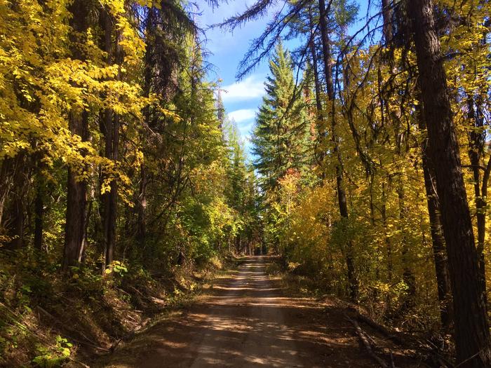
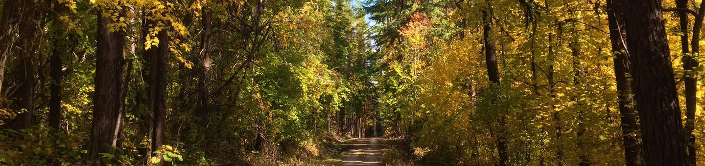
Lodgepole pine and tamarack are found throughout the campground, providing shade to many campsites. A wonderful campground for the entire family, the area offers hike-in access to Gillette Lake and Rufus Trail #148. An amphitheatre is also close and can be reached by one of the many trails.

Nearby Attractions

Gillette Lake and access to Rufus Trail for hikers.

Reservation

More from CampingHiking.net:

BOISE CREEK, California Campground Images, Info & Reservations

Listen Directions From Willow Creek, California, take State Route 299 for 2 miles west. Enter the campground directly from the highway. Phone 530-629-2118 Activities BIKING, BOATING, HISTORIC & CULTURAL SITE, CAMPING, FISHING, HIKING, HUNTING, VISITOR CENTER, WATER SPORTS, WILDLIFE VIEWING, SWIMMING SITE Keywords BOCR,Boise Creek Campground Related Link(s) Rec Area

CHECATS LAKE CABIN, Alaska Campground Images, Info & Reservations

Listen Directions The cabin is located approximately 45 miles northeast of Ketchikan on the mainland south of Rudyerd Bay. Accessible by float plane only. In fall, winter and early spring, the cabin may be inaccessible due to frozen lake surface (float planes cannot land). Please contact the Ketchikan-Misty Fjords Ranger

MINERS RETREAT, Oregon Campground Images, Info & Reservations

Listen Directions From Pendleton, Oregon: Travel south on Highway 395 for 50 miles to the Ukiah exit. Turn left on Highway 244 to Ukiah. Turn right (south) just before the city park; this road becomes Forest Service Road (FSR) 52 at the Forest boundary. Travel 50 miles to the small

SOUTH SANDUSKY CAMPGROUND, Illinois Campground Images, Info & Reservations

Listen Directions From I-57 take exit 71 and turn west onto Route 14. After 3 miles turn right on Rend City Road, then continue for 6 miles to the campground entrance on the right. Phone 618-724-2493 Activities BIKING, CAMPING, INTERPRETIVE PROGRAMS, FISHING, HIKING, WILDLIFE VIEWING, SWIMMING SITE, STAR GAZING Keywords

PINECREST, California Campground Images, Info & Reservations

Listen Directions From Sonora, take Highway 108 east for 30 miles, take the Pinecrest exit onto Pinecrest Lake Road and continue to the campground. Phone 209-965-3116 Activities BIKING, BOATING, CAMPING, FISHING, HIKING, HORSEBACK RIDING, DAY USE AREA, SWIMMING SITE Keywords PINC,PINECREST CAMPGROUND,STRAWBERRY CAMPGROUND,STANISLAUS NF -FS Related Link(s) Rec Area Info

SILVER DOLLAR, Colorado Campground Images, Info & Reservations

Listen Directions From Leadville, Colorado, drive west on County Road 4 and follow signs to the Turquoise Lake Recreation Area. Turn right on County Road 9C and follow to the campground entrance on the right. Phone 719-486-0749 (FOR INFORMATION ONLY, NO RESERVATIONS) Activities BOATING, HISTORIC & CULTURAL SITE, CAMPING, FISHING,